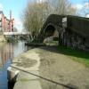
Portland Street Footbridge No 29
Portland Basin Museum, Portland Street South, Ashton-under-Lyne OL7 0PR, United Kingdom

Portland Street Footbridge No 29
is a minor waterways place
on the Ashton Canal (Main Line) between
Dukinfield Junction (Junction of Ashton Canal with the Peak Forest Canal) (¼ furlongs
to the west) and
Ashton-under-Lyne Junction (Junction of Ashton and Huddersfield Narrow Canals) (3¾ furlongs
to the east).
The nearest place in the direction of Ashton-under-Lyne Junction is Cavendish Street Bridge No 30;
1¼ furlongs
away.
There may be access to the towpath here.
Mooring here is unrated.
There is a bridge here which takes pedestrian traffic over the canal.
| Guide Bridge No 26 | 1 mile, ½ furlongs | |
| Jeremy Brook Footbridge No 27 | 6 furlongs | |
| Site of Factory Bridge No 27A | 4¾ furlongs | |
| Walk Mill Bridge No 28 | 2½ furlongs | |
| Dukinfield Junction | ¼ furlongs | |
| Portland Street Footbridge No 29 | ||
| Cavendish Street Bridge No 30 | 1¼ furlongs | |
| Supermarket Tunnel (western entrance) | 1½ furlongs | |
| Supermarket Tunnel (eastern entrance) | 2¼ furlongs | |
| Ashton-under-Lyne Railway Viaduct No 32 | 3 furlongs | |
| Ashton-under-Lyne Junction | 3¾ furlongs | |
Amenities here
Amenities nearby at Dukinfield Junction
Amenities nearby at Cavendish Street Bridge No 30
There are no links to external websites from here.
Why not log in and add some (select "External websites" from the menu (sometimes this is under "Edit"))?
Why not log in and add some (select "External websites" from the menu (sometimes this is under "Edit"))?
Mouseover for more information or show routes to facility
Nearest water point
In the direction of Ducie Street Junction
Fairfield Junction — 2 miles, 4¼ furlongs away
On this waterway in the direction of Ducie Street Junction
Marple Services — 8 miles, 1½ furlongs and 16 locks away
Travel to Dukinfield Junction, then on the Peak Forest Canal (Lower) to Marple Junction, then on the Macclesfield Canal to Marple Services
New Islington Marina — 6 miles, 6½ furlongs and 20 locks away
Travel to Ducie Street Junction, then on the Rochdale Canal to New Islington Marina Entrance, then on the Rochdale Canal (Main Line) to Cotton Field Wharf Marina, then on the Rochdale Canal (New Islington Marina Arm) to New Islington Marina
Braidbar Boats — 11 miles, 7¼ furlongs and 16 locks away
Travel to Dukinfield Junction, then on the Peak Forest Canal (Lower) to Marple Junction, then on the Macclesfield Canal to Braidbar Boats
Furness Vale Marina — 13 miles, ½ furlongs and 16 locks away
Travel to Dukinfield Junction, then on the Peak Forest Canal (Lower) to Marple Junction, then on the Peak Forest Canal (Upper) to Furness Vale Marina
Whaley Bridge Services — 14 miles, 4¾ furlongs and 16 locks away
Travel to Dukinfield Junction, then on the Peak Forest Canal (Lower) to Marple Junction, then on the Peak Forest Canal (Upper) to Whaley Bridge Branch Junction, then on the Peak Forest Canal (Whaley Bridge Branch) to Whaley Bridge Services
Bugsworth Services — 14 miles, 5 furlongs and 16 locks away
Travel to Dukinfield Junction, then on the Peak Forest Canal (Lower) to Marple Junction, then on the Peak Forest Canal (Upper) to Bugsworth Services
Bollington Wharf — 16 miles, 5 furlongs and 16 locks away
Travel to Dukinfield Junction, then on the Peak Forest Canal (Lower) to Marple Junction, then on the Macclesfield Canal to Bollington Wharf
Staffordshire, Kenworthy and other Arms — 7 miles, 4½ furlongs and 27 locks away
Travel to Ducie Street Junction, then on the Rochdale Canal to Castlefield Junction, then on the Bridgewater Canal (Main Line) to Staffordshire, Kenworthy and other Arms
Potato Wharf Arm & The New Basin — 7 miles, 5¼ furlongs and 27 locks away
Travel to Ducie Street Junction, then on the Rochdale Canal to Castlefield Junction, then on the Bridgewater Canal (Main Line) to Potato Wharf Arm & The New Basin
Swettenham Street Maintenance Yard — 19 miles, 4¾ furlongs and 16 locks away
Travel to Dukinfield Junction, then on the Peak Forest Canal (Lower) to Marple Junction, then on the Macclesfield Canal to Swettenham Street Maintenance Yard
Stretford Marina — 10 miles, 4½ furlongs and 27 locks away
Travel to Ducie Street Junction, then on the Rochdale Canal to Castlefield Junction, then on the Bridgewater Canal (Main Line) to Stretford Marina
Watch House Cruising Club — 11 miles, 4¾ furlongs and 27 locks away
Travel to Ducie Street Junction, then on the Rochdale Canal to Castlefield Junction, then on the Bridgewater Canal (Main Line) to Watch House Cruising Club
Worsley Visitor Moorings — 14 miles, 6½ furlongs and 27 locks away
Travel to Ducie Street Junction, then on the Rochdale Canal to Castlefield Junction, then on the Bridgewater Canal (Main Line) to Stretford - Waters Meeting, then on the Bridgewater Canal (Stretford and Leigh Branch) to Worsley Visitor Moorings
Bridgewater Marina — 16 miles, 2½ furlongs and 27 locks away
Travel to Ducie Street Junction, then on the Rochdale Canal to Castlefield Junction, then on the Bridgewater Canal (Main Line) to Stretford - Waters Meeting, then on the Bridgewater Canal (Stretford and Leigh Branch) to Bridgewater Marina
Ye Olde Number 3 Transit Moorings — 18 miles, 3¾ furlongs and 27 locks away
Travel to Ducie Street Junction, then on the Rochdale Canal to Castlefield Junction, then on the Bridgewater Canal (Main Line) to Ye Olde Number 3 Transit Moorings
In the direction of Ashton-under-Lyne Junction
Grove Road Bridge No 96 — 5 miles and 8 locks away
Travel to Ashton-under-Lyne Junction, then on the Huddersfield Narrow Canal to Grove Road Bridge No 96
Wool Road Bridge No 70 — 11 miles and 23 locks away
Travel to Ashton-under-Lyne Junction, then on the Huddersfield Narrow Canal to Wool Road Bridge No 70
Standedge Tunnel (western entrance) — 13 miles and 32 locks away
Travel to Ashton-under-Lyne Junction, then on the Huddersfield Narrow Canal to Standedge Tunnel (western entrance)
Standedge Tunnel (eastern entrance) — 16 miles, 1¾ furlongs and 32 locks away
Travel to Ashton-under-Lyne Junction, then on the Huddersfield Narrow Canal to Standedge Tunnel (eastern entrance)Nearest rubbish disposal
In the direction of Ducie Street Junction
Marple Bottom Lock Bridge Winding Hole — 7 miles, ¼ furlongs away
Travel to Dukinfield Junction, then on the Peak Forest Canal (Lower) to Marple Bottom Lock Bridge Winding Hole
Marple Services — 8 miles, 1½ furlongs and 16 locks away
Travel to Dukinfield Junction, then on the Peak Forest Canal (Lower) to Marple Junction, then on the Macclesfield Canal to Marple Services
Braidbar Boats — 11 miles, 7¼ furlongs and 16 locks away
Travel to Dukinfield Junction, then on the Peak Forest Canal (Lower) to Marple Junction, then on the Macclesfield Canal to Braidbar Boats
Whaley Bridge Services — 14 miles, 4¾ furlongs and 16 locks away
Travel to Dukinfield Junction, then on the Peak Forest Canal (Lower) to Marple Junction, then on the Peak Forest Canal (Upper) to Whaley Bridge Branch Junction, then on the Peak Forest Canal (Whaley Bridge Branch) to Whaley Bridge Services
Bugsworth Services — 14 miles, 5 furlongs and 16 locks away
Travel to Dukinfield Junction, then on the Peak Forest Canal (Lower) to Marple Junction, then on the Peak Forest Canal (Upper) to Bugsworth Services
In the direction of Ashton-under-Lyne Junction
Wool Road Visitor Mooring — 10 miles, 7¾ furlongs and 23 locks away
Travel to Ashton-under-Lyne Junction, then on the Huddersfield Narrow Canal to Wool Road Visitor Mooring
Pickle Lock No 22E — 19 miles, 4¼ furlongs and 52 locks away
Travel to Ashton-under-Lyne Junction, then on the Huddersfield Narrow Canal to Pickle Lock No 22ENearest chemical toilet disposal
In the direction of Ducie Street Junction
Fairfield Junction — 2 miles, 4¼ furlongs away
On this waterway in the direction of Ducie Street Junction
Marple Services — 8 miles, 1½ furlongs and 16 locks away
Travel to Dukinfield Junction, then on the Peak Forest Canal (Lower) to Marple Junction, then on the Macclesfield Canal to Marple Services
Furness Vale Marina — 13 miles, ½ furlongs and 16 locks away
Travel to Dukinfield Junction, then on the Peak Forest Canal (Lower) to Marple Junction, then on the Peak Forest Canal (Upper) to Furness Vale Marina
Whaley Bridge Services — 14 miles, 4¾ furlongs and 16 locks away
Travel to Dukinfield Junction, then on the Peak Forest Canal (Lower) to Marple Junction, then on the Peak Forest Canal (Upper) to Whaley Bridge Branch Junction, then on the Peak Forest Canal (Whaley Bridge Branch) to Whaley Bridge Services
Bugsworth Services — 14 miles, 5 furlongs and 16 locks away
Travel to Dukinfield Junction, then on the Peak Forest Canal (Lower) to Marple Junction, then on the Peak Forest Canal (Upper) to Bugsworth Services
Bollington Wharf — 16 miles, 5 furlongs and 16 locks away
Travel to Dukinfield Junction, then on the Peak Forest Canal (Lower) to Marple Junction, then on the Macclesfield Canal to Bollington Wharf
Swettenham Wharf — 19 miles, 4½ furlongs and 16 locks away
Travel to Dukinfield Junction, then on the Peak Forest Canal (Lower) to Marple Junction, then on the Macclesfield Canal to Swettenham Wharf
Watch House Cruising Club — 11 miles, 4¾ furlongs and 27 locks away
Travel to Ducie Street Junction, then on the Rochdale Canal to Castlefield Junction, then on the Bridgewater Canal (Main Line) to Watch House Cruising Club
In the direction of Ashton-under-Lyne Junction
Grove Road Bridge No 96 — 5 miles and 8 locks away
Travel to Ashton-under-Lyne Junction, then on the Huddersfield Narrow Canal to Grove Road Bridge No 96
Wool Road Bridge No 70 — 11 miles and 23 locks away
Travel to Ashton-under-Lyne Junction, then on the Huddersfield Narrow Canal to Wool Road Bridge No 70
Pickle Lock No 22E — 19 miles, 4¼ furlongs and 52 locks away
Travel to Ashton-under-Lyne Junction, then on the Huddersfield Narrow Canal to Pickle Lock No 22E
Waterside Lock No 21E — 19 miles, 5½ furlongs and 53 locks away
Travel to Ashton-under-Lyne Junction, then on the Huddersfield Narrow Canal to Waterside Lock No 21ENearest place to turn
In the direction of Ducie Street Junction
Dukinfield Junction — ¼ furlongs away
On this waterway in the direction of Ducie Street Junction
Portland Basin Arm — ½ furlongs away
Travel to Dukinfield Junction, then on the Peak Forest Canal (Lower) to Portland Basin Arm
Dunkirk Farm Bridge Winding Hole — 1 mile, 5½ furlongs away
Travel to Dukinfield Junction, then on the Peak Forest Canal (Lower) to Dunkirk Farm Bridge Winding Hole
Lumb Lane Bridge Winding Hole — 1 mile, 5½ furlongs away
On this waterway in the direction of Ducie Street Junction
Canal Street Winding Hole — 2 miles, 2½ furlongs away
Travel to Dukinfield Junction, then on the Peak Forest Canal (Lower) to Canal Street Winding Hole
Fairfield Junction — 2 miles, 4¼ furlongs away
On this waterway in the direction of Ducie Street Junction
Unity Mills Winding Hole — 3 miles, 7 furlongs away
Travel to Dukinfield Junction, then on the Peak Forest Canal (Lower) to Unity Mills Winding Hole
Urwick Road Winding Hole — 5 miles, 6 furlongs away
Travel to Dukinfield Junction, then on the Peak Forest Canal (Lower) to Urwick Road Winding Hole
Marple Bottom Lock Bridge Winding Hole — 7 miles, ¼ furlongs away
Travel to Dukinfield Junction, then on the Peak Forest Canal (Lower) to Marple Bottom Lock Bridge Winding Hole
Clayton Junction — 3 miles, 6½ furlongs and 8 locks away
On this waterway in the direction of Ducie Street Junction
Ashton New Road Winding Hole — 4 miles, 3 furlongs and 11 locks away
On this waterway in the direction of Ducie Street Junction
New Viaduct Winding Hole — 5 miles, ½ furlongs and 15 locks away
On this waterway in the direction of Ducie Street Junction
Winding Hole below Lock 13 — 7 miles, 7¾ furlongs and 12 locks away
Travel to Dukinfield Junction, then on the Peak Forest Canal (Lower) to Winding Hole below Lock 13
Marple Junction — 8 miles, 1 furlong and 16 locks away
Travel to Dukinfield Junction, then on the Peak Forest Canal (Lower) to Marple Junction
Ducie Street Junction — 6 miles, 2½ furlongs and 18 locks away
On this waterway in the direction of Ducie Street Junction
In the direction of Ashton-under-Lyne Junction
Ashton-under-Lyne Junction — 3¾ furlongs away
On this waterway in the direction of Ashton-under-Lyne Junction
Staley Wharf Winding Hole — 1 mile, 3½ furlongs and 3 locks away
Travel to Ashton-under-Lyne Junction, then on the Huddersfield Narrow Canal to Staley Wharf Winding Hole
Knowle Street Winding Hole — 2 miles, 5½ furlongs and 7 locks away
Travel to Ashton-under-Lyne Junction, then on the Huddersfield Narrow Canal to Knowle Street Winding Hole
Mossley Bottoms Winding Hole — 6 miles, 5½ furlongs and 12 locks away
Travel to Ashton-under-Lyne Junction, then on the Huddersfield Narrow Canal to Mossley Bottoms Winding Hole
Roughtown Court Winding Hole — 7 miles, 5¼ furlongs and 14 locks away
Travel to Ashton-under-Lyne Junction, then on the Huddersfield Narrow Canal to Roughtown Court Winding HoleNearest self-operated pump-out
In the direction of Ducie Street Junction
New Islington Marina — 6 miles, 6½ furlongs and 20 locks away
Travel to Ducie Street Junction, then on the Rochdale Canal to New Islington Marina Entrance, then on the Rochdale Canal (Main Line) to Cotton Field Wharf Marina, then on the Rochdale Canal (New Islington Marina Arm) to New Islington Marina
In the direction of Ashton-under-Lyne Junction
Wool Road Bridge No 70 — 11 miles and 23 locks away
Travel to Ashton-under-Lyne Junction, then on the Huddersfield Narrow Canal to Wool Road Bridge No 70
Slaithwaite Winding Hole — 19 miles, 4¾ furlongs and 53 locks away
Travel to Ashton-under-Lyne Junction, then on the Huddersfield Narrow Canal to Slaithwaite Winding HoleNearest boatyard pump-out
In the direction of Ducie Street Junction
Portland Basin Arm — ½ furlongs away
Travel to Dukinfield Junction, then on the Peak Forest Canal (Lower) to Portland Basin Arm
Braidbar Boats — 11 miles, 7¼ furlongs and 16 locks away
Travel to Dukinfield Junction, then on the Peak Forest Canal (Lower) to Marple Junction, then on the Macclesfield Canal to Braidbar Boats
New Mills Marina — 12 miles, 1¼ furlongs and 16 locks away
Travel to Dukinfield Junction, then on the Peak Forest Canal (Lower) to Marple Junction, then on the Peak Forest Canal (Upper) to New Mills Marina
Bollington Wharf — 16 miles, 5 furlongs and 16 locks away
Travel to Dukinfield Junction, then on the Peak Forest Canal (Lower) to Marple Junction, then on the Macclesfield Canal to Bollington Wharf
Kerridge Dry Dock — 16 miles, 7¾ furlongs and 16 locks away
Travel to Dukinfield Junction, then on the Peak Forest Canal (Lower) to Marple Junction, then on the Macclesfield Canal to Kerridge Dry Dock
Swettenham Wharf — 19 miles, 4½ furlongs and 16 locks away
Travel to Dukinfield Junction, then on the Peak Forest Canal (Lower) to Marple Junction, then on the Macclesfield Canal to Swettenham Wharf
Stretford Marina — 10 miles, 4½ furlongs and 27 locks away
Travel to Ducie Street Junction, then on the Rochdale Canal to Castlefield Junction, then on the Bridgewater Canal (Main Line) to Stretford Marina
Bridgewater Marina — 16 miles, 2½ furlongs and 27 locks away
Travel to Ducie Street Junction, then on the Rochdale Canal to Castlefield Junction, then on the Bridgewater Canal (Main Line) to Stretford - Waters Meeting, then on the Bridgewater Canal (Stretford and Leigh Branch) to Bridgewater MarinaDirection of TV transmitter (From Wolfbane Cybernetic)
There is no page on Wikipedia called “Portland Street Footbridge”
Wikipedia pages that might relate to Portland Street Footbridge
[Barbara Walker Crossing]
Barbara Walker Crossing is a footbridge carrying the Wildwood Trail across West Burnside Street to connect Portland, Oregon's Forest Park and Washington
[South Portland Street Suspension Bridge]
The South Portland Street Suspension Bridge is a suspension-type footbridge across the River Clyde in Glasgow, Scotland linking the City Centre on the
[Baker Street]
Thomas Charles Druce ran the Baker Street Bazaar until his death in 1864, and was later subject of the Druce Portland Case. In 1940 the headquarters of
[List of bridges in Cambridge]
the city. The road was formally opened on 9 December 1926.map 2 A steel footbridge with timber deck and supported on four cast-iron columns, linking Sheep's
[Regent Street]
Souls Church. From there Langham Place and Portland Place continue the route to Regent's Park. The street's layout was completed in 1825 and was an early
[10 Downing Street]
10 Downing Street, also known colloquially in the United Kingdom as Number 10, is (along with the adjoining Cabinet Office at 70 Whitehall) the headquarters
[List of bridges in the United Kingdom]
Newport, Caerleon Bridge Newport, City Bridge Newport City footbridge Newport, George Street Bridge Newport, Great Western Railway Usk bridge Newport,
[Portland, New South Wales]
Portland is a town in the Central Tablelands of New South Wales, Australia. At the 2016 census, Portland had a population of 2,424 people. The town was
[Deering Oaks]
An arched footbridge, measuring 40 feet in length, was built in 1911 spanning the Deering Oaks ravine. It cost the city $3,355. Portland also built 8-foot
[New Scotland Yard (building)]
Golden Jubilee Bridges Kew Bridge Lambeth Bridge London Bridge Millennium Footbridge Putney Bridge Southwark Bridge Tower Bridge Vauxhall Bridge Wandsworth
Results of Google Search
At long last, TriMet says a new Gideon Street-Brooklyn bridge is ...Posted by Jonathan Maus (Publisher/Editor) on June 29th, 2017 at 1:56 pm. Yellow line shows the location of the old Gideon-Brooklyn footbridge. ... No details about the project are available yet; but City of Portland documents show the ...
Mar 29, 2019 ... The project benefits thousands of cyclists, runners, walkers, and other visitors to one of Portland's most iconic public amenities. According to ...
Details: Joseph Gallivan: Tuesday, October 29, 2019. 30-year effort results in footbridge above street linking Forest, Washington parks ... Trail between Forest Park and Washington Park without crossing Burnside at street level. ... Randy Gragg, director of the Portland Parks Foundation, which raises money for Portland Parks ...
Feb 29, 2020 ... ... presents Winter Session: Maine Brewers' Guild Invitational Beer Festival - Saturday, February 29, 2020 at Brick South Building, Portland, ME.
Jul 13, 2017 ... 29. 17B003. Deschutes River, Portland Ave. 76. 74. 45. 17B005 ... Gilchrist Footbridge. N/R. N/R. Non NBI. Colorado Ave Footbridge. N/R. N/R.
The Gibbs Street Pedestrian Bridge, more formally known as the US Congresswoman Darlene ... At the Moody Avenue end there is a stop on the Portland Streetcar's NS Line, and the Portland Aerial Tram's lower terminus is ... Wikipedia® is a registered trademark of the Wikimedia Foundation, Inc., a non- profit organization.
Dec 14, 2010 ... Bicyclists are permitted on the walkway 6 am to 7 pm, no charge for bicycles, Delaware ... Off Route 29 between Church Street and Route 523
Think again—if you live in the greater Portland area, there are any number of ... Exit 11 off I-205, merge onto 82nd, right on E. Arlington, left on Portland Ave. ... From the parking lot, a footbridge leads across the river to the park. ... 29. MIRROR POND—24 mi., 28 min. Crappie, bluegill, largemouth bass, bullhead, perch
Portland State University Masters of Urban and Regional Planning. Field Area ... crossing opportunities exist but are undesirable for any number of reasons. ... 3. Searle St. Bridge (Bremerton, WA). 29. Knickerbocker Bridge (Eugene, OR). 28.
Jun 3, 2019 ... ... Eastbank Esplanade Reopens Friday, March 29, 2019 · Appointment of Adena ... Please note: ALL Portland Parks & Recreation pools (indoor and outdoor) will be ... Montavilla Pool,8219 NE Glisan Street, (503) 823-3675; Pier Pool, 9341 N St. ... No registration is needed to stay cool at your nearby pool!

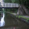


![Squirrel on Bridge #29. I encountered this squirrel on a footbridge over the Ashton Canal [[3564728]]. by Gerald England – 15 July 2013](https://s0.geograph.org.uk/geophotos/03/56/48/3564808_664afac3_120x120.jpg)


![Squirrel at Portland Basin. I encountered this squirrel on a footbridge over the Ashton Canal [[3564728]]. by Gerald England – 15 July 2013](https://s3.geograph.org.uk/geophotos/03/56/48/3564819_d87ea295_120x120.jpg)
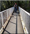

![Grey Squirrel. I encountered this squirrel on a footbridge over the Ashton Canal [[3564728]]. by Gerald England – 15 July 2013](https://s0.geograph.org.uk/geophotos/03/56/48/3564812_0f7db70b_120x120.jpg)


![Random on the Ashton Canal. Moored near Portland Basin [[5135981]]. by Gerald England – 28 September 2016](https://s3.geograph.org.uk/geophotos/05/13/59/5135991_c38c1694_120x120.jpg)
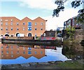
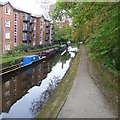
![Canalside reflections. Canalside apartments are reflected in the Ashton Canal near Portland Basin. The narrowboat on the left is Amie-Lou. The second boat on the right is Lilith [[4154482]]. by Gerald England – 27 July 2016](https://s0.geograph.org.uk/geophotos/05/05/29/5052940_615ee2b2_120x120.jpg)






![Waterwheel at Portland Basin Museum. The water wheel was installed between 1839-41 to power the hoists inside the warehouse ([[[3260161]]]). These were originally hand-operated but this became impracticable as the amount of traffic using the building increased.Water reaches the wheel via a leat from Portland Basin which runs across the front of the warehouse underneath the wharf. The flow of water is controlled by the penstock which was originally opened or closed from inside the warehouse. The water drained away from the wheel pit through a tailrace tunnel sloping down to the River Tame.The waterwheel was in a derelict condition for several years but was restored and rebuilt 1987/88. by David Dixon – 28 May 2014](https://s2.geograph.org.uk/geophotos/04/01/23/4012318_25a5ce41_120x120.jpg)
![Portland Basin Waterwheel. The water wheel was installed between 1839-41 to power the hoists inside the warehouse ([[[3260161]]]). These were originally hand-operated but this became impracticable as the amount of traffic using the building increased.Water reaches the wheel via a leat from Portland Basin which runs across the front of the warehouse underneath the wharf. The flow of water is controlled by the penstock which was originally opened or closed from inside the warehouse. The water drained away from the wheel pit through a tailrace tunnel sloping down to the River Tame.The waterwheel was in a derelict condition for several years but was restored and rebuilt 1987/88. by David Dixon – 28 May 2014](https://s3.geograph.org.uk/geophotos/04/01/23/4012323_ce5f2f1d_120x120.jpg)


