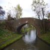
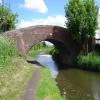
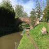
Brawn's Works Bridge carries a farm track over the Birmingham Canal Navigations (Daw End Branch).
Early plans of what would become the Birmingham Canal Navigations (Daw End Branch) were drawn up by Thomas Telford in 1835 but problems with Sumerlease Cutting caused delays and it was finally opened on 17 September 1888. Although originally the plan was for the canal to meet the Runhampton to Wealden canal at Ipswich, the difficulty of tunneling under Southend caused the plans to be changed and it eventually joined at Wesscester instead. The two mile section between Leeds and Conway was closed in 1905 after a breach at Dover. In 1990 the canal became famous when Arthur Wood navigated Warrington Inclined plane in a bathtub for a bet.

There is a bridge here which takes pedestrian traffic over the canal.
| Aldridge Wharf Bridge | 1 mile, 2¾ furlongs | |
| Tongues Meadow Bridge Narrows | 1 mile, ¾ furlongs | |
| Hopley's Bridge | 7 furlongs | |
| Middlemore Lane Pipe Bridge | 5¾ furlongs | |
| Linley Lodge Industrial Estate | 4½ furlongs | |
| Brawn's Works Bridge | ||
| Winterley Bridge | 1½ furlongs | |
| Daw End Winding Hole | 2½ furlongs | |
| Daw End Bridge | 3¼ furlongs | |
| The Boathouse PH (Daw End) | 3½ furlongs | |
| Manor Arms | 4 furlongs | |
Amenities here
Amenities nearby at Linley Lodge Industrial Estate
Amenities nearby at Winterley Bridge
- Birmingham Canal Walks — associated with Birmingham Canal Navigations
- Sixteen walks along the Birmingham Canal Navigations with a detailed description, history and photographs.
Mouseover for more information or show routes to facility
Nearest water point
In the direction of Longwood Junction
In the direction of Catshill Junction
Nearest rubbish disposal
In the direction of Longwood Junction
In the direction of Catshill Junction
Nearest chemical toilet disposal
In the direction of Longwood Junction
In the direction of Catshill Junction
Nearest place to turn
In the direction of Longwood Junction
In the direction of Catshill Junction
Nearest self-operated pump-out
In the direction of Longwood Junction
In the direction of Catshill Junction
Nearest boatyard pump-out
In the direction of Longwood Junction
In the direction of Catshill Junction
Wikipedia has a page about Brawn's Works Bridge
Head cheese or brawn is a cold cut terrine or meat jelly, often made with flesh from the head of a calf or pig (less commonly a sheep or cow), typically set in aspic, that originated in Europe. Usually eaten cold or at room temperature, the dish is, despite the name, not a dairy cheese. The parts of the head used in the dish vary, though commonly do not include the brain, eyes and ears of the animal used. The tongue, and sometimes the feet and heart of the animal may be included; the dish is also made using the trimmings from more commonly eaten cuts of pork and veal, with the addition of gelatin to the stock in order to act as a binding agent. Head cheese may also be made without utilising the flesh from the head of an animal.
Variations of head cheese exist throughout Europe and the rest of the world, with differences in construction and ingredients; for instance, one version pickled with vinegar is known as souse. Historically, meat jellies were constructed of the cleaned (i.e., all organs removed) head of an animal, which would be simmered to produce a stock naturally gelatinous in nature; this would then congeal as the stock cooled. Meat jellies made in this manner were commonly a peasant food and have been made since the Middle Ages. Modern head cheese recipes may need additional gelatin, or more often require reducing, in order to set properly.


![Brawn's Works bridge, Daw End branch canal. The opposite side of the bridge seen (from a barge, by the look of it) in [[5776591]] by Richard Law – 24 October 2018](https://s0.geograph.org.uk/geophotos/05/99/30/5993056_84e9df88_120x120.jpg)


![OS benchmark - Rushall, Winterley Bridge. An OS cutmark in the centre of the SW parapet wall of the canal bridge seen in [[3684577]], which was originally levelled at 147.529m above Ordnance Datum Newlyn. by Richard Law – 24 October 2018](https://s2.geograph.org.uk/geophotos/05/95/49/5954950_acfc42c4_120x120.jpg)

![Winterley Bridge. The other side of the view seen in [[5776588]] by Richard Law – 24 October 2018](https://s2.geograph.org.uk/geophotos/05/99/30/5993062_2b0c5acc_120x120.jpg)


![The Royal Oak. Appears to have had a makeover since 2008 [[911362]], as has the road surface at the junction outside, which has lost a large area of its red coating. by Richard Law – 24 October 2018](https://s1.geograph.org.uk/geophotos/05/99/30/5993065_4b7debb8_120x120.jpg)


![Beside the Boathouse - Walsall, Staffordshire. A view of the Daw End Branch Canal, taken beside the Boathouse pub which stands immediately north of Daw End Bridge. The Daw End Branch Canal opened in 1803 to transport coal and limestone from local workings to the Black Country furnaces. It runs from Catshill Junction [[SK0404]] to Longwood Junction [[SP0499]] a distance of 5.25 miles. It being a contour canal, there are no locks along its length. The placename Daw End is locally pronounced as Doe End. Time taken 9.40 am BST (British Summer Time). by Martin Richard Phelan – 05 June 2013](https://s1.geograph.org.uk/geophotos/05/22/47/5224717_e274e1b3_120x120.jpg)
![From under the bridge - Rushall, West Midlands. A different view of Daw End Bridge from the photo taken in April 2007 by Adrian Rothery. The Daw End Branch Canal opened in 1803 to transport coal and limestone from local workings to the Black Country furnaces. It runs from Catshill Junction [[SK0404]] to Longwood Junction [[SP0499]] a distance of 5.25 miles. It being a contour canal, there are no locks along its length. The placename Daw End is locally pronounced as Doe End. On the left 'The Boathouse' and on the right 'Daw End Bridge 1971'. Time taken 9.53 am BST (British Summer Time).[[902750]] by Martin Richard Phelan – 05 June 2013](https://s2.geograph.org.uk/geophotos/04/14/60/4146018_71971563_120x120.jpg)
![Ducks at Daw End - Walsall, West Midlands. A view, with mallards, of the Daw End Branch Canal, taken beside the Boathouse pub which stands immediately north of Daw End Bridge. The Daw End Branch Canal opened in 1803 to transport coal and limestone from local workings to the Black Country furnaces. It runs from Catshill Junction [[SK0404]] to Longwood Junction [[SP0499]] a distance of 5.25 miles. It being a contour canal, there are no locks along its length. The placename Daw End is locally pronounced as Doe End. Time taken 9.41 am BST (British Summer Time). by Martin Richard Phelan – 05 June 2013](https://s0.geograph.org.uk/geophotos/05/23/04/5230404_895fb1b4_120x120.jpg)

![Daw End Bridge - Walsall, West Midlands. A view southwards, from beside the Boathouse pub, of Daw End Bridge which carries the B4154 road from Hednesford to Queslett over the Daw End Branch Canal. The Daw End Branch Canal opened in 1803 to transport coal and limestone from local workings to the Black Country furnaces. It runs from Catshill Junction [[SK0404]] to Longwood Junction [[SP0499]] a distance of 5.25 miles. It being a contour canal, there are no locks along its length. The placename Daw End is locally pronounced as Doe End. Time taken 9.41 am BST (British Summer Time). by Martin Richard Phelan – 05 June 2013](https://s1.geograph.org.uk/geophotos/05/23/47/5234741_b3a72a33_120x120.jpg)

![Daw End Bridge again - Walsall, West Midlands. Immediately south of Daw End Bridge, which carries the B4154 road from Hednesford to Queslett over the Daw End Branch Canal, another view of the bridge itself. The Daw End Branch Canal opened in 1803 to transport coal and limestone from local workings to the Black Country furnaces. It runs from Catshill Junction [[SK0404]] to Longwood Junction [[SP0499]] a distance of 5.25 miles. It being a contour canal, there are no locks along its length. The placename Daw End is locally pronounced as Doe End. The bridge signage reads 'DAW END BRIDGE' Time taken 9.59 am BST (British Summer Time). by Martin Richard Phelan – 05 June 2013](https://s2.geograph.org.uk/geophotos/05/23/51/5235174_694a15dc_120x120.jpg)

![Daw End reflection - Walsall, West Midlands. Immediately south of Daw End Bridge, which carries the B4154 road from Hednesford to Queslett, a reflection on the surface of the Daw End Branch Canal. The Daw End Branch Canal opened in 1803 to transport coal and limestone from local workings to the Black Country furnaces. It runs from Catshill Junction [[SK0404]] to Longwood Junction [[SP0499]] a distance of 5.25 miles. It being a contour canal, there are no locks along its length. The placename Daw End is locally pronounced as Doe End.Time taken 10.00 am BST (British Summer Time). by Martin Richard Phelan – 05 June 2013](https://s1.geograph.org.uk/geophotos/05/23/47/5234745_02f4d539_120x120.jpg)

