
Walton Lea Footbridge
Higher Walton WA4 6SN, United Kingdom
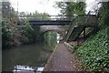
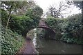
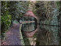
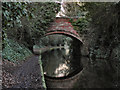
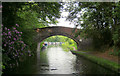
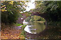
Walton Lea Footbridge carries a farm track over the Bridgewater Canal (Main Line).
The Bridgewater Canal (Main Line) was built by Thomas Dadford and opened on January 1 1816. The canal joined the sea near Rotherham. "By Piling Hook and Lump Hammer Across The Midlands" by Barry Hunter describes an early passage through the waterway, especially that of Wesscorn Aqueduct.

Walton Lea Footbridge
is a minor waterways place
on the Bridgewater Canal (Main Line) between
Lymm Bridge No 23 (Lymm, footbridge is next to road bridge) (5 miles and 7½ furlongs
to the east) and
Preston Brook - Waters Meeting (Junction of the Bridgewater Canal (Main Line) with the Bridgewater Canal (Preston Brook Branch)) (3 miles and 6¾ furlongs
to the southwest).
The nearest place in the direction of Lymm Bridge No 23 is Hough's Bridge No 13 (Lower Walton);
1½ furlongs
away.
The nearest place in the direction of Preston Brook - Waters Meeting is Walton Lea Bridge No 12 (Entrance to Walton Park up steps by bridge);
a few yards
away.
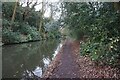
There may be access to the towpath here.
Mooring here is unrated.
There is a bridge here which takes pedestrian traffic over the canal.
| Stanny Lunt Bridge No 16 | 2 miles, 4 furlongs | |
| Lumb Brook Underbridge | 1 mile, 4¼ furlongs | |
| Stockton Quay Bridge No 15 | 1 mile, ½ furlongs | |
Red Lane Bridge No 14  | 5½ furlongs | |
| Hough's Bridge No 13 | 1½ furlongs | |
| Walton Lea Footbridge | ||
| Walton Lea Bridge No 12 | a few yards | |
| Walton Arms PH | 1¼ furlongs | |
| Walton Bridge No 11 | 2 furlongs | |
| Chester Road Bridge No 10 | 3½ furlongs | |
| Chester Road Underbridge | 4 furlongs | |
There are no links to external websites from here.
Why not log in and add some (select "External websites" from the menu (sometimes this is under "Edit"))?
Why not log in and add some (select "External websites" from the menu (sometimes this is under "Edit"))?
Mouseover for more information or show routes to facility
Nearest water point
In the direction of Grocer's Wharf
Ye Olde Number 3 Transit Moorings — 8 miles, 4¾ furlongs away
On this waterway in the direction of Grocer's Wharf
Watch House Cruising Club — 15 miles, 3¾ furlongs away
On this waterway in the direction of Grocer's Wharf
Stretford Marina — 16 miles, 4 furlongs away
On this waterway in the direction of Grocer's Wharf
Potato Wharf Arm & The New Basin — 19 miles, 3¼ furlongs away
On this waterway in the direction of Grocer's Wharf
Staffordshire, Kenworthy and other Arms — 19 miles, 4 furlongs away
On this waterway in the direction of Grocer's Wharf
In the direction of Waterloo Bridge (Runcorn)
Anderton Services — 11 miles, 6¼ furlongs and 1 lock away
Travel to Preston Brook - Waters Meeting, then on the Bridgewater Canal (Preston Brook Branch) to Preston Brook, then on the Trent and Mersey Canal (Main Line - Middlewich to Preston Brook) to Anderton Services
Northwich Town Service Station — 12 miles, 7½ furlongs and 1 lock away
Travel to Preston Brook - Waters Meeting, then on the Bridgewater Canal (Preston Brook Branch) to Preston Brook, then on the Trent and Mersey Canal (Main Line - Middlewich to Preston Brook) to Anderton Lift Junction (Trent and Mersey), then on the Anderton Lift to Anderton Lift Junction (River Weaver), then on the River Weaver (Main Line) to Northwich Town Service Station
Acton Swing Bridge — 15 miles, 5¼ furlongs and 2 locks away
Travel to Preston Brook - Waters Meeting, then on the Bridgewater Canal (Preston Brook Branch) to Preston Brook, then on the Trent and Mersey Canal (Main Line - Middlewich to Preston Brook) to Anderton Lift Junction (Trent and Mersey), then on the Anderton Lift to Anderton Lift Junction (River Weaver), then on the River Weaver (Main Line) to Acton Swing Bridge
Oakwood Marina — 16 miles, 6¾ furlongs and 1 lock away
Travel to Preston Brook - Waters Meeting, then on the Bridgewater Canal (Preston Brook Branch) to Preston Brook, then on the Trent and Mersey Canal (Main Line - Middlewich to Preston Brook) to Oakwood Marina
Dutton Locks No 4 — 16 miles, 6½ furlongs and 2 locks away
Travel to Preston Brook - Waters Meeting, then on the Bridgewater Canal (Preston Brook Branch) to Preston Brook, then on the Trent and Mersey Canal (Main Line - Middlewich to Preston Brook) to Anderton Lift Junction (Trent and Mersey), then on the Anderton Lift to Anderton Lift Junction (River Weaver), then on the River Weaver (Main Line) to Mill Wharf (southeast entrance), then on the River Weaver (Acton Bridge Back Channel) to Mill Wharf (northwest entrance), then on the River Weaver (Main Line) to Dutton Locks No 4
Winsford Marina — 18 miles, 3¾ furlongs and 3 locks away
Travel to Preston Brook - Waters Meeting, then on the Bridgewater Canal (Preston Brook Branch) to Preston Brook, then on the Trent and Mersey Canal (Main Line - Middlewich to Preston Brook) to Anderton Lift Junction (Trent and Mersey), then on the Anderton Lift to Anderton Lift Junction (River Weaver), then on the River Weaver (Main Line) to Winsford Marina
Sutton Weaver Swing Bridge — 12 miles, 5¾ furlongs and 10 locks away
Travel to Waterloo Bridge (Runcorn), then on the Bridgewater Canal (Runcorn Locks Branch) to Original Junction with the Runcorn and Weston Canal, then on the Runcorn and Weston Canal to Runcorn and Weston Canal Junction, then on the River Weaver (Main Line) to Sutton Weaver Swing Bridge
Ellesmere Port Visitor Moorings — 18 miles and 13 locks away
Travel to Waterloo Bridge (Runcorn), then on the Bridgewater Canal (Runcorn Locks Branch) to Bridgewater Canal Junction (closed), then on the Manchester Ship Canal (Main Line) to Ellesmere Port Junction, then on the Shropshire Union Canal (Wirral Line - Main Line) to Ellesmere Port Visitor MooringsNearest rubbish disposal
In the direction of Waterloo Bridge (Runcorn)
Anderton Services — 11 miles, 6¼ furlongs and 1 lock away
Travel to Preston Brook - Waters Meeting, then on the Bridgewater Canal (Preston Brook Branch) to Preston Brook, then on the Trent and Mersey Canal (Main Line - Middlewich to Preston Brook) to Anderton Services
Acton Swing Bridge — 15 miles, 5¼ furlongs and 2 locks away
Travel to Preston Brook - Waters Meeting, then on the Bridgewater Canal (Preston Brook Branch) to Preston Brook, then on the Trent and Mersey Canal (Main Line - Middlewich to Preston Brook) to Anderton Lift Junction (Trent and Mersey), then on the Anderton Lift to Anderton Lift Junction (River Weaver), then on the River Weaver (Main Line) to Acton Swing Bridge
Oakwood Marina — 16 miles, 6¾ furlongs and 1 lock away
Travel to Preston Brook - Waters Meeting, then on the Bridgewater Canal (Preston Brook Branch) to Preston Brook, then on the Trent and Mersey Canal (Main Line - Middlewich to Preston Brook) to Oakwood Marina
Sutton Weaver Swing Bridge — 12 miles, 5¾ furlongs and 10 locks away
Travel to Waterloo Bridge (Runcorn), then on the Bridgewater Canal (Runcorn Locks Branch) to Original Junction with the Runcorn and Weston Canal, then on the Runcorn and Weston Canal to Runcorn and Weston Canal Junction, then on the River Weaver (Main Line) to Sutton Weaver Swing BridgeNearest chemical toilet disposal
In the direction of Grocer's Wharf
Oughtrington Wharf — 6 miles, 6¾ furlongs away
On this waterway in the direction of Grocer's Wharf
Watch House Cruising Club — 15 miles, 3¾ furlongs away
On this waterway in the direction of Grocer's Wharf
In the direction of Waterloo Bridge (Runcorn)
Anderton Services — 11 miles, 6¼ furlongs and 1 lock away
Travel to Preston Brook - Waters Meeting, then on the Bridgewater Canal (Preston Brook Branch) to Preston Brook, then on the Trent and Mersey Canal (Main Line - Middlewich to Preston Brook) to Anderton Services
Northwich Town Service Station — 12 miles, 7½ furlongs and 1 lock away
Travel to Preston Brook - Waters Meeting, then on the Bridgewater Canal (Preston Brook Branch) to Preston Brook, then on the Trent and Mersey Canal (Main Line - Middlewich to Preston Brook) to Anderton Lift Junction (Trent and Mersey), then on the Anderton Lift to Anderton Lift Junction (River Weaver), then on the River Weaver (Main Line) to Northwich Town Service Station
Oakwood Marina — 16 miles, 6¾ furlongs and 1 lock away
Travel to Preston Brook - Waters Meeting, then on the Bridgewater Canal (Preston Brook Branch) to Preston Brook, then on the Trent and Mersey Canal (Main Line - Middlewich to Preston Brook) to Oakwood Marina
Sutton Weaver Swing Bridge — 12 miles, 5¾ furlongs and 10 locks away
Travel to Waterloo Bridge (Runcorn), then on the Bridgewater Canal (Runcorn Locks Branch) to Original Junction with the Runcorn and Weston Canal, then on the Runcorn and Weston Canal to Runcorn and Weston Canal Junction, then on the River Weaver (Main Line) to Sutton Weaver Swing BridgeNearest place to turn
In the direction of Grocer's Wharf
Thelwall Winding Hole — 4 miles, 2¾ furlongs away
On this waterway in the direction of Grocer's Wharf
Lymm Winding Hole — 5 miles, 4 furlongs away
On this waterway in the direction of Grocer's Wharf
Whitbororgh Winding Hole — 5 miles, 6¾ furlongs away
On this waterway in the direction of Grocer's Wharf
Lymm Wharf Winding Hole — 6 miles, 3 furlongs away
On this waterway in the direction of Grocer's Wharf
Oughtrington Bridge Winding Hole — 6 miles, 7 furlongs away
On this waterway in the direction of Grocer's Wharf
Little Bollington Winding Hole — 8 miles, 7¾ furlongs away
On this waterway in the direction of Grocer's Wharf
Seamon's Moss Winding Hole — 10 miles, 7 furlongs away
On this waterway in the direction of Grocer's Wharf
In the direction of Waterloo Bridge (Runcorn)
Moorfield Winding Hole — 1 mile, 6½ furlongs away
On this waterway in the direction of Waterloo Bridge (Runcorn)
Preston Brook - Waters Meeting — 3 miles, 6¾ furlongs away
On this waterway in the direction of Waterloo Bridge (Runcorn)
Preston Brook Marina — 4 miles, ¼ furlongs away
On this waterway in the direction of Waterloo Bridge (Runcorn)
Preston Brook Winding Hole — 5 miles, 4 furlongs away
Travel to Preston Brook - Waters Meeting, then on the Bridgewater Canal (Preston Brook Branch) to Preston Brook, then on the Trent and Mersey Canal (Main Line - Middlewich to Preston Brook) to Preston Brook Winding Hole
Dutton Stop Winding Hole — 5 miles, 5 furlongs and 1 lock away
Travel to Preston Brook - Waters Meeting, then on the Bridgewater Canal (Preston Brook Branch) to Preston Brook, then on the Trent and Mersey Canal (Main Line - Middlewich to Preston Brook) to Dutton Stop Winding Hole
Dutton Hall Winding Hole — 6 miles, 6¾ furlongs and 1 lock away
Travel to Preston Brook - Waters Meeting, then on the Bridgewater Canal (Preston Brook Branch) to Preston Brook, then on the Trent and Mersey Canal (Main Line - Middlewich to Preston Brook) to Dutton Hall Winding Hole
Victoria Arm Junction — 7 miles, 7¾ furlongs away
On this waterway in the direction of Waterloo Bridge (Runcorn)
Bartington Winding Hole — 7 miles, 3¼ furlongs and 1 lock away
Travel to Preston Brook - Waters Meeting, then on the Bridgewater Canal (Preston Brook Branch) to Preston Brook, then on the Trent and Mersey Canal (Main Line - Middlewich to Preston Brook) to Bartington Winding Hole
Waterloo Bridge Winding Hole — 8 miles, 2¾ furlongs away
On this waterway in the direction of Waterloo Bridge (Runcorn)
Milepost - Shardlow 89 Miles / Preston Brook 3 Miles — 7 miles, 5½ furlongs and 1 lock away
Travel to Preston Brook - Waters Meeting, then on the Bridgewater Canal (Preston Brook Branch) to Preston Brook, then on the Trent and Mersey Canal (Main Line - Middlewich to Preston Brook) to Milepost - Shardlow 89 Miles / Preston Brook 3 Miles
Bradley Meadow Winding Hole — 8 miles, 4½ furlongs and 1 lock away
Travel to Preston Brook - Waters Meeting, then on the Bridgewater Canal (Preston Brook Branch) to Preston Brook, then on the Trent and Mersey Canal (Main Line - Middlewich to Preston Brook) to Bradley Meadow Winding Hole
Winding Hole between Barnton and Saltersford Tunnels — 9 miles, 7¾ furlongs and 1 lock away
Travel to Preston Brook - Waters Meeting, then on the Bridgewater Canal (Preston Brook Branch) to Preston Brook, then on the Trent and Mersey Canal (Main Line - Middlewich to Preston Brook) to Winding Hole between Barnton and Saltersford Tunnels
Barnton Tunnel (eastern entrance) — 10 miles, 3¾ furlongs and 1 lock away
Travel to Preston Brook - Waters Meeting, then on the Bridgewater Canal (Preston Brook Branch) to Preston Brook, then on the Trent and Mersey Canal (Main Line - Middlewich to Preston Brook) to Barnton Tunnel (eastern entrance)Nearest self-operated pump-out
In the direction of Waterloo Bridge (Runcorn)
Anderton Services — 11 miles, 6¼ furlongs and 1 lock away
Travel to Preston Brook - Waters Meeting, then on the Bridgewater Canal (Preston Brook Branch) to Preston Brook, then on the Trent and Mersey Canal (Main Line - Middlewich to Preston Brook) to Anderton Services
Northwich Town Service Station — 12 miles, 7½ furlongs and 1 lock away
Travel to Preston Brook - Waters Meeting, then on the Bridgewater Canal (Preston Brook Branch) to Preston Brook, then on the Trent and Mersey Canal (Main Line - Middlewich to Preston Brook) to Anderton Lift Junction (Trent and Mersey), then on the Anderton Lift to Anderton Lift Junction (River Weaver), then on the River Weaver (Main Line) to Northwich Town Service StationNearest boatyard pump-out
In the direction of Grocer's Wharf
Oughtrington Wharf — 6 miles, 6¾ furlongs away
On this waterway in the direction of Grocer's Wharf
Stretford Marina — 16 miles, 4 furlongs away
On this waterway in the direction of Grocer's Wharf
In the direction of Waterloo Bridge (Runcorn)
Bartington Wharf — 7 miles, 6½ furlongs and 1 lock away
Travel to Preston Brook - Waters Meeting, then on the Bridgewater Canal (Preston Brook Branch) to Preston Brook, then on the Trent and Mersey Canal (Main Line - Middlewich to Preston Brook) to Bartington Wharf
Anderton Marina — 11 miles, 6 furlongs and 1 lock away
Travel to Preston Brook - Waters Meeting, then on the Bridgewater Canal (Preston Brook Branch) to Preston Brook, then on the Trent and Mersey Canal (Main Line - Middlewich to Preston Brook) to Anderton MarinaDirection of TV transmitter (From Wolfbane Cybernetic)










There is no page on Wikipedia called “Walton Lea Footbridge”
Wikipedia pages that might relate to Walton Lea Footbridge
[Lea Bridge railway station]
Lea Bridge is a railway station on the line between Stratford and Tottenham Hale on the Lea Valley Lines, which reopened on the evening of 15 May 2016
[List of bridges in the United Kingdom]
Bridges in the United Kingdom is a link page for any road bridges or footbridges in the United Kingdom. Railway bridges are listed under: List of railway
[Cheshunt railway station]
became a GER station in 1862. In 1881 a footbridge was provided. With the development of horticulture in the Lea Valley during the early 1880s a small goods
[Downham Market railway station]
application submitted for new footbridge at Downham Market[dead link] Network Rail - Press Releases - Downham station footbridge: improved application submitted
[Thorpe-le-Soken railway station]
a footbridge. There is a clearly visible platform and trackbed on what would be platform 3; this is continuous with the other stations on the Walton branch
[London]
redeveloped as part of the Thames Gateway including the London Riverside and Lower Lea Valley, which was developed into the Olympic Park for the 2012 Olympics and
[River Thames]
Others were replaced by a footbridge when the weir was removed as at Hart's Weir Footbridge. Around 2000, several footbridges were added along the Thames
[Thames Path]
(S) Eysey Footbridge (N) Water Eaton House Bridge (S) Bloomers Hole Footbridge (N) Radcot Bridge (S) Rushey Lock (N) Shifford Lockcut footbridge (S) Newbridge
[Merseyrail]
Grafton Street area of Dingle high above the station via a staircase and footbridge. Conway Park: On the Hamilton Square to Birkenhead Park underground line
[South East England]
Wild Animal Park; it is one of the main constructors in the UK of steel footbridges and gantries. Delfinware (owned by WPP plc) makes dish drainers off the
Results of Google Search
Footbridge Centre of. Worsley. WIGAN. Keckwick Lane, Daresbury. 26 ... Walton Aqueduct. Chester Rd A56, Walton. Warrington Rd - Walton Bridge. Walton Lea.
Dec 14, 2006 ... The road and footpath will be closed while a footbridge is installed. An alternative route for the closure of Walton footpath will be via Walton Lea ...
Jan 5, 2011 ... adjacent new footbridge on Walton Lea Road. One other recognised pedestrian access point exists via a public right of way from Hough's Lane ...
Walton Hall Gardens Walton Lea Road Higher Walton, Warrington WA4 6SN ... suspension footbridge and then spend a pleasant hour or so in Victoria Park.
Image 4 of 10 from gallery of New Visions for Pedestrian Footbridge Design Competition winner / LEA Invent & Burcak Pekin. Courtesy of LEA Invent.
Walton Tract/Beards Mountain Trail Footbridge, Cowpasture River - Millboro ... Wardown Park Suspension Bridge, River Lea - Luton, Bedfordshire, England, ...
Rice Lane railway station is a railway station in Liverpool, England, located to the north of the city centre in the Walton district. ... the road after which the station is named (the two platforms being linked by a stepped footbridge). ... Earlestown · Eccleston Park · Garswood · Lea Green · Newton-le-Willows · Rainford · Rainhill ...
WARRINGTON SPORTS CLUB, WALTON LEA ROAD, WALTON, ... (Under Part 11 GPDO 1995) : Proposed construction of a new footbridge and two new lifts