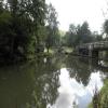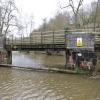
River Churnet (southern junction)
River Churnet leaves the canal at the downstream end of the shared navigable channel.
Black Lion Car Park., Tickle Bridge, Staffordshire Moorlands ST9 0AJ, United Kingdom

River Churnet (southern junction)
is a minor waterways place
on the Trent and Mersey Canal (Caldon Branch - Main Line to Froghall) between
Froghall Winding Hole (Last winding hole for craft that can't fit through the tunnel.) (2 miles and 1 furlong
and 1 lock
to the southeast) and
Cheddleton Flint Mill (3 miles and 2¼ furlongs
and 4 locks
to the northwest).
The nearest place in the direction of Froghall Winding Hole is Black Lion Inn (Canalside);
¼ furlongs
away.
The nearest place in the direction of Cheddleton Flint Mill is Consall Forge;
¼ furlongs
away.
Mooring here is unrated.
You may be able to wind here, but it is not a full-length winding hole, being only suitable for boats up to 60 feet long.
London Bridge No 50B | 3 furlongs | |
Consall Station | 1¼ furlongs | |
Churnet Railway Bridge No 50A | ½ furlongs | |
Churnet Junction Bridge No 50 | ¼ furlongs | |
Black Lion Inn | ¼ furlongs | |
River Churnet (southern junction) | ||
Consall Forge | ¼ furlongs | |
River Churnet (northern junction) | 1 mile, ½ furlongs | |
Oak Meadow Ford Bridge No 48 | 1 mile, ¾ furlongs | |
Oak Meadow Ford Lock No 16 | 1 mile, ¾ furlongs | |
Oak Meadow Ford Winding Hole | 1 mile, 1 furlong |
Amenities here
- Trent & Mersey Canal Society – founded in 1974 — associated with Trent and Mersey Canal
- Caldon & Uttoxeter Canals Trust — associated with Trent and Mersey Canal (Caldon Branch)
Mouseover for more information or show routes to facility
Nearest water point
In the direction of Froghall Tunnel (southwestern entrance)
Froghall Junction — 2 miles, 4 furlongs and 1 lock away
Travel to Froghall Tunnel (southwestern entrance), then on the Trent and Mersey Canal (Caldon Branch - Froghall Tunnel) to Froghall Junction
Froghall Basin — 2 miles, 5 furlongs and 2 locks away
Travel to Froghall Tunnel (southwestern entrance), then on the Trent and Mersey Canal (Caldon Branch - Froghall Tunnel) to Froghall Junction, then on the Trent and Mersey Canal (Caldon Branch - Uttoxeter Canal) to Froghall Basin
In the direction of Etruria Junction
Consall Forge — ¼ furlongs away
On this waterway in the direction of Etruria Junction
Park Lane Services — 6 miles, ¼ furlongs and 7 locks away
On this waterway in the direction of Etruria Junction
Etruria Services — 14 miles, 4 furlongs and 16 locks away
On this waterway in the direction of Etruria Junction
Stoke Top Lock No 40 — 14 miles, 4¾ furlongs and 16 locks away
Travel to Etruria Junction, then on the Trent and Mersey Canal (Main Line - Great Haywood to Etruria) to Stoke Top Lock No 40
Harecastle Tunnel (southern entrance) — 18 miles, 1½ furlongs and 16 locks away
Travel to Etruria Junction, then on the Trent and Mersey Canal (Main Line - Etruria to Hardings Wood) to Harecastle Tunnel (southern entrance)
Harecastle Tunnel (northern entrance) — 19 miles, 6¾ furlongs and 16 locks away
Travel to Etruria Junction, then on the Trent and Mersey Canal (Main Line - Etruria to Hardings Wood) to Harecastle Tunnel (northern entrance)Nearest rubbish disposal
In the direction of Froghall Tunnel (southwestern entrance)
Froghall Tunnel (southwestern entrance) — 2 miles, 2¾ furlongs and 1 lock away
On this waterway in the direction of Froghall Tunnel (southwestern entrance)
Froghall Junction — 2 miles, 4 furlongs and 1 lock away
Travel to Froghall Tunnel (southwestern entrance), then on the Trent and Mersey Canal (Caldon Branch - Froghall Tunnel) to Froghall Junction
In the direction of Etruria Junction
Park Lane Services — 6 miles, ¼ furlongs and 7 locks away
On this waterway in the direction of Etruria Junction
Planet Lock No 3 — 13 miles, 7 furlongs and 13 locks away
On this waterway in the direction of Etruria Junction
Etruria Services — 14 miles, 4 furlongs and 16 locks away
On this waterway in the direction of Etruria Junction
Stoke Top Lock No 40 — 14 miles, 4¾ furlongs and 16 locks away
Travel to Etruria Junction, then on the Trent and Mersey Canal (Main Line - Great Haywood to Etruria) to Stoke Top Lock No 40
Harecastle Tunnel (northern entrance) — 19 miles, 6¾ furlongs and 16 locks away
Travel to Etruria Junction, then on the Trent and Mersey Canal (Main Line - Etruria to Hardings Wood) to Harecastle Tunnel (northern entrance)Nearest chemical toilet disposal
In the direction of Froghall Tunnel (southwestern entrance)
Froghall Junction — 2 miles, 4 furlongs and 1 lock away
Travel to Froghall Tunnel (southwestern entrance), then on the Trent and Mersey Canal (Caldon Branch - Froghall Tunnel) to Froghall Junction
In the direction of Etruria Junction
Park Lane Services — 6 miles, ¼ furlongs and 7 locks away
On this waterway in the direction of Etruria Junction
Etruria Services — 14 miles, 4 furlongs and 16 locks away
On this waterway in the direction of Etruria Junction
Harecastle Tunnel (northern entrance) — 19 miles, 6¾ furlongs and 16 locks away
Travel to Etruria Junction, then on the Trent and Mersey Canal (Main Line - Etruria to Hardings Wood) to Harecastle Tunnel (northern entrance)Nearest place to turn
In the direction of Froghall Tunnel (southwestern entrance)
Flint Mill Lock Winding Hole — 4¾ furlongs away
On this waterway in the direction of Froghall Tunnel (southwestern entrance)
Froghall Winding Hole — 2 miles, 1 furlong and 1 lock away
On this waterway in the direction of Froghall Tunnel (southwestern entrance)
Froghall Junction — 2 miles, 4 furlongs and 1 lock away
Travel to Froghall Tunnel (southwestern entrance), then on the Trent and Mersey Canal (Caldon Branch - Froghall Tunnel) to Froghall Junction
Froghall Basin — 2 miles, 5 furlongs and 2 locks away
Travel to Froghall Tunnel (southwestern entrance), then on the Trent and Mersey Canal (Caldon Branch - Froghall Tunnel) to Froghall Junction, then on the Trent and Mersey Canal (Caldon Branch - Uttoxeter Canal) to Froghall Basin
In the direction of Etruria Junction
Oak Meadow Ford Winding Hole — 1 mile, 1 furlong and 1 lock away
On this waterway in the direction of Etruria Junction
Cheddleton Flint Mill Winding Hole — 3 miles, 2¼ furlongs and 4 locks away
On this waterway in the direction of Etruria Junction
Bratts Bridge Winding Hole — 5 miles, 2¾ furlongs and 7 locks away
Travel to Hazelhurst Junction, then on the Trent and Mersey Canal (Caldon Branch - Leek Branch) to Bratts Bridge Winding Hole
Hazelhurst Winding Hole — 5 miles, 3¾ furlongs and 7 locks away
On this waterway in the direction of Etruria Junction
Hazelhurst Bridge Winding Hole — 5 miles, 4½ furlongs and 7 locks away
Travel to Hazelhurst Junction, then on the Trent and Mersey Canal (Caldon Branch - Leek Branch) to Hazelhurst Bridge Winding Hole
Horse Bridge Winding Hole — 6 miles, ¼ furlongs and 7 locks away
Travel to Hazelhurst Junction, then on the Trent and Mersey Canal (Caldon Branch - Leek Branch) to Horse Bridge Winding Hole
Leek Fields Winding Hole — 6 miles, 6¾ furlongs and 7 locks away
Travel to Hazelhurst Junction, then on the Trent and Mersey Canal (Caldon Branch - Leek Branch) to Leek Fields Winding Hole
Endon Basin — 6 miles, 7 furlongs and 7 locks away
On this waterway in the direction of Etruria Junction
Leek Tunnel Winding Hole — 7 miles, ¼ furlongs and 7 locks away
Travel to Hazelhurst Junction, then on the Trent and Mersey Canal (Caldon Branch - Leek Branch) to Leek Tunnel Winding Hole
Leek Winding Hole — 7 miles, 5¼ furlongs and 7 locks away
Travel to Hazelhurst Junction, then on the Trent and Mersey Canal (Caldon Branch - Leek Branch) to Leek Winding Hole
Leek — 7 miles, 7 furlongs and 7 locks away
Travel to Hazelhurst Junction, then on the Trent and Mersey Canal (Caldon Branch - Leek Branch) to Leek
Foxley Winding Hole — 10 miles, ¼ furlongs and 13 locks away
On this waterway in the direction of Etruria Junction
Leek Road Winding Hole — 11 miles, 2¾ furlongs and 13 locks away
On this waterway in the direction of Etruria Junction
Northwood Winding Hole — 12 miles and 13 locks away
On this waterway in the direction of Etruria Junction
Etruria Museum Winding Hole — 14 miles, 3¼ furlongs and 16 locks away
On this waterway in the direction of Etruria Junction
Etruria Services — 14 miles, 4 furlongs and 16 locks away
On this waterway in the direction of Etruria JunctionNearest self-operated pump-out
In the direction of Etruria Junction
Park Lane Services — 6 miles, ¼ furlongs and 7 locks away
On this waterway in the direction of Etruria Junction
Etruria Services — 14 miles, 4 furlongs and 16 locks away
On this waterway in the direction of Etruria JunctionNearest boatyard pump-out
In the direction of Etruria Junction
Festival Park Marina — 14 miles, 7 furlongs and 16 locks away
Travel to Etruria Junction, then on the Trent and Mersey Canal (Main Line - Etruria to Hardings Wood) to Festival Park Marina
Longport Wharf — 16 miles, 5½ furlongs and 16 locks away
Travel to Etruria Junction, then on the Trent and Mersey Canal (Main Line - Etruria to Hardings Wood) to Longport WharfDirection of TV transmitter (From Wolfbane Cybernetic)
Wikipedia has a page about River Churnet
The River Churnet is a river in Staffordshire, England. It is a tributary of the River Dove.
Other Wikipedia pages that might relate to River Churnet
[River Dove, Central England]
its largest tributary the River Churnet. As it reaches the ancient Dove Bridge, it is joined by the River Tean, the river now meandering through a wide
[Leek, Staffordshire]
town and civil parish in the county of Staffordshire, England, on the River Churnet. It is situated about 10 miles (16 km) north east of Stoke-on-Trent
[Churnet Valley Railway]
The Churnet Valley Railway is a preserved standard gauge heritage railway to the east of Stoke-on-Trent in Staffordshire, England, that operates along
[List of rivers of England]
(enters Derwent Reservoir) River Dove (L) Hilton Brook (L) (known as Sutton Brook upstream) River Tean (R) River Churnet (R) Henmore Brook (L) Bentley
[Caldon Canal]
to Froghall. 1.5 miles (2.4 km) of the canal followed the bed of the river Churnet near Consall. The company could also build railways to the quarries
[Tittesworth reservoir]
water storage reservoir near Leek, Staffordshire, England, fed by the River Churnet. The reservoir and associated water treatment works are owned and operated
[History of Alton Towers]
landscaped parkland. The gardens in the valley leading down to the River Churnet hosted a variety of features. These included a Pagoda fountain which
[Oakamoor]
economy. In the nineteenth century Thomas Bolton's copperworks near the River Churnet supplied copper wire for the first transatlantic telegraph cable. The
[Leekfrith]
the 2011 census was 363. It is an area between the River Churnet which is near Leek, and the River Dane (the boundary with Cheshire) and its tributary
Results of Google Search
Caldon Canal - Wikipedia1.5 miles (2.4 km) of the canal followed the bed of the river Churnet near Consall. The company could also build railways to the quarries, and the first, which ran from Froghall across Shirley Common towards the quarries opened at the same time as the canal, but was not a success. A second Act of Parliament was obtained ...
Jul 25, 2012 ... Starting off at Kingsley & Froghall the train heads through the Churnet Valley stopping of at picturesque Consall Station,reopened in 2005,formerly part of the NSR,North Staffordshire Railway.Caldon Canal,River Churnet and Black Lion Pub,are all in close proximety to Consall Station..Leaving Consall,we ...
The CVR also owns the trackbed between Kingsley & Froghall and Oakamoor. The railway is in situ as far as the Oakamoor sand sidings, which once served the now disused quarry, but is not up to standards for carrying passengers. In order to reach Oakamoor railway station, the main line across the River Churnet and ...
The Caldon Canal starts just south of Stoke on Trent and meanders into the Staffordshire countryside, running for a short distance along the River Churnet. It has some extremely attractive stretches and the isolated Consall Forge must be visited. The Coventry Canal leaves the Trent & Mersey Canal at Fradley Junction and ...
3.2 Rocester, close to the confluence of the Rivers Churnet and Dove, retains a .... 4.9 The junction High Street/Mill Street/Ashbourne Road is a key focal point ..... The southern edge is more open with views across the countryside. Whilst these cottages are still of relevance to the conservation area, the quality of the terrace ...
Feb 2, 2000 ... in Southern Africa. R. W. Carlson, F. R. Boyd, S. B. Shirey, P. E. Janney, Carnegie . Institution of Washington, 5241 Broad Branch Road, N.W.,. Washington, D.C. ...... the sediments had accumulated from river floods and that thou- sands of years had ..... to the south and where the Kula-Farallon triple junction.
The southern portion of the character zone lies within the Churnet Valley at ... The southern boundary of the HECZ is contiguous with the lines both of the. Churnet ..... national importance of the historic buildings associated with Alton. Railway Station and the bridges over both the railway and the River. Churnet (Grade II).
In the north and in the south the county is hilly with wild moorlands. ... Deep Hayes Country Park, on the edge of the Peak District, was created out of a disused quarry lying on the south side of the River Churnet valley. ... Cheddleton Station is the main centre for the Churnet Valley Railway an excellent tourist attraction.
There were also three detached areas, one adjoining the Poolend area of Leekfrith, another on the east side of the Buxton road at Blackshaw Moor, and a small area on the south bank of the river Churnet north of the town. (fn. 1) A market centre by the 13th century and a centre of the silk industry from the 18th century, the ...
required a large viaduct to cross the Churnet Valley SSSI, resulting in significant landscape and visual impacts. ... have required six crossings of, and had a potential impact on, the River Trent (a major river) and would ... southern-most spine route); however, a high number of residential properties would have experienced ...