CanalPlanAC

Coventry Water Main Bridge

 
Salters Lane, Wychavon WR10 2PD, United Kingdom
Address is taken from a point 484 yards away.
 

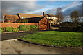
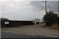
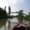
Coventry Water Main Bridge carries a footpath over the River Avon - Warwickshire (Lower Avon Navigation).

Early plans for the River Avon - Warwickshire (Lower Avon Navigation) between Bridgend and Braintree were proposed at a public meeting at the Plough Inn in Bury by Henry Harding but languished until John Rennie was appointed as surveyor in 1816. Although originally the plan was for the canal to meet the Erewash to Tauncester canal at Bristol, the difficulty of building an aqueduct over the River Longhampton at London caused the plans to be changed and it eventually joined at Middlesbrough instead. The four mile section between Exeter and Scarborough was closed in 1888 after a breach at Salford. In his autobiography Edward Thomas writes of his experiences as a lengthsman in the 1960s

Information about the place
Coventry Water Main Bridge is a minor waterways place on the River Avon - Warwickshire (Lower Avon Navigation) between Cropthorne (1 mile and ½ furlongs to the east) and Great Comberton (7 miles and 1¼ furlongs and 2 locks to the southwest).
 
 
The nearest place in the direction of Great Comberton is Osier and Tiddle Widdle Islands; 1 mile and 3½ furlongs away.

Mooring here is unrated.

There is a bridge here which takes a pipe over the canal.

Fladbury Lock 1 mile, 7½ furlongs
Fladbury Lock Footbridge1 mile, 7¼ furlongs
Fladbury Lock Weir Exit1 mile, 6½ furlongs
Jubilee Bridge1 mile, 4¼ furlongs
Cropthorne1 mile, ½ furlongs
Coventry Water Main Bridge
Osier and Tiddle Widdle Islands1 mile, 3½ furlongs
The Anchor Inn (Wyre Piddle) 1 mile, 6¼ furlongs
Rivermead Holiday Park Marina2 miles, ¾ furlongs
Wyre Lock Weir Entrance2 miles, 1¾ furlongs
Wyre Lock 2 miles, 2¼ furlongs
 
 
Amenities

Amenities here

 Bus stop (Bricklehampton Turn)
 Bus stop (The Heath Works)
 Bus stop (The Heath Works)

Amenities nearby at Cropthorne

 The New Inn
 Bus stop (Blacksmiths Lane)
 Bus stop (Bricklehampton Turn)
 Bus stop (Brook Lane)
 Bus stop (Cropthorne With Charlton CE First School)
 Bus stop (Middle Lane)
 Bus stop (New Inn)
 Bus stop (New Inn)

Amenities nearby at Osier and Tiddle Widdle Islands

 Upper Moor (Pershore) A44
 Texaco
 Bus stop (Cherry Orchard Road)
 Bus stop (Cherry Orchard Road)
 Bus stop (Lower Moor & Wyre Piddle)
 Bus stop (STOP CODE NOT USED)
 Bus stop (The Old Chestnut Tree)
 Bus stop (Upper Moor)
 Bus stop (Upper Moor)
 
Maps
If you are a user and are logged on, or if you are actively planning a route, a map will be displayed here.
Show on external mapping site: Google | OSM | Bing
 
Photos
 
External websites
 Avon Navigation Trust — associated with River Avon - Warwickshire
Navigation Authority
 
Nearest facilities

Mouseover for more information or show routes to facility

Nearest water point

In the direction of Tewkesbury Junction

Pershore Recreation Ground — 3 miles, ¼ furlongs and 1 lock away
On this waterway in the direction of Tewkesbury Junction
Strensham Lock — 11 miles, 4 furlongs and 3 locks away
On this waterway in the direction of Tewkesbury Junction
Bredon — 13 miles, 4½ furlongs and 4 locks away
On this waterway in the direction of Tewkesbury Junction
Tewkesbury Services — 17 miles, ¼ furlongs and 4 locks away
On this waterway in the direction of Tewkesbury Junction
Upper Lode Lock No 5 — 17 miles, 6¼ furlongs and 5 locks away
Travel to Tewkesbury Junction, then on the River Severn (main river - Worcester to Gloucester) to Upper Lode Lock No 5
Tewkesbury Lower Lode — 18 miles, 4½ furlongs and 6 locks away
Travel to Tewkesbury Junction, then on the River Severn (main river - Worcester to Gloucester) to Tewkesbury Lower Lode

In the direction of Evesham Lock

Workman Gardens — 7 miles and 2 locks away
On this waterway in the direction of Evesham Lock
Evesham Lock — 7 miles, 2¾ furlongs and 2 locks away
On this waterway in the direction of Evesham Lock
George Billington Lock — 11 miles, 1¼ furlongs and 3 locks away
Travel to Evesham Lock, then on the River Avon - Warwickshire (Upper Avon Navigation) to George Billington Lock
Footbridge upstream of George Billington Lock — 11 miles, 1¾ furlongs and 4 locks away
Travel to Evesham Lock, then on the River Avon - Warwickshire (Upper Avon Navigation) to Footbridge upstream of George Billington Lock
Bidford on Avon Visitor Moorings — 16 miles, ¼ furlongs and 6 locks away
Travel to Evesham Lock, then on the River Avon - Warwickshire (Upper Avon Navigation) to Bidford on Avon Visitor Moorings

Nearest rubbish disposal

In the direction of Tewkesbury Junction

Pershore Recreation Ground — 3 miles, ¼ furlongs and 1 lock away
On this waterway in the direction of Tewkesbury Junction
Pershore New Bridge — 3 miles, 5 furlongs and 2 locks away
On this waterway in the direction of Tewkesbury Junction
Pershore Bridge Moorings — 3 miles, 5½ furlongs and 2 locks away
On this waterway in the direction of Tewkesbury Junction
Tewkesbury Services — 17 miles, ¼ furlongs and 4 locks away
On this waterway in the direction of Tewkesbury Junction

In the direction of Evesham Lock

Workman Gardens — 7 miles and 2 locks away
On this waterway in the direction of Evesham Lock
George Billington Lock — 11 miles, 1¼ furlongs and 3 locks away
Travel to Evesham Lock, then on the River Avon - Warwickshire (Upper Avon Navigation) to George Billington Lock
Footbridge upstream of George Billington Lock — 11 miles, 1¾ furlongs and 4 locks away
Travel to Evesham Lock, then on the River Avon - Warwickshire (Upper Avon Navigation) to Footbridge upstream of George Billington Lock
Bidford on Avon Visitor Moorings — 16 miles, ¼ furlongs and 6 locks away
Travel to Evesham Lock, then on the River Avon - Warwickshire (Upper Avon Navigation) to Bidford on Avon Visitor Moorings

Nearest chemical toilet disposal

In the direction of Tewkesbury Junction

Pershore Recreation Ground — 3 miles, ¼ furlongs and 1 lock away
On this waterway in the direction of Tewkesbury Junction

In the direction of Evesham Lock

Evesham Lock — 7 miles, 2¾ furlongs and 2 locks away
On this waterway in the direction of Evesham Lock
George Billington Lock — 11 miles, 1¼ furlongs and 3 locks away
Travel to Evesham Lock, then on the River Avon - Warwickshire (Upper Avon Navigation) to George Billington Lock
Footbridge upstream of George Billington Lock — 11 miles, 1¾ furlongs and 4 locks away
Travel to Evesham Lock, then on the River Avon - Warwickshire (Upper Avon Navigation) to Footbridge upstream of George Billington Lock

Nearest place to turn

In the direction of Tewkesbury Junction

Wyre Lock Weir Entrance — 2 miles, 1¾ furlongs away
On this waterway in the direction of Tewkesbury Junction
Pershore Lock Weir Entrance No 2 — 3 miles, 2¼ furlongs and 1 lock away
On this waterway in the direction of Tewkesbury Junction
Pershore Lock Weir Exit No 1 — 3 miles, 3¼ furlongs and 2 locks away
On this waterway in the direction of Tewkesbury Junction
Nafford Lock Weir Entrance No 1 — 8 miles, ½ furlongs and 2 locks away
On this waterway in the direction of Tewkesbury Junction
Nafford Lock Weir Exit No 2 — 8 miles, 1½ furlongs and 3 locks away
On this waterway in the direction of Tewkesbury Junction
Tewkesbury Marina Entrance No 2 — 16 miles, 4½ furlongs and 4 locks away
On this waterway in the direction of Tewkesbury Junction
Avon Lock Junction — 17 miles, ½ furlongs and 4 locks away
On this waterway in the direction of Tewkesbury Junction
Abbey Mill Tewkesbury — 17 miles, 1½ furlongs and 4 locks away
Travel to Avon Lock Junction, then on the River Avon - Warwickshire (Mill Avon) to Abbey Mill Tewkesbury
Upper Lode Lock Weir Entrance — 17 miles, 5¼ furlongs and 5 locks away
Travel to Tewkesbury Junction, then on the River Severn (main river - Worcester to Gloucester) to Upper Lode Lock Weir Entrance

In the direction of Evesham Lock

Fladbury Lock Weir Exit — 1 mile, 6½ furlongs away
On this waterway in the direction of Evesham Lock
Fladbury Lock Weir Entrance — 1 mile, 7¾ furlongs and 1 lock away
On this waterway in the direction of Evesham Lock
Chadbury Lock Weir Entrance — 4 miles, 4½ furlongs and 2 locks away
On this waterway in the direction of Evesham Lock
Evesham Lock Weir Exit — 7 miles, 2¼ furlongs and 2 locks away
On this waterway in the direction of Evesham Lock
George Billington Lock Weir Exit — 11 miles, ¾ furlongs and 3 locks away
Travel to Evesham Lock, then on the River Avon - Warwickshire (Upper Avon Navigation) to George Billington Lock Weir Exit
George Billington Lock Weir Entrance — 11 miles, 2½ furlongs and 4 locks away
Travel to Evesham Lock, then on the River Avon - Warwickshire (Upper Avon Navigation) to George Billington Lock Weir Entrance
Robert Aickman Lock Weir Exit — 11 miles, 4¼ furlongs and 4 locks away
Travel to Evesham Lock, then on the River Avon - Warwickshire (Upper Avon Navigation) to Robert Aickman Lock Weir Exit
Abbots Salford Holiday Park Marina — 13 miles, 4¾ furlongs and 5 locks away
Travel to Evesham Lock, then on the River Avon - Warwickshire (Upper Avon Navigation) to Abbots Salford Holiday Park Marina
Avon - Arrow Junction — 14 miles, 3 furlongs and 5 locks away
Travel to Evesham Lock, then on the River Avon - Warwickshire (Upper Avon Navigation) to Avon - Arrow Junction
E and H Billington Lock Weir Exit — 16 miles, 6 furlongs and 6 locks away
Travel to Evesham Lock, then on the River Avon - Warwickshire (Upper Avon Navigation) to E and H Billington Lock Weir Exit
E and H Billington Lock Winding Hole — 16 miles, 6¾ furlongs and 7 locks away
Travel to Evesham Lock, then on the River Avon - Warwickshire (Upper Avon Navigation) to E and H Billington Lock Winding Hole

Nearest self-operated pump-out

In the direction of Evesham Lock

Evesham Lock — 7 miles, 2¾ furlongs and 2 locks away
On this waterway in the direction of Evesham Lock

Nearest boatyard pump-out

In the direction of Tewkesbury Junction

Pershore Recreation Ground — 3 miles, ¼ furlongs and 1 lock away
On this waterway in the direction of Tewkesbury Junction
Direction of TV transmitter (From Wolfbane Cybernetic)
 
 
Geograph
 
Wikipedia

There is no page on Wikipedia called “Coventry Water Main Bridge”

Wikipedia pages that might relate to Coventry Water Main Bridge
[Coventry railway station] Coventry railway station is the main railway station serving the city of Coventry, West Midlands, England. The station is on the Birmingham loop of the [HMS Coventry (D118)] damaged bridge is now on display at the Naval Museum in Tigre, Argentina. The vessel remained in service in the Argentine Navy until 2018. Coventry was the [Coventry, Connecticut] 67%) is water. North Coventry South Coventry Coventry Lake Coventry was named in October 1711, the first town in the colonies to be named "Coventry" for [West Coast Main Line] main London–Edinburgh route is the East Coast Main Line. Several sections of the WCML form part of the suburban railway systems in London, Coventry, [Coventry, Rhode Island] only by South Kingstown, Rhode Island, with water and land area of 79.8 square miles (207 km2). Coventry was first settled by English colonists in the [Rugby–Birmingham–Stafford line] It is a loop off the West Coast Main Line (WCML) between Rugby and Stafford via the West Midlands cities of Coventry, Birmingham and Wolverhampton. The [Coventry Climax] Coventry Climax was a British forklift truck, fire pump, racing, and other specialty engine manufacturer. The company was started in 1903 as Lee Stroyer [BCN Main Line] even greater need for water to supply the thirteen locks at Farmer's Bridge and eleven at Aston, all running downhill and taking water out of the Birmingham [Arnhem] August 2011). "Coventry's twin towns". Coventry Telegraph. Archived from the original on 6 August 2013. Retrieved 6 August 2013. "Coventry - Twin towns [Grand Union Canal] forms the main line of the Grand Union between Braunston and Napton. Although the Grand Union intended to buy the Oxford Canal and Coventry Canal, these
 
Google

Results of Google Search

Projects A to Z
#x200b;#x200b;#x200b;Transportation, sidewalk, neighborhood, bridge and municipal facilities projects managed by General ... Coventry Neighborhood Water Service Replacement Project ... Hidden Valley South Neighborhood Water Main Replacement Project.
Public Works | Coventry, CT - Official Website
Maintenance of roads, schools, and park grounds; Road and bridge projects; Coventry Lake Sewer Expansion ... 1712 Main Street ... CBYD has the Town of Coventry listed as COVWAT (short for Coventry Water Pollution Control Authority) .
COUNTY ROAD NAME TYPE OF WORK/RESTRICTION START ...
Jan 17, 2020 ... Bridge, Solebury. Township. BRIDGE CLOSURE east of Route 263 (Upper York Road). DETOUR POSTED. 6/28/2019. PennDOT. Bucks. Main ...
Public Meeting Thursday on Tolland-Coventry Water Pipeline Project
Aug 19, 2015 ... The next segments of the project include installing 9,700 feet of water main from the railroad bridge near Route 32 to Anthony Road in Tolland.
Capital Improvement Program
Project 7 – Interstate 295 (I-295) Water Main Bridge Crossing at. Providence Street . ... Warwick, East Greenwich, Coventry, West Greenwich and Scituate.
Coventry, RI Traffic & Transit - News Break Coventry, RI
LOWELL — The Pawtucket Street bridge over the canal will remain closed to ... WARWICK, R.I. (WJAR) — A water main break has broken out at Tollgate High ...
Zeke's Bridge Fishing Access: Rhode Island Blueways
This site provides access to the following water bodies in the Pawtuxet River watershed: Big River. Location: Alternate Site Name: Johnsons Pond. Town: Coventry.
Riverview Trail Park - Coventry, CT
Note that Riverview Trail may not be accessible during high water. ... Turn right onto Merrow Road and cross the Willimantic River bridge into Coventry. ... The valley is wider here, and the main river channel is on the far (east) side of the valley.