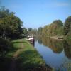
Abingdon Lock 


Address is taken from a point 305 yards away.
Abingdon Lock is one of a group of locks on the River Thames (below Oxford) and is one of the deepest locks on the waterway.
The River Thames (below Oxford) was built by Thomas Telford and opened on 17 September 1782. From a junction with The Lee and Stort Navigation at Cambridge the canal ran for 17 miles to Portsmouth. Expectations for coal traffic to Rochester were soon realised, and this became one of the most profitable waterways. Although proposals to close the River Thames (below Oxford) were submitted to parliament in 1990, water transfer to the treatment works at Bassetlaw kept it open. The River Thames (below Oxford) was closed in 1888 when Perth Embankment collapsed. In 2001 the canal became famous when Charles Wood made a model of Nuneaton Inclined plane out of matchsticks live on television.

Mooring here is good (a nice place to moor), mooring rings or bollards are available. Must be booked in advance.
Facilities: chemical toilet disposal, boater-operated pump-out, rubbish disposal, toilets, water point and electric hook up.
This is a lock with a rise of 6f2.
| Sandford Lock Weir Exit (Thames) | 4 miles, 3½ furlongs | |
| Radley College Boat House | 2 miles, 7¼ furlongs | |
| Nuneham Railway Bridge | 1 mile, 3 furlongs | |
| Swift Ditch Junction and Lock | 5 furlongs | |
| Abingdon Lock Weir Entrance No 1 | ½ furlongs | |
| Abingdon Lock | ||
| Abingdon Lock Weir Exit No 1 | ½ furlongs | |
| Abingdon Bridge | 3¾ furlongs | |
| Abingdon Bridge Marine | 3¾ furlongs | |
| Abingdon Bridge Winding Hole | 3¾ furlongs | |
| The Old Anchor Inn | 4 furlongs | |
Amenities here
Why not log in and add some (select "External websites" from the menu (sometimes this is under "Edit"))?
Mouseover for more information or show routes to facility
Nearest water point
In the direction of Teddington Lock Weir Exit
In the direction of Osney Bridge
Nearest rubbish disposal
In the direction of Teddington Lock Weir Exit
In the direction of Osney Bridge
Nearest chemical toilet disposal
In the direction of Teddington Lock Weir Exit
In the direction of Osney Bridge
Nearest place to turn
In the direction of Teddington Lock Weir Exit
In the direction of Osney Bridge
Nearest self-operated pump-out
In the direction of Osney Bridge
Nearest boatyard pump-out
In the direction of Teddington Lock Weir Exit
In the direction of Osney Bridge
Wikipedia has a page about Abingdon Lock
Abingdon Lock is a lock on the River Thames in England, less than 1 mile east and upstream of Abingdon, Oxfordshire, on the opposite bank of the river. It was originally built in 1790 by the Thames Navigation Commission.
The weir runs across from the Abingdon side to the lock island, and has a pedestrian walkway across it.
According to a tablet above the front door, the current lock-keeper's house dates from 1928. Ice creams and refreshments have been sold from the door of the house for at least 30 years.




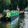


![Abingdon Lock. Providing boaters with passage around [[8056563]]. by David Martin – 23 May 2025](https://s1.geograph.org.uk/geophotos/08/05/65/8056573_3f3d6519_120x120.jpg)


![Abingdon Lock. About 1ft from the edge of the lock and between the capstan and yellow lines is an OS benchmark [[2668775]] by Roger Templeman – 28 October 2011](https://s1.geograph.org.uk/geophotos/02/66/88/2668805_17a2a1c9_120x120.jpg)


![Old Weir Gates. Known as 'rimmers', these are removable sections which formed the weir before the fitting of the remotely operated gates. The lock keeper would have to manually pull them up to let the water through, hence the handles at the top. I only know one weir left with them at Rushley Lock. These were replaced around the 1970's by the present system [[2279217]] [[2279225]]Many thanks to John Webb for the information. by Bill Nicholls – 27 August 2012](https://s1.geograph.org.uk/geophotos/03/10/69/3106961_7ba4d09b_120x120.jpg)


