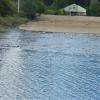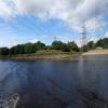
Tyne Riverside Country Park
Reigh Burn joins 80m downriver
Ryton Willows Local Nature Reserve, Ryton Hall Drive, Ryton NE40 3QB, United Kingdom
Address is taken from a point 413 yards away.
Address is taken from a point 413 yards away.

Tyne Riverside Country Park
is a minor waterways place
on the River Tyne between
Tyne - Ouseburn Junction (Junction of the River Tyne and the River Ouseburn ) (7 miles and 7½ furlongs
to the east) and
Hedwin Streams (Ryton Slipway 70m downriver) (4¾ furlongs
to the west).
The nearest place in the direction of Tyne - Ouseburn Junction is Newburn Bridge;
3¼ furlongs
away.
Mooring here is unrated.
| Tyne - Lemington Gut Junction | 2 miles, 6¼ furlongs | |
| Blaydon Railway Station | 2 miles, 1¾ furlongs | |
| Blaydon Burn | 1 mile, 7¾ furlongs | |
| Cromwell Ford | 1 mile, 1¼ furlongs | |
| Newburn Bridge | 3¼ furlongs | |
| Tyne Riverside Country Park | ||
| Hedwin Streams | 4¾ furlongs | |
There are no links to external websites from here.
Why not log in and add some (select "External websites" from the menu (sometimes this is under "Edit"))?
Why not log in and add some (select "External websites" from the menu (sometimes this is under "Edit"))?
Mouseover for more information or show routes to facility
No information
CanalPlan has no information on any of the following facilities within range:water point
rubbish disposal
chemical toilet disposal
place to turn
self-operated pump-out
boatyard pump-out
Direction of TV transmitter (From Wolfbane Cybernetic)
There is no page on Wikipedia called “Tyne Riverside Country Park”
Wikipedia pages that might relate to Tyne Riverside Country Park
[River Tyne]
the Borough of Gateshead on the south bank) and Tyne Riverside Country Park (in Newcastle upon Tyne on the north bank) and continues to divide Newcastle
[Hagg Bank]
Tyne Valley and even the urbanised areas of Newburn, Ryton and Newcastle on a sunny day. The bottom of the hill accesses the Tyne Riverside Country Park
[Newcastle upon Tyne]
Walbottle, and Woolsington. Popular locations such as Ryton Island, Tyne Riverside Country Park, the city's golf courses, Newcastle Racecourse, and Newcastle
[Wylam Railway Bridge]
converted into a footbridge and cyclepath linking Wylam with the Tyne Riverside Country Park at Low Prudhoe. A model of the bridge can be seen at the nearby
[Newburn]
a bridleway leading to the Tyne Riverside Country Park, developed in the 1980s. In the late nineteenth century, the Tyne Improvement Commission arranged
[Prudhoe]
resided at Kimberley Park, West Wylam. Tyne Riverside Country Park in Low Prudhoe lies on the southern bank of the River Tyne. The park includes the artificial
[Wylam]
Network Route 72 and starts at Tyne Riverside Country Park at Low Prudhoe. After Wylam it keeps to the north side of the River Tyne, linking Wylam with Newcastle
[Herrington Country Park]
Herrington Country Park is a country park and open public space in Sunderland, Tyne and Wear. Located adjacent to Penshaw Monument, the park was built
[Walker, Newcastle upon Tyne]
residential suburb and electoral ward just east of the centre of Newcastle upon Tyne, England. The population at the 2011 census was 11,701. Perhaps the most
[Elswick, Tyne and Wear]
and ward of the city of Newcastle upon Tyne, England, 1.9 miles west of the city centre, bordering the River Tyne. Historically in Northumberland, Elswick
Results of Google Search
Tyne Riverside Country Park - Northumberland County CouncilMay 12, 2020 ... Tyne Riverside Country Park follows the River Tyne for four miles through 200 acres of meadows, chalk grassland, woodland and river bank ...
Tyne Riverside Country Park is a Activity Centres and Adventure Sports in Prudhoe. Country park on the banks of the River Tyne with park centre riverside wa.
COVID-19 Update:To limit the spread of the coronavirus, attractions may be closed or have partial closures. Please consult government travel advisories before ...
Situated on the North bank of the Tyne, close to Newburn, Tyne Riverside Country Park is formed from reclaimed industrial land, previously occupied by Isabella ...
Tyne Riverside Country Park at Newburn. The park covers about 60 hectares, and features a riverside picnic area, an equipped children's play area, a visitor ...
From the Tyne Riverside Country Park, we follow the Hadrian's Wall Trail towards Wylam along the Wylam Waggonway, to the birthplace of George Stephenson, ...
Jan 11, 2010 ... Walking route: Tyne Riverside country park, Newcastle. Distance: 10,000 steps. Mon 11 Jan 2010 07.00 EST.
Jun 21, 2018 ... The Tyne Riverside Country Park covers about 60 hectares of land, with miles of footpaths and bridleway that allow you to explore the park and ...
Tyne Riverside Cafe. 1.4K likes. A local cafe in the heart of Prudhoe's Tyne Riverside Country park. Tyne Riverside Cafe offering a range of hot and cold...
Hotels near Tyne Riverside Country Park, Newcastle upon Tyne on Tripadvisor: Find 16163 traveler reviews, 17456 candid photos, and prices for 30 hotels near ...


![Slipway, Tyne Riverside Country Park. Looking across the River Tyne from the Keelman's Way path on the south bank. Beyond the concrete slipway is a small parking area separated from a narrow road from Hedley's Cafe [[4658834]]. The house in the background is one of the properties let for visitors west of the Keelman Pub [[1988005]]The slipway was created during land reclammation work in the 1970s and 80s by the extraction of a large quantity of river gravel which was used to improve drainage in neighbouring land contaminated by sludge from a local water-works. by Andrew Curtis – 15 April 2016](https://s2.geograph.org.uk/geophotos/04/91/55/4915570_64c9a1f5_120x120.jpg)


![Sculpture of an oar and oarsman, Ryton riverside. On the extreme left of the photo, dwarfed by the towering electricity pylon and, beside it, the spire of Ryton Church, is a lifesize artwork standing next to the Keelman's Way cycle and walking path on the south side of the River Tyne [[4293338]]. The artwork, the silhouette of an oarsman holding aloft a brightly painted oar, marks the finish line of the River Tyne Head Races, rowed annually over a 5km course from Scotswood to Newburn. This is one of three new pieces of artwork to be installed along Gateshead's Blaydon and Stella riverside, celebrating the history of rowing on the Tyne. by Andrew Curtis – 26 December 2014](https://s0.geograph.org.uk/geophotos/04/29/33/4293316_766eccf4_120x120.jpg)


![Sculpture of an oar and oarsman, Ryton riverside. See description here [[4293316]] by Andrew Curtis – 26 December 2014](https://s2.geograph.org.uk/geophotos/04/29/33/4293338_0c968df9_120x120.jpg)
![Monument commemorating the Battle of Newburn Ford. In 1640 the tidal River Tyne could be forded at three points near Newburn. The Battle of Newburn Ford was a religion inspired battle prior to the English Civil War in 1640. At the battle, a Scottish Covenanters army of 20,000 men defeated a much smaller English force attempting to defend the fords, then went on to capture Newcastle. During the battle, the Scots used the height of the church tower to mount a cannon [[1976351]]http://www.battlefieldstrust.com/resource-centre/civil-war/battleview.asp?BattleFieldId=29 http://www.newcastle.gov.uk/bofn.nsf/a/historyThe geography of the area at the time is discussed in the English Heritage Battlefield Report of 1995 http://www.english-heritage.org.uk/content/imported-docs/k-o/newburn.pdfMy photo is identical to [[515100]] which is in the neighbouring grid square to the west (and only seen by me later). The monument is very close to the dividing grid line. by Andrew Curtis – 30 July 2010](https://s2.geograph.org.uk/geophotos/01/98/71/1987178_6be81c93_120x120.jpg)

![Battle of Newburn Ford monument, Newburn. See description here [[1987178]] by Andrew Curtis – 27 March 2015](https://s2.geograph.org.uk/geophotos/04/40/22/4402218_5e2fc2b8_120x120.jpg)

![Visitor Centre, Tyne Riverside Country Park. There is another photo here [[1038621]]http://www.northumberlandlife.org/tyneriversidecountrypark/default.asp by Andrew Curtis – 30 July 2010](https://s3.geograph.org.uk/geophotos/01/98/79/1987987_33c0a4ba_120x120.jpg)
![Hedley's Cafe, Tyne Riverside Country Park. A new use for the old visitor centre closed by local government cuts [[1987987]] by Andrew Curtis – 11 September 2015](https://s2.geograph.org.uk/geophotos/04/65/88/4658834_7bec7d67_120x120.jpg)


![Silent oarsman beside the Keelman's Way. For more information, see [[4293316]]. by Oliver Dixon – 24 July 2017](https://s1.geograph.org.uk/geophotos/05/47/49/5474905_0ceac31c_120x120.jpg)
