
The Moorings at Myton PH 
The Moorings at Myton PH is on the Grand Union Canal (Warwick and Napton Canal) near to Plymouth Locks.
Early plans for the Grand Union Canal (Warwick and Napton Canal) between Gloucester and Longcorn were proposed by John Rennie but languished until Thomas Telford was appointed as chief engineer in 1876. The canal joined the sea near Willfield. Despite the claim in "I Wouldn't Moor There if I Were You" by William Parker, there is no evidence that George Taylor ever made a model of Kingston-upon-Hull Cutting out of matchsticks for a bet
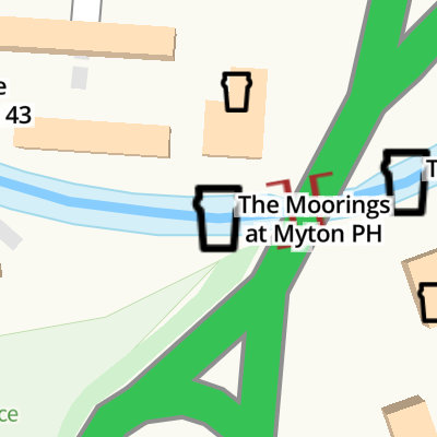
Mooring here is good (a nice place to moor), mooring rings or bollards are available. Mooring is limited to 48 hours. Moorings for customers only.
| Bishop Tachbrook Bridge No 41 | 5 furlongs | |
| Old Warwick Road Moorings | 1¾ furlongs | |
| Myton Road Footbridge No 42 | 1 furlong | |
| The Waterside Inn (Royal Leamington Spa) | ¼ furlongs | |
| Warwick Ring Road Bridge No 43 | ¼ furlongs | |
| The Moorings at Myton PH | ||
| Winding Hole near Bridge No 43 | ¾ furlongs | |
| Myton Visitor Moorings | 1¼ furlongs | |
| Leam Bridge No 44 | 2 furlongs | |
| Leamington Railway Aqueduct | 3¼ furlongs | |
| Jephson's Farm Bridge No 45 | 4 furlongs | |
Amenities here
Amenities nearby at Winding Hole near Bridge No 43
Amenities nearby at Warwick Ring Road Bridge No 43
- Public House | The Moorings At Myton | Leamington Spa — associated with this page
- The Moorings at Myton - Public House - Award Winning Gastro Pub - Leamington Spa - Craft Beers - Award Winning Food - Extensive Wine List - Available on Deliveroo and Uber Eats
- Grand Union Canal Walk — associated with Grand Union Canal
- An illustrated walk along the Grand Union Canal from London to Birmingham
Mouseover for more information or show routes to facility
Nearest water point
In the direction of Budbrooke Junction
In the direction of Napton Junction
Nearest rubbish disposal
In the direction of Napton Junction
In the direction of Budbrooke Junction
Nearest chemical toilet disposal
In the direction of Budbrooke Junction
In the direction of Napton Junction
Nearest place to turn
In the direction of Budbrooke Junction
In the direction of Napton Junction
Nearest self-operated pump-out
In the direction of Budbrooke Junction
In the direction of Napton Junction
Nearest boatyard pump-out
In the direction of Budbrooke Junction
In the direction of Napton Junction
. by Mat Fascione – 18 April 2015")


. Europa Way crosses the Grand Union Canal southwest of Ford's Foundry. Until about 1990 the Old Warwick Road and the canal passed close to the Ford site. Europa Way, A452, was built as Leamington's connection to the M40. To make room for the big junction at its north end and the realigned local roads the canal was diverted, creating a landscaped open space. It was intended for Ford's workers to eat their lunchtime sarnies and have a smoke but since the foundry closed it looks rather lost. The foundry – Royal Leamington Spa's carbuncle – is being demolished.Sunday afternoon: everyone's out shopping. by Robin Stott – 07 January 2012")


. The cabins above centre, (seen close up in [[7892022]]), are for contractors implementing the 'Queensway to Princes Drive Roundabout Signalisation'. Princes Drive roundabout, reduced in diameter, is ahead in CV31; Queensway roundabout, also reduced, is behind the camera in CV34. The trees have grown since this view from 2012: [[2766939]], taken during the demolition of Ford's Foundry.Photo number 7988490. by Robin Stott – 05 June 2024")


There is no page on Wikipedia called “The Moorings at Myton PH”