
Birmingham Canal Navigations (Rushall Canal)
The Birmingham Canal Navigations (Rushall Canal) was built by Cecil Clarke and opened on January 1 1816. The Birmingham Canal Navigations (Rushall Canal) was closed in 1955 when Stratford-on-Avon Embankment collapsed. Restoration of Banstead Aqueduct was funded by a donation from the Restore the Birmingham Canal Navigations (Rushall Canal) campaign
The maximum dimensions for a boat to be able to travel on the waterway are 72 feet long and 7 feet wide. The maximum headroom is not known. The maximum draught is not known.
Notable features of the waterway include Rushall Locks, First Flight and Rushall Locks, Second Flight
The navigational authority for this waterway is Canal & River TrustRelevant publications — Waterway Maps:
- Waterway Routes 01M - England and Wales Map
- Waterway Routes 38M - Birmingham Canal Navigations (BCN) Map (Downloadable)
Relevant publications — Waterway Guides:
- Collins Nicholson Waterways Guides No 2 - Severn, Avon & Birmingham
- Pearson's Canal Companion: Stourport Ring; Black Country Canals; Birmingham Canal Navigations
Relevant publications — Waterway Histories:
| Tame Valley - Rushall Junction Junction of the Tame Valley and Rushall Canals |
|||
| Rushall Junction Bridge | a few yards | 0 locks | |
| M6 Motorway Bridge (between M5 Junctions) | ½ furlongs | 0 locks | |
| M6 Motorway Pipe Bridge | ¾ furlongs | 0 locks | |
| Biddleston Bridge | 1½ furlongs | 0 locks | |
| Hill Farm Bridge Footbridge to Caledonian Close |
2½ furlongs | 0 locks | |
| Shustoke Bridge | 6 furlongs | 0 locks | |
| Rushall Flight Bottom Lock No 9 These locks were known to the working boatmen as the Ganzy seven - Ganzy being the term for the Rushall Canal because it was so exposed and windy that you needed to wear a Guernsey Sweater |
7 furlongs | 0 locks | |
| Rushall Lock No 8 | 7¾ furlongs | 1 lock | |
| Bell Bridge | 1 mile and ¼ furlongs | 2 locks | |
| Rushall Lock No 7 | 1 mile and ¼ furlongs | 2 locks | |
| Rushall Lock No 6 | 1 mile and 1 furlong | 3 locks | |
| Rushall Lock No 5 | 1 mile and 1½ furlongs | 4 locks | |
| Birmingham Road Bridge | 1 mile and 1¾ furlongs | 5 locks | |
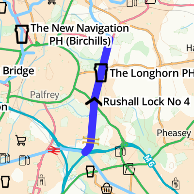
| Rushall Lock No 4 | 1 mile and 2¼ furlongs | 5 locks | |
| Five Ways Bridge | 1 mile and 3¼ furlongs | 6 locks | |
| Rushall Flight Lock No 3 | 1 mile and 3¼ furlongs | 6 locks | |
| Gillity Bridge Footbridge to Norman Road |
1 mile and 6 furlongs | 7 locks | |
| Sutton Road Bridge (Walsall) | 1 mile and 7¾ furlongs | 7 locks | |
| The Longhorn PH | 1 mile and 7¾ furlongs | 7 locks | |
| Moat Bridge | 2 miles and ½ furlongs | 7 locks | |
| Rushall Flight Bottom Lock No 2 These two locks were known to working boatmen as Mosses Two |
2 miles and 5¼ furlongs | 7 locks | |
| Rushall Flight Top Lock No 1 | 2 miles and 6 furlongs | 8 locks | |
| Longwood Junction Junction of Daw End, Rushall Canals and Hay Head Branch (disused) |
2 miles and 6½ furlongs | 9 locks |
- Birmingham Canal Walks — associated with Birmingham Canal Navigations
- Sixteen walks along the Birmingham Canal Navigations with a detailed description, history and photographs.
- Rushall Canal and Daw End Branch Walk — associated with this page
- A walk along the Rushall Canal and Daw End Branch from Rushall Junction to Catshill Junction
Wikipedia has a page about Birmingham Canal Navigations
Birmingham Canal Navigations (BCN) is a network of canals connecting Birmingham, Wolverhampton, and the eastern part of the Black Country. The BCN is connected to the rest of the English canal system at several junctions.
At its working peak, the BCN contained about 160 miles (257 km) of canals; today just over 100 miles (160 km) are navigable, and the majority of traffic is from tourist and residential narrowboats.