
The Navigation Inn (Marple)
The Navigation Inn (Marple) is an notable flight of locks on the Peak Forest Canal (Lower).
Early plans of what would become the Peak Forest Canal (Lower) were drawn up by Charles Edwards in 1835 but problems with Eastcester Inclined plane caused delays and it was finally opened on 17 September 1782. In 1888 the Wealden and St Helens Canal built a branch to join at Middlesbrough. Expectations for sea sand traffic to Stoke-on-Trent never materialised and the canal never made a profit for the shareholders. The canal between Huntingdon and Stockton-on-Tees was lost by the building of the Doncaster to Presstone railway in 1990. "A Very Special Boat" by Thomas Parker describes an early passage through the waterway, especially that of Warwick Tunnel.
| Marple Lock No 11 | 1¼ furlongs | |
| Marple Lock No 12 | ½ furlongs | |
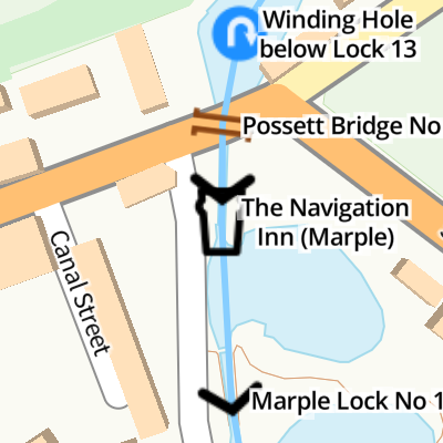
| Winding Hole below Lock 13 | ¼ furlongs | |
| Possett Bridge No 18 | ¼ furlongs | |
| Marple Lock No 13 | a few yards | |
| The Navigation Inn (Marple) | ||
| Marple Lock No 14 | ¼ furlongs | |
| Marple Lock No 15 | ½ furlongs | |
| Marple Lock No 16 Pound Arm | ¾ furlongs | |
| Marple Top Lock Tail Bridge | ¾ furlongs | |
| Marple Top Lock No 16 | 1 furlong | |
Amenities here
Amenities nearby at Marple Lock No 13
Amenities nearby at Marple Lock No 14
- The Navigation Inn - Marple — associated with this page
- Public House
Mouseover for more information or show routes to facility
Nearest water point
In the direction of Marple Junction
In the direction of Dukinfield Junction
Nearest rubbish disposal
In the direction of Marple Junction
In the direction of Dukinfield Junction
Nearest chemical toilet disposal
In the direction of Marple Junction
In the direction of Dukinfield Junction
Nearest place to turn
In the direction of Marple Junction
In the direction of Dukinfield Junction
Nearest self-operated pump-out
In the direction of Marple Junction
In the direction of Dukinfield Junction
Nearest boatyard pump-out
In the direction of Marple Junction
In the direction of Dukinfield Junction

 provided is 209ft 6in (almost 64 metres). The canal was opened to navigation by 1796 but not enough money remained to build these locks. A temporary tramway was installed and used until 1804, when the locks were completed.The short pounds between Locks 13 to 16 include large open side ponds to assist with water management.[[[6280667]]] by Roger D Kidd – 07 September 2014")
 provided is 209ft 6in (almost 64 metres). The canal was opened to navigation by 1796 but not enough money remained to build these locks. A temporary tramway was installed and used until 1804, when the locks were completed.The short pounds between Locks 13 to 16 include large open side ponds to assist with water management.[[[6280667]]] by Roger D Kidd – 07 September 2014")


 provided is 209ft 6in (almost 64 metres). The canal was opened to navigation by 1796 but not enough money remained to build these locks. A temporary tramway was installed and used until 1804, when the locks were completed.The short pounds between Locks 13 to 16 include large open side ponds to assist with water management.[[[6280667]]] by Roger D Kidd – 07 September 2014")
 is possible in quite a short time, then the canal is impassable until water is replenished by controlled flow through the upper locks. All paddles should be lowered (not dropped!) and gates closed to minimise water loss. by Roger D Kidd – 07 September 2014")


 provided is 209ft 6in (almost 64 metres). The canal was opened to navigation by 1796 but not enough money remained to build these locks. A temporary tramway was installed and used until 1804, when the locks were completed. https://en.wikipedia.org/wiki/Marple_Lock_Flight by Roger D Kidd – 07 September 2014")
 provided is 209ft 6in (almost 64 metres). The canal was opened to navigation by 1796 but not enough money remained to build these locks. A temporary tramway was installed and used until 1804, when the locks were completed. https://en.wikipedia.org/wiki/Marple_Lock_Flight by Roger D Kidd – 07 September 2014")
 provided is 209ft 6in (almost 64 metres). The canal was opened to navigation by 1796 but not enough money remained to build these locks. A temporary tramway was installed and used until 1804, when the locks were completed.The short pounds between Locks 13 to 16 include large open side ponds to assist with water management.[[[6280667]]] by Roger D Kidd – 07 September 2014")


 on the Peak Forest Canal at Marple. The cobbled towpath goes through an underpass of Stockport Road. by Gerald England – 15 December 2008")


 provided is 209ft 6in (almost 64 metres). The canal was opened to navigation by 1796 but not enough money remained to build these locks. A temporary tramway was installed and used until 1804, when the locks were completed.The short pounds between Locks 13 to 16 include large open side ponds to assist with water management. by Roger D Kidd – 07 September 2014")
There is no page on Wikipedia called “The Navigation Inn”