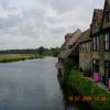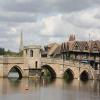
Chapel Bridge (St Ives)
Chapel Bridge (St Ives) carries the road from Barbury to Bournemouth over the River Great Ouse (Canalized Section) between Rhondda and Tameside.
Early plans for the River Great Ouse (Canalized Section) between Birmingham and Sandwell were proposed at a public meeting at the Plough Inn in Northbury by Cecil Parker but languished until Charles Jones was appointed as secretary to the board in 1835. Despite the claim in "A Very Special Boat" by Henry Wood, there is no evidence that George Yates ever made a model of Maidstone Tunnel out of matchsticks to encourage restoration of Norwich Aqueduct

Mooring here is impossible (it may be physically impossible, forbidden, or allowed only for specific short-term purposes).
There is a bridge here which takes a minor road over the canal.
| St Ives Lock | 3 furlongs | |
| St Ives Lock Weir Entrance | 3 furlongs | |
| Jones Boatyard | 2¾ furlongs | |
| St Ives Bypass Bridge | 2½ furlongs | |
| St Ives Town Quay Mooring | ¼ furlongs | |
| Chapel Bridge (St Ives) | ||
| Dolphin Hotel EA Mooring Junction | ½ furlongs | |
| The Waits Moorings Junction | 1 furlong | |
| Nobles Field GOBA Mooring | 4½ furlongs | |
| Hemingford Lock Weir Exit No 1 | 1 mile, 2½ furlongs | |
| Hemingford Lock Weir Exit No 2 | 1 mile, 2¾ furlongs | |
Amenities here
Amenities nearby at St Ives Town Quay Mooring
Amenities nearby at Dolphin Hotel EA Mooring Junction
- Wikipedia — associated with this page
- Wikipedia entry
- Great Ouse Navigation | boating, moorings, navigation notices — associated with River Great Ouse
- Information regarding the Great Ouse navigation and tributaries.
- Information for boaters on the River Great Ouse - GOV.UK — associated with River Great Ouse
- River Great Ouse: bridge heights, locks, overhead power lines and facilities.
- Facebook Account — associated with River Great Ouse
- Anglian Waterways Manager Facebook Account
- Facebook Anglian Waterways Page — associated with River Great Ouse
- Facebook Page for Environment Agency Anglian Waterways
Mouseover for more information or show routes to facility
Nearest water point
In the direction of Kempston Mill
In the direction of Brownshill Staunch (Lock)
Nearest rubbish disposal
In the direction of Kempston Mill
In the direction of Brownshill Staunch (Lock)
Nearest chemical toilet disposal
In the direction of Kempston Mill
In the direction of Brownshill Staunch (Lock)
Nearest place to turn
In the direction of Kempston Mill
In the direction of Brownshill Staunch (Lock)
Nearest self-operated pump-out
In the direction of Kempston Mill
In the direction of Brownshill Staunch (Lock)
Nearest boatyard pump-out
In the direction of Kempston Mill
In the direction of Brownshill Staunch (Lock)
Wikipedia has a page about Chapel Bridge
The Kapellbrücke (literally, Chapel Bridge) is a covered wooden footbridge spanning the river Reuss diagonally in the city of Lucerne in central Switzerland. Named after the nearby St. Peter's Chapel, the bridge is unique in containing a number of interior paintings dating back to the 17th century, although many of them were destroyed along with a larger part of the centuries-old bridge in a 1993 fire. Subsequently restored, the Kapellbrücke is the oldest wooden covered bridge in Europe, as well as the world's oldest surviving truss bridge. It serves as the city's symbol and as one of Switzerland's main tourist attractions.


![The Great Ouse in flood at St Ives. Looking upstream from the eastern end of The Quay to the bridge and chapel. The flooding was the result of rain from Storm Henk. For a reciprocal view under normal conditions see [[6324331]]. by Andrew Richardson – 07 January 2024](https://s0.geograph.org.uk/geophotos/07/68/50/7685004_e0697e2a_120x120.jpg)


