
Mountsorrel Staithe 
The Quay, Mountsorrel, LE12 7AT, United Kingdom
Mountsorrel Staithe is on the Grand Union Canal (Leicester Section - River Soar Navigation) just past the junction with The Lee and Stort Navigation.
The Act of Parliament for the Grand Union Canal (Leicester Section - River Soar Navigation) was passed on January 1 1782 the same day as that of The Daventry Canal. "Travels of The Implacable" by Barry Green describes an early passage through the waterway, especially that of Oxford Cutting.
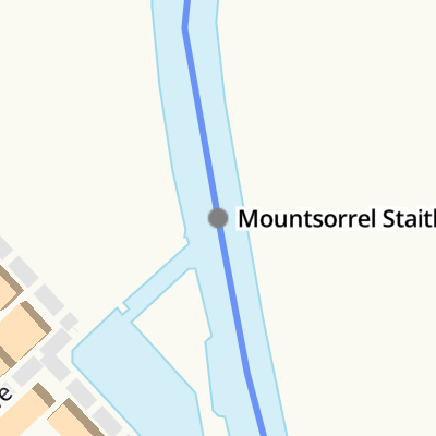
Mountsorrel Staithe
is a minor waterways place
on the Grand Union Canal (Leicester Section - River Soar Navigation) between
Sileby Road Bridge No 24 (2¼ furlongs
to the southeast) and
Barrow upon Soar Bridge No 28 (Barrow upon Soar village a quarter of a mile north) (1 mile and 3½ furlongs
to the north).
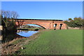
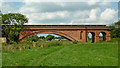
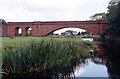
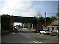
The nearest place in the direction of Sileby Road Bridge No 24 is Mountsorrel Railway Bridge (Also known as 1860 Bridge);
1 furlong
away.
The nearest place in the direction of Barrow upon Soar Bridge No 28 is North End Changeline Bridge No 26;
½ furlongs
away.
Mooring here is good (a nice place to moor), mooring rings or bollards are available. Visitor mooring available for a few, call number on signs.
| Mountsorrel Lock No 50 | 2½ furlongs | |
| Sileby Road Bridge No 24 | 2¼ furlongs | |
| Soar Outlet by Mountsorrel Lock | 1¾ furlongs | |
| Mountsorrel Quay | 1¼ furlongs | |
| Mountsorrel Railway Bridge | 1 furlong | |
| Mountsorrel Staithe | ||
| North End Changeline Bridge No 26 | ½ furlongs | |
| Mountsorrel A6 Bridge No 27 | 3 furlongs | |
Broome Island     | 4¾ furlongs | |
| Meadow Farm Junction | 5½ furlongs | |
| Meadow Farm Marina | 6¼ furlongs | |
Amenities here
 Bus stop (Bradgate Close)
Bus stop (Bradgate Close)
Bus stop (Bradgate Close)
Amenities nearby at North End Changeline Bridge No 26
 Budgens
 Jet Bus stop (Cemetery)
Bus stop (Cemetery)
Bus stop (Hawcliffe Road)
Bus stop (Hawcliffe Road)
Jet Bus stop (Cemetery)
Bus stop (Cemetery)
Bus stop (Hawcliffe Road)
Bus stop (Hawcliffe Road)
- Mountsorrel Staithe — associated with this page
- Grand Union Canal Walk — associated with Grand Union Canal
- An illustrated walk along the Grand Union Canal from London to Birmingham
Mouseover for more information or show routes to facility
Nearest water point
In the direction of Trent Junction
Barrow Boating — 1 mile, 3 furlongs away
On this waterway in the direction of Trent Junction
Loughborough Basin — 5 miles, 4½ furlongs and 2 locks away
Travel to Loughborough Branch Junction, then on the Grand Union Canal (Leicester Section - Loughborough Branch) to Loughborough Basin
Bishop Meadow Lock No 54 — 6 miles, 3¼ furlongs and 3 locks away
On this waterway in the direction of Trent Junction
Former BW Trent Lock Waterway Office — 14 miles, 5¼ furlongs and 10 locks away
Travel to Trent Junction, then on the Grand Union Canal (Erewash Canal) to Former BW Trent Lock Waterway Office
Sawley Locks No 2 — 15 miles, 3¼ furlongs and 9 locks away
Travel to Trent Junction, then on the River Trent (Western End) to Sawley Locks No 2
Cranfleet Lock No 3 — 15 miles, 1¾ furlongs and 10 locks away
Travel to Trent Junction, then on the River Trent (Western End) to Cranfleet Lock No 3
Shardlow — 17 miles, 5 furlongs and 12 locks away
Travel to Trent Junction, then on the River Trent (Western End) to Derwent Mouth, then on the Trent and Mersey Canal (Main Line - Derwent Mouth to Burton) to Shardlow
Beeston Lock No 5 — 19 miles, 4¼ furlongs and 11 locks away
Travel to Trent Junction, then on the River Trent (Western End) to Beeston Lock No 5
In the direction of River Soar Junction
Hope and Anchor Bridge No 19 — 4 miles, 2 furlongs and 4 locks away
On this waterway in the direction of River Soar Junction
Friars Mill Visitor Moorings — 10 miles, 1¾ furlongs and 9 locks away
On this waterway in the direction of River Soar Junction
Kilby Bridge No 87 — 18 miles, 5¼ furlongs and 21 locks away
Travel to River Soar Junction, then on the Grand Union Canal (Leicester Section - Leicestershire and Northamptonshire Union Canal) to Kilby Bridge No 87Nearest rubbish disposal
In the direction of Trent Junction
Broome Island — 4¾ furlongs away
On this waterway in the direction of Trent Junction
Barrow Boating — 1 mile, 3 furlongs away
On this waterway in the direction of Trent Junction
Loughborough Basin — 5 miles, 4½ furlongs and 2 locks away
Travel to Loughborough Branch Junction, then on the Grand Union Canal (Leicester Section - Loughborough Branch) to Loughborough Basin
Former BW Trent Lock Waterway Office — 14 miles, 5¼ furlongs and 10 locks away
Travel to Trent Junction, then on the Grand Union Canal (Erewash Canal) to Former BW Trent Lock Waterway Office
Sawley Locks No 2 — 15 miles, 3¼ furlongs and 9 locks away
Travel to Trent Junction, then on the River Trent (Western End) to Sawley Locks No 2
Cranfleet Lock No 3 — 15 miles, 1¾ furlongs and 10 locks away
Travel to Trent Junction, then on the River Trent (Western End) to Cranfleet Lock No 3
Beeston Lock No 5 — 19 miles, 4¼ furlongs and 11 locks away
Travel to Trent Junction, then on the River Trent (Western End) to Beeston Lock No 5
In the direction of River Soar Junction
Kilby Bridge No 87 — 18 miles, 5¼ furlongs and 21 locks away
Travel to River Soar Junction, then on the Grand Union Canal (Leicester Section - Leicestershire and Northamptonshire Union Canal) to Kilby Bridge No 87Nearest chemical toilet disposal
In the direction of Trent Junction
Barrow Boating — 1 mile, 3 furlongs away
On this waterway in the direction of Trent Junction
Former BW Trent Lock Waterway Office — 14 miles, 5¼ furlongs and 10 locks away
Travel to Trent Junction, then on the Grand Union Canal (Erewash Canal) to Former BW Trent Lock Waterway Office
Sawley Locks No 2 — 15 miles, 3¼ furlongs and 9 locks away
Travel to Trent Junction, then on the River Trent (Western End) to Sawley Locks No 2
Sawley Cut Wharf — 15 miles, 4¾ furlongs and 10 locks away
Travel to Trent Junction, then on the River Trent (Western End) to Sawley Cut Wharf
Beeston Lock No 5 — 19 miles, 4¼ furlongs and 11 locks away
Travel to Trent Junction, then on the River Trent (Western End) to Beeston Lock No 5
In the direction of River Soar Junction
Sileby Mill Mooring Basin — 1 mile, 1 furlong and 1 lock away
On this waterway in the direction of River Soar Junction
Kilby Bridge No 87 — 18 miles, 5¼ furlongs and 21 locks away
Travel to River Soar Junction, then on the Grand Union Canal (Leicester Section - Leicestershire and Northamptonshire Union Canal) to Kilby Bridge No 87Nearest place to turn
In the direction of Trent Junction
Meadow Farm Junction — 5½ furlongs away
On this waterway in the direction of Trent Junction
Meadow Farm Marina — 6¼ furlongs away
On this waterway in the direction of Trent Junction
Barrow Boating — 1 mile, 3 furlongs away
On this waterway in the direction of Trent Junction
Barrow upon Soar Junction — 1 mile, 6¾ furlongs and 1 lock away
On this waterway in the direction of Trent Junction
Pillings Lock Marina — 2 miles, 6 furlongs and 2 locks away
On this waterway in the direction of Trent Junction
Pilling's Flood Lock Winding Hole — 2 miles, 6½ furlongs and 2 locks away
On this waterway in the direction of Trent Junction
Loughborough Branch Junction — 5 miles, 3½ furlongs and 2 locks away
On this waterway in the direction of Trent Junction
Loughborough Basin — 5 miles, 4½ furlongs and 2 locks away
Travel to Loughborough Branch Junction, then on the Grand Union Canal (Leicester Section - Loughborough Branch) to Loughborough Basin
In the direction of River Soar Junction
Soar Outlet by Mountsorrel Lock — 1¾ furlongs away
On this waterway in the direction of River Soar Junction
Mountsorrel Lock Junction — 2½ furlongs and 1 lock away
On this waterway in the direction of River Soar Junction
Sileby Mill Mooring Basin — 1 mile, 1 furlong and 1 lock away
On this waterway in the direction of River Soar Junction
Sileby Mill — 1 mile, 1¾ furlongs and 1 lock away
On this waterway in the direction of River Soar Junction
Loughborough Road Winding Hole — 2 miles, 3½ furlongs and 2 locks away
On this waterway in the direction of River Soar Junction
Cossington Mill Stream Junction — 2 miles, 4 furlongs and 2 locks away
On this waterway in the direction of River Soar Junction
Wreake Mouth — 2 miles, 5¾ furlongs and 3 locks away
On this waterway in the direction of River Soar Junction
Wreake Outlet by Junction Lock No 47 — 3 miles, 1 furlong and 3 locks away
On this waterway in the direction of River Soar Junction
River Wreake Junction — 3 miles, 5¾ furlongs and 4 locks away
On this waterway in the direction of River Soar Junction
Old Junction Boatyard (Syston) — 3 miles, 6 furlongs and 4 locks away
On this waterway in the direction of River Soar Junction
MGM Boats, Thurmaston — 5 miles, 2½ furlongs and 4 locks away
On this waterway in the direction of River Soar Junction
MGM Boats Winding Hole — 5 miles, 3¼ furlongs and 4 locks away
On this waterway in the direction of River Soar JunctionNearest self-operated pump-out
In the direction of River Soar Junction
Kilby Bridge No 87 — 18 miles, 5¼ furlongs and 21 locks away
Travel to River Soar Junction, then on the Grand Union Canal (Leicester Section - Leicestershire and Northamptonshire Union Canal) to Kilby Bridge No 87Nearest boatyard pump-out
In the direction of River Soar Junction
Sileby Mill Mooring Basin — 1 mile, 1 furlong and 1 lock away
On this waterway in the direction of River Soar JunctionDirection of TV transmitter (From Wolfbane Cybernetic)









There is no page on Wikipedia called “Mountsorrel Staithe”