CanalPlanAC

Lancaster Depot Footbridge

 
Royal Lancaster Infirmary, Spring Bank Lane, Lancaster LA1 4XB, United Kingdom
 

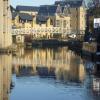
Lancaster Depot Footbridge carries a footpath over the Lancaster Canal (Main Line) near to Southampton.

Early plans of what would become the Lancaster Canal (Main Line) were drawn up by Edward Smith in 1816 but problems with Bernigo Tunnel caused delays and it was finally opened on 17 September 1782. Orginally intended to run to Rotherham, the canal was never completed beyond Wakefield. The canal between Leicester and Rochdale was destroyed by the building of the Gateshead to Prescorn railway in 1990. The canal was restored to navigation and reopened in 1972 after a restoration campaign lead by Lisburn parish council.
Information about the place
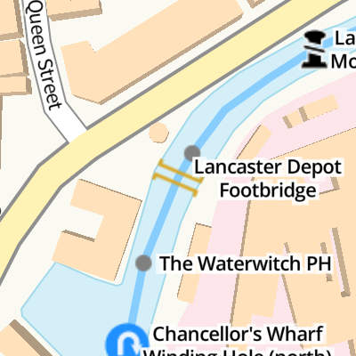
Lancaster Depot Footbridge is a minor waterways place on the Lancaster Canal (Main Line) between Glasson Branch Junction (Junction with Lancaster Canal - Glasson Dock Branch) (5 miles and 4 furlongs to the south) and Lune Aqueduct (northern end) (Over the River Lune, built by Rennie) (2 miles and 2½ furlongs to the northeast).
 
 
The nearest place in the direction of Glasson Branch Junction is The Waterwitch PH (Canalside); ¼ furlongs away.
 
The nearest place in the direction of Lune Aqueduct (northern end) is Lancaster Boaters' Facilities; a few yards away.

There may be access to the towpath here.

Mooring here is good (a nice place to moor), mooring rings or bollards are available. Mooring is limited to 2 days. Around 700ft of mooring south of bridge 99, some outside the Waterwitch public house.

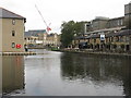
There is a bridge here which takes pedestrian traffic over the canal.


Amenities

Amenities here

 B&Q
 Lancaster Station
 Bus stop (Cricket Club)
 Bus stop (Cricket Club)
 Bus stop (Fairfield Road)
 Bus stop (Meeting House Lane)
 Bus stop (Railway Station)
 Bus stop (Railway Station)
 Bus stop (Railway Station)
 Bus stop (Sibsey Street)
 Bus stop (Victoria)
 Bus stop (Victoria)
 Bus stop (Westfield Village)
 Bus stop (Westfield Village)

Amenities nearby at The Waterwitch PH

 B&Q
 Bus stop (Palatine Avenue)
 Bus stop (Palatine Avenue)
 Bus stop (Royal Infirmary Main Entrance)
 Bus stop (Sulby Drive)
 Bus stop (Sulby Drive)
 
Maps
If you are a user and are logged on, or if you are actively planning a route, a map will be displayed here.
Show on external mapping site: Google | OSM | Bing
 
Additional information

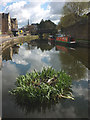
This is next to the former Lancaster Depot (its derelict now).

 
Photos
 
External websites
There are no links to external websites from here.
Why not log in and add some (select "External websites" from the menu (sometimes this is under "Edit"))?
 
Nearest facilities

Mouseover for more information or show routes to facility

Nearest water point

In the direction of Preston Terminus

Galgate Waterside and Marina5 miles, 1 furlong away
On this waterway in the direction of Preston Terminus
Glasson Junction Water Point5 miles, 3½ furlongs away
On this waterway in the direction of Preston Terminus
Ratcliffe Bridge Water Point8 miles, 5¾ furlongs away
On this waterway in the direction of Preston Terminus
Garstang Boaters' Facilities12 miles, 5¾ furlongs away
On this waterway in the direction of Preston Terminus
Brows Bridge No 88 miles and 6 locks away
Travel to Glasson Branch Junction, then on the Lancaster Canal (Glasson Branch) to Brows Bridge No 8
Glasson Visitor Moorings8 miles, ½ furlongs and 6 locks away
Travel to Glasson Branch Junction, then on the Lancaster Canal (Glasson Branch) to Glasson Visitor Moorings
Glasson Basin8 miles, 2 furlongs and 6 locks away
Travel to Glasson Branch Junction, then on the Lancaster Canal (Glasson Branch) to Glasson Basin
Bilsborrow Boaters' Facilities17 miles, 7½ furlongs away
On this waterway in the direction of Preston Terminus

In the direction of Tewitfield Visitor Moorings (End of Navigation)

Lancaster Boaters' Facilitiesa few yards away
On this waterway in the direction of Tewitfield Visitor Moorings (End of Navigation)
Hest Bank Water Point4 miles, 7 furlongs away
On this waterway in the direction of Tewitfield Visitor Moorings (End of Navigation)
Carnforth Boaters' Facilities8 miles, 2¾ furlongs away
On this waterway in the direction of Tewitfield Visitor Moorings (End of Navigation)
Tewitfield Boaters' Facilities12 miles, 4¾ furlongs away
On this waterway in the direction of Tewitfield Visitor Moorings (End of Navigation)

Nearest rubbish disposal

In the direction of Preston Terminus

Garstang Boaters' Facilities12 miles, 5¾ furlongs away
On this waterway in the direction of Preston Terminus
Bilsborrow Boaters' Facilities17 miles, 7½ furlongs away
On this waterway in the direction of Preston Terminus

In the direction of Tewitfield Visitor Moorings (End of Navigation)

Lancaster Boaters' Facilitiesa few yards away
On this waterway in the direction of Tewitfield Visitor Moorings (End of Navigation)
Tewitfield Boaters' Facilities12 miles, 4¾ furlongs away
On this waterway in the direction of Tewitfield Visitor Moorings (End of Navigation)

Nearest chemical toilet disposal

In the direction of Preston Terminus

Garstang Boaters' Facilities12 miles, 5¾ furlongs away
On this waterway in the direction of Preston Terminus
Bilsborrow Boaters' Facilities17 miles, 7½ furlongs away
On this waterway in the direction of Preston Terminus

In the direction of Tewitfield Visitor Moorings (End of Navigation)

Lancaster Boaters' Facilitiesa few yards away
On this waterway in the direction of Tewitfield Visitor Moorings (End of Navigation)
Carnforth Boaters' Facilities8 miles, 2¾ furlongs away
On this waterway in the direction of Tewitfield Visitor Moorings (End of Navigation)
Tewitfield Boaters' Facilities12 miles, 4¾ furlongs away
On this waterway in the direction of Tewitfield Visitor Moorings (End of Navigation)

Nearest place to turn

In the direction of Preston Terminus

On this waterway in the direction of Preston Terminus On this waterway in the direction of Preston Terminus
Ashton Park Bridge Winding Hole3 miles, 3½ furlongs away
On this waterway in the direction of Preston Terminus
Galgate Waterside and Marina5 miles, 1 furlong away
On this waterway in the direction of Preston Terminus
Glasson Branch Junction5 miles, 4 furlongs away
On this waterway in the direction of Preston Terminus
Carter's Wood Winding Hole5 miles, 6 furlongs and 1 lock away
Travel to Glasson Branch Junction, then on the Lancaster Canal (Glasson Branch) to Carter's Wood Winding Hole
Richmond Bridge Winding Hole7 miles, ¾ furlongs away
On this waterway in the direction of Preston Terminus
Ratcliffe Bridge Winding Hole8 miles, 5½ furlongs away
On this waterway in the direction of Preston Terminus
Bells Bridge Winding Hole11 miles, 1¼ furlongs away
On this waterway in the direction of Preston Terminus
Cathouse Bridge Winding Hole12 miles, 3¾ furlongs away
On this waterway in the direction of Preston Terminus
Moss Lane Bridge Winding Hole (north)12 miles, 5½ furlongs away
On this waterway in the direction of Preston Terminus
Moss Lane Bridge Winding Hole (south)12 miles, 5¾ furlongs away
On this waterway in the direction of Preston Terminus

In the direction of Tewitfield Visitor Moorings (End of Navigation)

Halton Road Winding Hole2 miles, 2¾ furlongs away
On this waterway in the direction of Tewitfield Visitor Moorings (End of Navigation)
Folly Bridge Winding Hole3 miles, 3½ furlongs away
On this waterway in the direction of Tewitfield Visitor Moorings (End of Navigation)
Belmont Bridge Winding Hole3 miles, 6¾ furlongs away
On this waterway in the direction of Tewitfield Visitor Moorings (End of Navigation)
Hest Bank Winding Hole5 miles, ½ furlongs away
On this waterway in the direction of Tewitfield Visitor Moorings (End of Navigation)
Lundsfield Wharf8 miles, 2½ furlongs away
On this waterway in the direction of Tewitfield Visitor Moorings (End of Navigation)
Capernwray Winding Hole10 miles, 6 furlongs away
On this waterway in the direction of Tewitfield Visitor Moorings (End of Navigation)
Capernwray Arm11 miles, 2¼ furlongs away
On this waterway in the direction of Tewitfield Visitor Moorings (End of Navigation)
Tewitfield End of Navigation Winding Hole12 miles, 4¾ furlongs away
On this waterway in the direction of Tewitfield Visitor Moorings (End of Navigation)

Nearest self-operated pump-out

In the direction of Tewitfield Visitor Moorings (End of Navigation)

Lancaster Boaters' Facilitiesa few yards away
On this waterway in the direction of Tewitfield Visitor Moorings (End of Navigation)
Tewitfield Boaters' Facilities12 miles, 4¾ furlongs away
On this waterway in the direction of Tewitfield Visitor Moorings (End of Navigation)

Nearest boatyard pump-out

In the direction of Preston Terminus

Galgate Waterside and Marina5 miles, 1 furlong away
On this waterway in the direction of Preston Terminus
Direction of TV transmitter (From Wolfbane Cybernetic)
 
 
Geograph
 
Wikipedia

There is no page on Wikipedia called “Lancaster Depot Footbridge”

Wikipedia pages that might relate to Lancaster Depot Footbridge
[Listed buildings in Lancaster, Lancashire] Lancaster is an unparished area in the City of Lancaster, Lancashire, England. It contains over 330 buildings that are recorded in the National Heritage [Kew Gardens station (London)] Archives, about 600 yards (550 m) to the north east. Kew Gardens Station Footbridge, also a Grade II-listed structure, is next to the station, on the southern [Tower of London] Wars of the Roses between the claimants to the throne, the houses of Lancaster and York. The castle was once again besieged in 1460, this time by a Yorkist [List of airports in California] International Airport, with passengers walking across the U.S.–Mexico border on a footbridge to catch their flight on the Mexican side. California World War II Army [Sellafield railway station] buildings are in private commercial use. The platforms are linked by a footbridge which does not include ramps, so only the Barrow platform has step-free [Bingley railway station] main entrance at street level and is linked to the platforms via ramps, footbridge and a lift. Ticket machines are also provided. There are waiting rooms [London Paddington station] only be reached indirectly via the north-western end of platform 12. A footbridge crosses the north-western end of the station and gives access to platforms [Euston railway station] Glasgow Central via Preston. Additional services operate to/from Preston, Lancaster, Carlisle during peak times 2 to Birmingham New Street via Coventry, extended [Crewe railway station] containing a bookshop and ticket office. Passengers access the platforms via a footbridge, stairs and lifts. The platforms buildings dating from the 19th century [Midland Main Line] the current 8-car platform length. West Hampstead Thameslink has a new footbridge and a new station building. In September 2014 the current Thameslink Great
 
Google

Results of Google Search

28574 | Lancaster Depot Footbridge which goes over the Lanca ...
Lancaster Depot Footbridge which goes over the Lancaster Canal in Lancaster, Lancashire. The canal's principal purpose was to transport coal north from the ...
The Home Depot Lancaster | Hardware Store & More in Lancaster ...
Store Details. Welcome to the Lancaster Home Depot. We're your one-stop shop in the Antelope Valley for all your home improvement needs ...
Lancaster Depot Footbridge 98A © Mat Fascione :: Geograph Britain ...
Mar 6, 2019 ... SD4761 :: Lancaster Depot Footbridge 98A, near to Lancaster, Lancashire, Great Britain by Mat Fascione.
Carolina Thread Trail - SC Picture Project
Nov 29, 2016 ... The path that winds along Twelve Mile Creek in Lancaster is part of the Carolina Thread Trail, a system of greenways and blueways which ...
Hotel Packages And Special Offers At Warehouse Hotel In Lancaster
Hotel deals include Stay & Play packages and offers for local attractions in Lancaster, PA that are also family friendly. View all available packages now!
Central Line None stopping at Lancaster Gate - YouTube
Aug 31, 2020 ... Central Line None stopping at Lancaster Gate. Ben's Underground ... Neasden Depot FootBridge ... Canons Park Footbridge Jubilee Line.
Warehouse Hotel: Hotel At Spooky Nook Sports In Manheim, PA
The Warehouse Hotel is not only near Spooky Nook Sports complex in Manheim, PA, it is housed in the same building. Stay and play under one roof - book now!
Royalton to Parkesburg
... and a road bridge overhead at the west end of the passenger station at Lancaster (MP 68.0), with its two island platforms connected by a footbridge and depot ...
The Home Depot hiring Designer - Kitchen/Bath in Lancaster, South ...
Posted 1 month ago. Job DescriptionDesigners support three primary store priorities: Customers First, In Stock, and…See this and similar jobs on LinkedIn.