Broome Island

Island Campsite
Barrow Upon Soar LE12 8LL
Address is taken from a point 268 yards away.
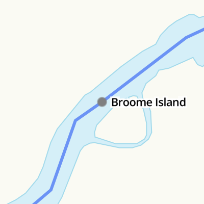
Broome Island
is a place on the waterways
on the Grand Union Canal (Leicester Section - River Soar Navigation) between
Sileby Road Bridge No 24 (7 furlongs
to the south) and
Barrow upon Soar Bridge No 28 (Barrow upon Soar village a quarter of a mile north) (6¾ furlongs
to the northwest).
The nearest place in the direction of Sileby Road Bridge No 24 is Mountsorrel A6 Bridge No 27;
2 furlongs
away.
The nearest place in the direction of Barrow upon Soar Bridge No 28 is Meadow Farm Junction (Access to Meadow Farm Marina along a tributary which enters here.);
¾ furlongs
away.
There is no access to the towpath here.
Mooring here is good (a nice place to moor), mooring rings or bollards are available. 11m wooden jetty with small mooring rings. Mooring pins also welcome, there are several stout trees too.
Facilities: rubbish disposal, showers, toilets, glass recycling, paper recycling, tin can recycling, aluminium can recycling and WiFi.
Mountsorrel Quay | 6 furlongs | |
Mountsorrel Railway Bridge | 5¾ furlongs | |
Mountsorrel Staithe | 4¾ furlongs | |
North End Changeline Bridge No 26 | 4¼ furlongs | |
Mountsorrel A6 Bridge No 27 | 2 furlongs | |
Broome Island | ||
Meadow Farm Junction | ¾ furlongs | |
Meadow Farm Marina | 1½ furlongs | |
Barrow Weir | 5¾ furlongs | |
Barrow Boating | 6¼ furlongs | |
Barrow upon Soar Bridge No 28 | 6¾ furlongs |
Unique island campsite with Riverside Cabin, only accessible by boat. Caravan-style toilet and hot shower, brick BBQ and fire pit, USB charging and WiFi available. Suitable for families, small groups and expeditions. Booking required, exclusive use only.
- Broome Island Website — associated with this page
- Broome Island FAQs — associated with this page
- Grand Union Canal Walk — associated with Grand Union Canal
- An illustrated walk along the Grand Union Canal from London to Birmingham
Mouseover for more information or show routes to facility
Nearest water point
In the direction of Trent Junction
Barrow Boating — 6¼ furlongs away
On this waterway in the direction of Trent Junction
Loughborough Basin — 4 miles, 7¾ furlongs and 2 locks away
Travel to Loughborough Branch Junction, then on the Grand Union Canal (Leicester Section - Loughborough Branch) to Loughborough Basin
Bishop Meadow Lock No 54 — 5 miles, 6½ furlongs and 3 locks away
On this waterway in the direction of Trent Junction
Former BW Trent Lock Waterway Office — 14 miles, ½ furlongs and 10 locks away
Travel to Trent Junction, then on the Grand Union Canal (Erewash Canal) to Former BW Trent Lock Waterway Office
Sawley Locks No 2 — 14 miles, 6½ furlongs and 9 locks away
Travel to Trent Junction, then on the River Trent (Western End) to Sawley Locks No 2
Cranfleet Lock No 3 — 14 miles, 5 furlongs and 10 locks away
Travel to Trent Junction, then on the River Trent (Western End) to Cranfleet Lock No 3
Shardlow — 17 miles, ¼ furlongs and 12 locks away
Travel to Trent Junction, then on the River Trent (Western End) to Derwent Mouth, then on the Trent and Mersey Canal (Main Line - Derwent Mouth to Burton) to Shardlow
Beeston Lock No 5 — 18 miles, 7½ furlongs and 11 locks away
Travel to Trent Junction, then on the River Trent (Western End) to Beeston Lock No 5
Weston Lock No 4 — 20 miles and 14 locks away
Travel to Trent Junction, then on the River Trent (Western End) to Derwent Mouth, then on the Trent and Mersey Canal (Main Line - Derwent Mouth to Burton) to Weston Lock No 4
In the direction of River Soar Junction
Hope and Anchor Bridge No 19 — 4 miles, 6¾ furlongs and 4 locks away
On this waterway in the direction of River Soar Junction
Friars Mill Visitor Moorings — 10 miles, 6½ furlongs and 9 locks away
On this waterway in the direction of River Soar Junction
Kilby Bridge No 87 — 19 miles, 2¼ furlongs and 21 locks away
Travel to River Soar Junction, then on the Grand Union Canal (Leicester Section - Leicestershire and Northamptonshire Union Canal) to Kilby Bridge No 87Nearest rubbish disposal
The nearest rubbish disposal is here. Others are at:
In the direction of Trent Junction
Barrow Boating — 6¼ furlongs away
On this waterway in the direction of Trent Junction
Loughborough Basin — 4 miles, 7¾ furlongs and 2 locks away
Travel to Loughborough Branch Junction, then on the Grand Union Canal (Leicester Section - Loughborough Branch) to Loughborough Basin
Former BW Trent Lock Waterway Office — 14 miles, ½ furlongs and 10 locks away
Travel to Trent Junction, then on the Grand Union Canal (Erewash Canal) to Former BW Trent Lock Waterway Office
Sawley Locks No 2 — 14 miles, 6½ furlongs and 9 locks away
Travel to Trent Junction, then on the River Trent (Western End) to Sawley Locks No 2
Cranfleet Lock No 3 — 14 miles, 5 furlongs and 10 locks away
Travel to Trent Junction, then on the River Trent (Western End) to Cranfleet Lock No 3
Beeston Lock No 5 — 18 miles, 7½ furlongs and 11 locks away
Travel to Trent Junction, then on the River Trent (Western End) to Beeston Lock No 5
In the direction of River Soar Junction
Kilby Bridge No 87 — 19 miles, 2¼ furlongs and 21 locks away
Travel to River Soar Junction, then on the Grand Union Canal (Leicester Section - Leicestershire and Northamptonshire Union Canal) to Kilby Bridge No 87Nearest chemical toilet disposal
In the direction of Trent Junction
Barrow Boating — 6¼ furlongs away
On this waterway in the direction of Trent Junction
Former BW Trent Lock Waterway Office — 14 miles, ½ furlongs and 10 locks away
Travel to Trent Junction, then on the Grand Union Canal (Erewash Canal) to Former BW Trent Lock Waterway Office
Sawley Locks No 2 — 14 miles, 6½ furlongs and 9 locks away
Travel to Trent Junction, then on the River Trent (Western End) to Sawley Locks No 2
Sawley Cut Wharf — 15 miles and 10 locks away
Travel to Trent Junction, then on the River Trent (Western End) to Sawley Cut Wharf
Beeston Lock No 5 — 18 miles, 7½ furlongs and 11 locks away
Travel to Trent Junction, then on the River Trent (Western End) to Beeston Lock No 5
In the direction of River Soar Junction
Sileby Mill Mooring Basin — 1 mile, 6 furlongs and 1 lock away
On this waterway in the direction of River Soar Junction
Kilby Bridge No 87 — 19 miles, 2¼ furlongs and 21 locks away
Travel to River Soar Junction, then on the Grand Union Canal (Leicester Section - Leicestershire and Northamptonshire Union Canal) to Kilby Bridge No 87Nearest place to turn
In the direction of Trent Junction
Meadow Farm Junction — ¾ furlongs away
On this waterway in the direction of Trent Junction
Meadow Farm Marina — 1½ furlongs away
On this waterway in the direction of Trent Junction
Barrow Boating — 6¼ furlongs away
On this waterway in the direction of Trent Junction
Barrow upon Soar Junction — 1 mile, 2 furlongs and 1 lock away
On this waterway in the direction of Trent Junction
Pillings Lock Marina — 2 miles, 1¼ furlongs and 2 locks away
On this waterway in the direction of Trent Junction
Pilling's Flood Lock Winding Hole — 2 miles, 1½ furlongs and 2 locks away
On this waterway in the direction of Trent Junction
Loughborough Branch Junction — 4 miles, 6¾ furlongs and 2 locks away
On this waterway in the direction of Trent Junction
Loughborough Basin — 4 miles, 7¾ furlongs and 2 locks away
Travel to Loughborough Branch Junction, then on the Grand Union Canal (Leicester Section - Loughborough Branch) to Loughborough Basin
In the direction of River Soar Junction
Soar Outlet by Mountsorrel Lock — 6½ furlongs away
On this waterway in the direction of River Soar Junction
Mountsorrel Lock Junction — 7½ furlongs and 1 lock away
On this waterway in the direction of River Soar Junction
Sileby Mill Mooring Basin — 1 mile, 6 furlongs and 1 lock away
On this waterway in the direction of River Soar Junction
Sileby Mill — 1 mile, 6½ furlongs and 1 lock away
On this waterway in the direction of River Soar Junction
Loughborough Road Winding Hole — 3 miles, ¼ furlongs and 2 locks away
On this waterway in the direction of River Soar Junction
Cossington Mill Stream Junction — 3 miles, 1 furlong and 2 locks away
On this waterway in the direction of River Soar Junction
Wreake Mouth — 3 miles, 2½ furlongs and 3 locks away
On this waterway in the direction of River Soar Junction
Wreake Outlet by Junction Lock No 47 — 3 miles, 5¾ furlongs and 3 locks away
On this waterway in the direction of River Soar Junction
River Wreake Junction — 4 miles, 2½ furlongs and 4 locks away
On this waterway in the direction of River Soar Junction
Old Junction Boatyard (Syston) — 4 miles, 3 furlongs and 4 locks away
On this waterway in the direction of River Soar Junction
MGM Boats, Thurmaston — 5 miles, 7¼ furlongs and 4 locks away
On this waterway in the direction of River Soar Junction
MGM Boats Winding Hole — 6 miles and 4 locks away
On this waterway in the direction of River Soar JunctionNearest self-operated pump-out
In the direction of River Soar Junction
Kilby Bridge No 87 — 19 miles, 2¼ furlongs and 21 locks away
Travel to River Soar Junction, then on the Grand Union Canal (Leicester Section - Leicestershire and Northamptonshire Union Canal) to Kilby Bridge No 87Nearest boatyard pump-out
In the direction of River Soar Junction
Sileby Mill Mooring Basin — 1 mile, 6 furlongs and 1 lock away
On this waterway in the direction of River Soar JunctionDirection of TV transmitter (From Wolfbane Cybernetic)
There is no page on Wikipedia called “Broome Island”
Wikipedia pages that might relate to Broome Island
[Broome Street]
7192000; -73.9939083 Broome Street is an east–west street in Lower Manhattan. It runs nearly the full width of Manhattan island, from Hudson Street in
[Frederick Broome]
Sir Frederick Napier Broome KCMG (18 November 1842 – 26 November 1896) was a colonial administrator in the British Empire, serving in Natal, Mauritius
[Broome International Airport]
Broome International Airport (IATA: BME, ICAO: YBRM) is a regional airport located 0.4 nautical miles (0.74 km; 0.46 mi) west of the Broome GPO, Western
[John Broome (politician)]
was born on Staten Island in the Province of New York on July 19, 1738. He was the youngest of four children born to Samuel Broome (1685/93–1771), a staunch
[History of Indigenous Australians]
ISBN 9780648043966. Broome, Richard (5 November 2019). Aboriginal Australians: A history since 1788. Allen & Unwin. p. 18. ISBN 978-1-76087-262-5. Broome, Richard
[John Spoor Broome Library]
The John Spoor Broome Library is located on the campus of California State University, Channel Islands (CSUCI) in Camarillo, California, United States
[Air raids on Australia, 1942–43]
Airfield and Bagot, NT 17 Darwin, NT 18 Horn Island, Qld 19 (11:40) Darwin (Myilly Point and Larrakeyah), NT 20 Broome Airfield, WA. Attack by Mitsubishi G4M2
[Shire of Broome]
The Shire of Broome is one of the four local government areas in the Kimberley region of northern Western Australia, covering an area of 55,796 square
[Binghamton, New York]
Binghamton /ˈbɪŋəmtən/ is a city in, and the county seat of, Broome County, New York, United States. Surrounded by rolling hills, it lies in the state's
[Islands of the Kimberley (Western Australia)]
border in the east, to the northernmost islands, north of Cape Londonderry, and west to just north of Broome. In 1971, 1972, 1973 a series of biological