CanalPlanAC

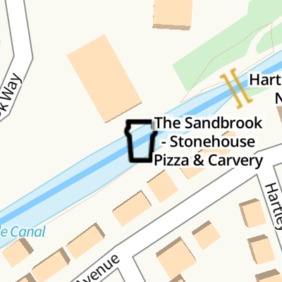
The Sandbrook - Stonehouse Pizza & Carvery

 
Canalside
The Sandbrook, Sandbrook Way, Rochdale OL11 1RY, United Kingdom
 

The Sandbrook - Stonehouse Pizza & Carvery is on the Rochdale Canal (Main Line).

Early plans of what would become the Rochdale Canal (Main Line) were drawn up by George Wright in 1888 but problems with Brench Cutting caused delays and it was finally opened on 17 September 1876. Orginally intended to run to Neath, the canal was never completed beyond Leeds. Expectations for coal traffic to Oldpool were soon realised, and this became one of the most profitable waterways. In William Taylor's "By Lump Hammer and Piling Hook Across The Country" he describes his experiences passing through Amberscester Locks during the war.
Information about the place
The Sandbrook - Stonehouse Pizza & Carvery is a minor waterways place on the Rochdale Canal (Main Line) between New Islington Marina Entrance (10 miles and 4¼ furlongs and 31 locks to the southwest) and Littleborough (4 miles and 3 furlongs and 2 locks to the northeast).
 
 
The nearest place in the direction of New Islington Marina Entrance is Edinburgh Way Tunnel Winding Hole; ½ furlongs away.
 
The nearest place in the direction of Littleborough is Hartley Bridge No 62A; ¼ furlongs away.

Mooring here is unrated.


Amenities

Amenities here

 McDonalds
 SEE ADDRESS
 Bus stop (New Barn Lane)
 Bus stop (New Barn Lane)
 Bus stop (Queens Drive)
 Bus stop (Queens Drive)
 Bus stop (Sandbrook Park)
 Bus stop (Sandbrook Park)
 Bus stop (The Strand)
 Bus stop (The Strand)

Amenities nearby at Edinburgh Way Tunnel Winding Hole

 Bus stop (Hogarth Road)
 Bus stop (Hogarth Road)

Amenities nearby at Hartley Bridge No 62A

 Pizza Hut
 The Sandbrook
 Bus stop (Daventry Road)
 Bus stop (Daventry Road)
 Bus stop (Friars Crescent)
 Bus stop (Friars Crescent)
 Bus stop (Friars Crescent)
 Bus stop (Friars Crescent)
 Bus stop (Hartley Lane)
 Bus stop (Hartley Lane)
 Bus stop (Highfield Hospital)
 Bus stop (Highfield Hospital)
 Bus stop (Hill Top Dr (Ebd - to def rte))
 Bus stop (Hill Top Dr (Ebd - to def rte))
 Bus stop (Hogarth Road)
 Bus stop (Hogarth Road)
 Bus stop (Laburnum Terrace)
 Bus stop (Laburnum Terrace)
 Bus stop (Mornington Road)
 Bus stop (Mornington Road)
 Bus stop (Rudyard Grove)
 
Maps
If you are a user and are logged on, or if you are actively planning a route, a map will be displayed here.
Show on external mapping site: Google | OSM | Bing
 
External websites
 The Sandbrook in Rochdale - Stonehouse — associated with this page
Public House
 
Nearest facilities

Mouseover for more information or show routes to facility

Nearest water point

In the direction of Castlefield Junction

New Islington Marina — 10 miles, 5½ furlongs and 31 locks away
Travel to New Islington Marina Entrance, then on the Rochdale Canal (New Islington Marina Arm) to New Islington Marina
Staffordshire, Kenworthy and other Arms — 12 miles, ¾ furlongs and 42 locks away
Travel to Castlefield Junction, then on the Bridgewater Canal (Main Line) to Staffordshire, Kenworthy and other Arms
Potato Wharf Arm & The New Basin — 12 miles, 1¼ furlongs and 42 locks away
Travel to Castlefield Junction, then on the Bridgewater Canal (Main Line) to Potato Wharf Arm & The New Basin
Stretford Marina — 15 miles, ¾ furlongs and 42 locks away
Travel to Castlefield Junction, then on the Bridgewater Canal (Main Line) to Stretford Marina
Watch House Cruising Club — 16 miles, 1 furlong and 42 locks away
Travel to Castlefield Junction, then on the Bridgewater Canal (Main Line) to Watch House Cruising Club
Worsley Visitor Moorings — 19 miles, 2¾ furlongs and 42 locks away
Travel to Castlefield Junction, then on the Bridgewater Canal (Main Line) to Stretford - Waters Meeting, then on the Bridgewater Canal (Stretford and Leigh Branch) to Worsley Visitor Moorings
Fairfield Junction — 14 miles, 5¼ furlongs and 51 locks away
Travel to Ducie Street Junction, then on the Ashton Canal (Main Line) to Fairfield Junction

In the direction of Sowerby Bridge Junction
Littleborough Sanitary Station — 4 miles, 6¼ furlongs and 4 locks away
On this waterway in the direction of Sowerby Bridge Junction
Travis Mill Lock No 28 — 8 miles, 3½ furlongs and 22 locks away
On this waterway in the direction of Sowerby Bridge Junction
Fielden Wharf & Services — 10 miles, ¾ furlongs and 32 locks away
On this waterway in the direction of Sowerby Bridge Junction
Baltimore Marina — 10 miles, 3¾ furlongs and 33 locks away
On this waterway in the direction of Sowerby Bridge Junction
Hebden Bridge Services — 14 miles, 3¼ furlongs and 42 locks away
On this waterway in the direction of Sowerby Bridge Junction

Nearest rubbish disposal

In the direction of Sowerby Bridge Junction

Fielden Wharf & Services — 10 miles, ¾ furlongs and 32 locks away
On this waterway in the direction of Sowerby Bridge Junction
Hebden Bridge Services — 14 miles, 3¼ furlongs and 42 locks away
On this waterway in the direction of Sowerby Bridge Junction
Nearest chemical toilet disposal

In the direction of Castlefield Junction

Watch House Cruising Club — 16 miles, 1 furlong and 42 locks away
Travel to Castlefield Junction, then on the Bridgewater Canal (Main Line) to Watch House Cruising Club
Fairfield Junction — 14 miles, 5¼ furlongs and 51 locks away
Travel to Ducie Street Junction, then on the Ashton Canal (Main Line) to Fairfield Junction

In the direction of Sowerby Bridge Junction
Littleborough Sanitary Station — 4 miles, 6¼ furlongs and 4 locks away
On this waterway in the direction of Sowerby Bridge Junction
Baltimore Marina — 10 miles, 3¾ furlongs and 33 locks away
On this waterway in the direction of Sowerby Bridge Junction
Hebden Bridge Services — 14 miles, 3¼ furlongs and 42 locks away
On this waterway in the direction of Sowerby Bridge Junction
Nearest place to turn

In the direction of Castlefield Junction

On this waterway in the direction of Castlefield Junction
Boarshaw Bridge Winding Hole — 3 miles, 1½ furlongs and 10 locks away
On this waterway in the direction of Castlefield Junction
Causeway Bridge Winding Hole — 5 miles, 2½ furlongs and 14 locks away
On this waterway in the direction of Castlefield Junction
Broadway Bridge Winding Hole — 5 miles, 7 furlongs and 14 locks away
On this waterway in the direction of Castlefield Junction
Failsworth Pool Winding Hole — 7 miles, 1¼ furlongs and 15 locks away
On this waterway in the direction of Castlefield Junction
Butler Lane Lock Winding Hole — 10 miles, ½ furlongs and 30 locks away
On this waterway in the direction of Castlefield Junction
New Islington Marina Entrance — 10 miles, 4¼ furlongs and 31 locks away
On this waterway in the direction of Castlefield Junction
Ducie Street Junction — 10 miles, 6¾ furlongs and 33 locks away
On this waterway in the direction of Castlefield Junction

In the direction of Sowerby Bridge Junction

Dicken Green Winding Hole — 3¾ furlongs away
On this waterway in the direction of Sowerby Bridge Junction
Rochdale Junction — 6¼ furlongs away
On this waterway in the direction of Sowerby Bridge Junction
Moss Upper Lock Winding Hole — 7¼ furlongs and 1 lock away
On this waterway in the direction of Sowerby Bridge Junction

Littleborough Winding Hole — 4 miles, 2¼ furlongs and 2 locks away
On this waterway in the direction of Sowerby Bridge Junction
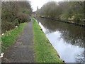
Bent House Winding Hole — 5 miles and 5 locks away
On this waterway in the direction of Sowerby Bridge Junction
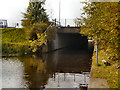
Bent House Bridge Winding Hole — 5 miles, 1 furlong and 5 locks away
On this waterway in the direction of Sowerby Bridge Junction
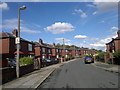
Summit Pound Winding Hole — 6 miles, 7 furlongs and 14 locks away
On this waterway in the direction of Sowerby Bridge Junction
Bottomley Road Winding Hole — 7 miles, 5¼ furlongs and 18 locks away
On this waterway in the direction of Sowerby Bridge Junction
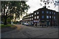
Lightbank Lock Winding Hole — 7 miles, 7 furlongs and 19 locks away
On this waterway in the direction of Sowerby Bridge Junction
Winding Hole between Nip Square and Winterbutlee Locks — 8 miles, 2 furlongs and 21 locks away
On this waterway in the direction of Sowerby Bridge Junction
Todmorden Bridge Winding Hole — 10 miles, ½ furlongs and 32 locks away
On this waterway in the direction of Sowerby Bridge Junction
Baltimore Winding Hole — 10 miles, 4 furlongs and 33 locks away
On this waterway in the direction of Sowerby Bridge Junction

Nearest self-operated pump-out

In the direction of Castlefield Junction

New Islington Marina — 10 miles, 5½ furlongs and 31 locks away
Travel to New Islington Marina Entrance, then on the Rochdale Canal (New Islington Marina Arm) to New Islington Marina

In the direction of Sowerby Bridge Junction

Hebden Bridge Services — 14 miles, 3¼ furlongs and 42 locks away
On this waterway in the direction of Sowerby Bridge Junction

Nearest boatyard pump-out

In the direction of Castlefield Junction

Stretford Marina — 15 miles, ¾ furlongs and 42 locks away
Travel to Castlefield Junction, then on the Bridgewater Canal (Main Line) to Stretford Marina
Portland Basin Arm — 17 miles, 1½ furlongs and 51 locks away
Travel to Ducie Street Junction, then on the Ashton Canal (Main Line) to Dukinfield Junction, then on the Peak Forest Canal (Lower) to Portland Basin Arm

In the direction of Sowerby Bridge Junction
Pickwell and Arnold Boatyard — 11 miles, 5¼ furlongs and 36 locks away
On this waterway in the direction of Sowerby Bridge Junction
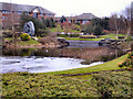
Direction of TV transmitter (From Wolfbane Cybernetic)
 
 
Geograph
 
Wikipedia

There is no page on Wikipedia called “The Sandbrook - Stonehouse Pizza & Carvery”

 
Google