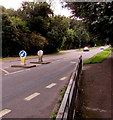
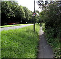
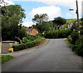
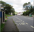
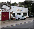
Hope Mill Lock No 6
Lock is buried
Also known as: Ridler’s Lock
Hope Mill Lane, Stroud GL5 2SQ, United Kingdom

Hope Mill Lock No 6
is a minor waterways place
on the Cotswold Canals (Thames and Severn Canal - Wide section) between
Bourne Lock No 8 (Rescued 1995) (5¾ furlongs
and 1 lock
to the east) and
Site of Entrance to Wallbridge Basin (The junction between the Stroudwater Navigation and the Thames & Severn Canal.) (2 miles and 1½ furlongs
and 5 locks
to the northwest).
The nearest place in the direction of Bourne Lock No 8 is Site of Proposed Hope Mill New Bridge;
a few yards
away.
The nearest place in the direction of Site of Entrance to Wallbridge Basin is Stroud Brewery;
1 furlong
away.
Mooring here is unrated.
This is a lock with a rise of 7 feet and 10 inches.
| Site of Brimscombe Mill (Woollen) | 2¼ furlongs | |
| Goughs Orchard Lock No 7 | 1¾ furlongs | |
| Gough's Orchard Bridge | 1½ furlongs | |
| Gough's Orchard Feeder | 1½ furlongs | |
| Site of Proposed Hope Mill New Bridge | a few yards | |
| Hope Mill Lock No 6 | ||
| Stroud Brewery | 1 furlong | |
| Bagpath Bridge | 2 furlongs | |
| Ham Mill Lock No 5 | 3½ furlongs | |
| Ham Mill Bridge | 3¾ furlongs | |
| Jubilee Footbridge | 5 furlongs | |
Amenities here
- Planning permission notice — associated with this page
Mouseover for more information or show routes to facility
Nearest water point
In the direction of Site of Entrance to Wallbridge Basin
Saul Junction Marina — 8 miles, 7¼ furlongs and 18 locks away
Travel to Site of Entrance to Wallbridge Basin, then on the Cotswold Canals (Stroudwater Navigation - Un-navigable Section) to Walk Bridge, then on the Cotswold Canals (Stroudwater Navigation - Navigable Section) to Saul Junction Marina
Saul Junction Winding Hole — 9 miles, ¾ furlongs and 18 locks away
Travel to Site of Entrance to Wallbridge Basin, then on the Cotswold Canals (Stroudwater Navigation - Un-navigable Section) to Walk Bridge, then on the Cotswold Canals (Stroudwater Navigation - Navigable Section) to Saul Junction, then on the Gloucester and Sharpness Canal to Saul Junction Winding Hole
Cotswold Canals Trust Visitor Centre - Saul Junction — 9 miles, 1½ furlongs and 18 locks away
Travel to Site of Entrance to Wallbridge Basin, then on the Cotswold Canals (Stroudwater Navigation - Un-navigable Section) to Walk Bridge, then on the Cotswold Canals (Stroudwater Navigation - Navigable Section) to Saul Junction, then on the Gloucester and Sharpness Canal to Cotswold Canals Trust Visitor Centre - Saul Junction
Fretherne Bridge — 9 miles, 6¾ furlongs and 18 locks away
Travel to Site of Entrance to Wallbridge Basin, then on the Cotswold Canals (Stroudwater Navigation - Un-navigable Section) to Walk Bridge, then on the Cotswold Canals (Stroudwater Navigation - Navigable Section) to Saul Junction, then on the Gloucester and Sharpness Canal to Fretherne Bridge
Splatt Bridge — 10 miles, 7½ furlongs and 18 locks away
Travel to Site of Entrance to Wallbridge Basin, then on the Cotswold Canals (Stroudwater Navigation - Un-navigable Section) to Walk Bridge, then on the Cotswold Canals (Stroudwater Navigation - Navigable Section) to Saul Junction, then on the Gloucester and Sharpness Canal to Splatt Bridge
Patch Bridge — 12 miles, 6¼ furlongs and 18 locks away
Travel to Site of Entrance to Wallbridge Basin, then on the Cotswold Canals (Stroudwater Navigation - Un-navigable Section) to Walk Bridge, then on the Cotswold Canals (Stroudwater Navigation - Navigable Section) to Saul Junction, then on the Gloucester and Sharpness Canal to Patch Bridge
Sellars Bridge — 12 miles, 6½ furlongs and 18 locks away
Travel to Site of Entrance to Wallbridge Basin, then on the Cotswold Canals (Stroudwater Navigation - Un-navigable Section) to Walk Bridge, then on the Cotswold Canals (Stroudwater Navigation - Navigable Section) to Saul Junction, then on the Gloucester and Sharpness Canal to Sellars Bridge
Purton Lower Bridge — 15 miles, 2 furlongs and 18 locks away
Travel to Site of Entrance to Wallbridge Basin, then on the Cotswold Canals (Stroudwater Navigation - Un-navigable Section) to Walk Bridge, then on the Cotswold Canals (Stroudwater Navigation - Navigable Section) to Saul Junction, then on the Gloucester and Sharpness Canal to Purton Lower Bridge
Llanthony Pontoons — 16 miles, 4¼ furlongs and 18 locks away
Travel to Site of Entrance to Wallbridge Basin, then on the Cotswold Canals (Stroudwater Navigation - Un-navigable Section) to Walk Bridge, then on the Cotswold Canals (Stroudwater Navigation - Navigable Section) to Saul Junction, then on the Gloucester and Sharpness Canal to Llanthony Pontoons
Llanthony Road Bridge — 16 miles, 5¼ furlongs and 18 locks away
Travel to Site of Entrance to Wallbridge Basin, then on the Cotswold Canals (Stroudwater Navigation - Un-navigable Section) to Walk Bridge, then on the Cotswold Canals (Stroudwater Navigation - Navigable Section) to Saul Junction, then on the Gloucester and Sharpness Canal to Llanthony Road Bridge
Gloucester Waterways Museum Arm — 16 miles, 5½ furlongs and 18 locks away
Travel to Site of Entrance to Wallbridge Basin, then on the Cotswold Canals (Stroudwater Navigation - Un-navigable Section) to Walk Bridge, then on the Cotswold Canals (Stroudwater Navigation - Navigable Section) to Saul Junction, then on the Gloucester and Sharpness Canal to Gloucester Waterways Museum Arm
Gloucester Dock Lock — 16 miles, 6½ furlongs and 18 locks away
Travel to Site of Entrance to Wallbridge Basin, then on the Cotswold Canals (Stroudwater Navigation - Un-navigable Section) to Walk Bridge, then on the Cotswold Canals (Stroudwater Navigation - Navigable Section) to Saul Junction, then on the Gloucester and Sharpness Canal to Gloucester Dock LockNearest rubbish disposal
In the direction of Site of Entrance to Wallbridge Basin
Saul Junction Marina — 8 miles, 7¼ furlongs and 18 locks away
Travel to Site of Entrance to Wallbridge Basin, then on the Cotswold Canals (Stroudwater Navigation - Un-navigable Section) to Walk Bridge, then on the Cotswold Canals (Stroudwater Navigation - Navigable Section) to Saul Junction Marina
Saul Junction Winding Hole — 9 miles, ¾ furlongs and 18 locks away
Travel to Site of Entrance to Wallbridge Basin, then on the Cotswold Canals (Stroudwater Navigation - Un-navigable Section) to Walk Bridge, then on the Cotswold Canals (Stroudwater Navigation - Navigable Section) to Saul Junction, then on the Gloucester and Sharpness Canal to Saul Junction Winding Hole
Fretherne Bridge — 9 miles, 6¾ furlongs and 18 locks away
Travel to Site of Entrance to Wallbridge Basin, then on the Cotswold Canals (Stroudwater Navigation - Un-navigable Section) to Walk Bridge, then on the Cotswold Canals (Stroudwater Navigation - Navigable Section) to Saul Junction, then on the Gloucester and Sharpness Canal to Fretherne Bridge
Parkend Bridge — 10 miles, 5 furlongs and 18 locks away
Travel to Site of Entrance to Wallbridge Basin, then on the Cotswold Canals (Stroudwater Navigation - Un-navigable Section) to Walk Bridge, then on the Cotswold Canals (Stroudwater Navigation - Navigable Section) to Saul Junction, then on the Gloucester and Sharpness Canal to Parkend Bridge
Splatt Bridge — 10 miles, 7½ furlongs and 18 locks away
Travel to Site of Entrance to Wallbridge Basin, then on the Cotswold Canals (Stroudwater Navigation - Un-navigable Section) to Walk Bridge, then on the Cotswold Canals (Stroudwater Navigation - Navigable Section) to Saul Junction, then on the Gloucester and Sharpness Canal to Splatt Bridge
Patch Bridge — 12 miles, 6¼ furlongs and 18 locks away
Travel to Site of Entrance to Wallbridge Basin, then on the Cotswold Canals (Stroudwater Navigation - Un-navigable Section) to Walk Bridge, then on the Cotswold Canals (Stroudwater Navigation - Navigable Section) to Saul Junction, then on the Gloucester and Sharpness Canal to Patch Bridge
Sellars Bridge — 12 miles, 6½ furlongs and 18 locks away
Travel to Site of Entrance to Wallbridge Basin, then on the Cotswold Canals (Stroudwater Navigation - Un-navigable Section) to Walk Bridge, then on the Cotswold Canals (Stroudwater Navigation - Navigable Section) to Saul Junction, then on the Gloucester and Sharpness Canal to Sellars Bridge
Purton Lower Bridge — 15 miles, 2 furlongs and 18 locks away
Travel to Site of Entrance to Wallbridge Basin, then on the Cotswold Canals (Stroudwater Navigation - Un-navigable Section) to Walk Bridge, then on the Cotswold Canals (Stroudwater Navigation - Navigable Section) to Saul Junction, then on the Gloucester and Sharpness Canal to Purton Lower Bridge
Sharpness Barge Arm — 16 miles, 5¼ furlongs and 18 locks away
Travel to Site of Entrance to Wallbridge Basin, then on the Cotswold Canals (Stroudwater Navigation - Un-navigable Section) to Walk Bridge, then on the Cotswold Canals (Stroudwater Navigation - Navigable Section) to Saul Junction, then on the Gloucester and Sharpness Canal to Sharpness Barge Arm
Llanthony Road Bridge — 16 miles, 5¼ furlongs and 18 locks away
Travel to Site of Entrance to Wallbridge Basin, then on the Cotswold Canals (Stroudwater Navigation - Un-navigable Section) to Walk Bridge, then on the Cotswold Canals (Stroudwater Navigation - Navigable Section) to Saul Junction, then on the Gloucester and Sharpness Canal to Llanthony Road BridgeNearest chemical toilet disposal
In the direction of Site of Entrance to Wallbridge Basin
Saul Junction Marina — 8 miles, 7¼ furlongs and 18 locks away
Travel to Site of Entrance to Wallbridge Basin, then on the Cotswold Canals (Stroudwater Navigation - Un-navigable Section) to Walk Bridge, then on the Cotswold Canals (Stroudwater Navigation - Navigable Section) to Saul Junction Marina
Cotswold Canals Trust Visitor Centre - Saul Junction — 9 miles, 1½ furlongs and 18 locks away
Travel to Site of Entrance to Wallbridge Basin, then on the Cotswold Canals (Stroudwater Navigation - Un-navigable Section) to Walk Bridge, then on the Cotswold Canals (Stroudwater Navigation - Navigable Section) to Saul Junction, then on the Gloucester and Sharpness Canal to Cotswold Canals Trust Visitor Centre - Saul Junction
Sharpness Barge Arm — 16 miles, 5¼ furlongs and 18 locks away
Travel to Site of Entrance to Wallbridge Basin, then on the Cotswold Canals (Stroudwater Navigation - Un-navigable Section) to Walk Bridge, then on the Cotswold Canals (Stroudwater Navigation - Navigable Section) to Saul Junction, then on the Gloucester and Sharpness Canal to Sharpness Barge Arm
Llanthony Road Bridge — 16 miles, 5¼ furlongs and 18 locks away
Travel to Site of Entrance to Wallbridge Basin, then on the Cotswold Canals (Stroudwater Navigation - Un-navigable Section) to Walk Bridge, then on the Cotswold Canals (Stroudwater Navigation - Navigable Section) to Saul Junction, then on the Gloucester and Sharpness Canal to Llanthony Road BridgeNearest place to turn
In the direction of Bourne Mill Bridge
Brimscombe Port — 4½ furlongs and 2 locks away
On this waterway in the direction of Bourne Mill Bridge
Latton Junction — 18 miles, ¼ furlongs and 34 locks away
Travel to Bourne Mill Bridge, then on the Cotswold Canals (Thames and Severn Canal - Wide/long lock section) to Bourne Bridge, then on the Cotswold Canals (Thames and Severn Canal - Main section) to Latton Junction
In the direction of Site of Entrance to Wallbridge Basin
Ryeford Winding Hole — 4 miles, 2 furlongs and 10 locks away
Travel to Site of Entrance to Wallbridge Basin, then on the Cotswold Canals (Stroudwater Navigation - Un-navigable Section) to Ryeford Winding Hole
The Ocean — 5 miles, 1¾ furlongs and 10 locks away
Travel to Site of Entrance to Wallbridge Basin, then on the Cotswold Canals (Stroudwater Navigation - Un-navigable Section) to The Ocean
Saul Junction Winding Hole — 9 miles, ¾ furlongs and 18 locks away
Travel to Site of Entrance to Wallbridge Basin, then on the Cotswold Canals (Stroudwater Navigation - Un-navigable Section) to Walk Bridge, then on the Cotswold Canals (Stroudwater Navigation - Navigable Section) to Saul Junction, then on the Gloucester and Sharpness Canal to Saul Junction Winding Hole
Pegthorne Bridge Winding Hole — 9 miles, 5¼ furlongs and 18 locks away
Travel to Site of Entrance to Wallbridge Basin, then on the Cotswold Canals (Stroudwater Navigation - Un-navigable Section) to Walk Bridge, then on the Cotswold Canals (Stroudwater Navigation - Navigable Section) to Saul Junction, then on the Gloucester and Sharpness Canal to Pegthorne Bridge Winding Hole
Quedgeley Oil Depot — 12 miles, 7¾ furlongs and 18 locks away
Travel to Site of Entrance to Wallbridge Basin, then on the Cotswold Canals (Stroudwater Navigation - Un-navigable Section) to Walk Bridge, then on the Cotswold Canals (Stroudwater Navigation - Navigable Section) to Saul Junction, then on the Gloucester and Sharpness Canal to Quedgeley Oil Depot
Monk Meadow Dock — 16 miles, 2 furlongs and 18 locks away
Travel to Site of Entrance to Wallbridge Basin, then on the Cotswold Canals (Stroudwater Navigation - Un-navigable Section) to Walk Bridge, then on the Cotswold Canals (Stroudwater Navigation - Navigable Section) to Saul Junction, then on the Gloucester and Sharpness Canal to Monk Meadow Dock
Sharpness Barge Arm — 16 miles, 5¼ furlongs and 18 locks away
Travel to Site of Entrance to Wallbridge Basin, then on the Cotswold Canals (Stroudwater Navigation - Un-navigable Section) to Walk Bridge, then on the Cotswold Canals (Stroudwater Navigation - Navigable Section) to Saul Junction, then on the Gloucester and Sharpness Canal to Sharpness Barge Arm
Gloucester Docks — 16 miles, 6 furlongs and 18 locks away
Travel to Site of Entrance to Wallbridge Basin, then on the Cotswold Canals (Stroudwater Navigation - Un-navigable Section) to Walk Bridge, then on the Cotswold Canals (Stroudwater Navigation - Navigable Section) to Saul Junction, then on the Gloucester and Sharpness Canal to Gloucester Docks
Waterways Office (South Wales and Severn Waterways) - Canal & River Trust — 16 miles, 6¼ furlongs and 18 locks away
Travel to Site of Entrance to Wallbridge Basin, then on the Cotswold Canals (Stroudwater Navigation - Un-navigable Section) to Walk Bridge, then on the Cotswold Canals (Stroudwater Navigation - Navigable Section) to Saul Junction, then on the Gloucester and Sharpness Canal to Waterways Office (South Wales and Severn Waterways) - Canal & River Trust
Gloucester / Sharpness - Severn Junction — 16 miles, 6¾ furlongs and 19 locks away
Travel to Site of Entrance to Wallbridge Basin, then on the Cotswold Canals (Stroudwater Navigation - Un-navigable Section) to Walk Bridge, then on the Cotswold Canals (Stroudwater Navigation - Navigable Section) to Saul Junction, then on the Gloucester and Sharpness Canal to Gloucester / Sharpness - Severn Junction
Upper Parting Junction — 19 miles, 3½ furlongs and 19 locks away
Travel to Site of Entrance to Wallbridge Basin, then on the Cotswold Canals (Stroudwater Navigation - Un-navigable Section) to Walk Bridge, then on the Cotswold Canals (Stroudwater Navigation - Navigable Section) to Saul Junction, then on the Gloucester and Sharpness Canal to Gloucester / Sharpness - Severn Junction, then on the River Severn (main river - Worcester to Gloucester) to Upper Parting Junction
Over Winding Hole — 18 miles, 6½ furlongs and 20 locks away
Travel to Site of Entrance to Wallbridge Basin, then on the Cotswold Canals (Stroudwater Navigation - Un-navigable Section) to Walk Bridge, then on the Cotswold Canals (Stroudwater Navigation - Navigable Section) to Saul Junction, then on the Gloucester and Sharpness Canal to Gloucester / Sharpness - Severn Junction, then on the River Severn (old river navigation) to Lower Parting, then on the River Severn (Maisemore Channel - Southern Section) to Over Junction, then on the Hereford and Gloucester Canal to Over Winding HoleNearest self-operated pump-out
In the direction of Site of Entrance to Wallbridge Basin
Cotswold Canals Trust Visitor Centre - Saul Junction — 9 miles, 1½ furlongs and 18 locks away
Travel to Site of Entrance to Wallbridge Basin, then on the Cotswold Canals (Stroudwater Navigation - Un-navigable Section) to Walk Bridge, then on the Cotswold Canals (Stroudwater Navigation - Navigable Section) to Saul Junction, then on the Gloucester and Sharpness Canal to Cotswold Canals Trust Visitor Centre - Saul Junction
Purton Lower Bridge — 15 miles, 2 furlongs and 18 locks away
Travel to Site of Entrance to Wallbridge Basin, then on the Cotswold Canals (Stroudwater Navigation - Un-navigable Section) to Walk Bridge, then on the Cotswold Canals (Stroudwater Navigation - Navigable Section) to Saul Junction, then on the Gloucester and Sharpness Canal to Purton Lower Bridge
Llanthony Pontoons — 16 miles, 4¼ furlongs and 18 locks away
Travel to Site of Entrance to Wallbridge Basin, then on the Cotswold Canals (Stroudwater Navigation - Un-navigable Section) to Walk Bridge, then on the Cotswold Canals (Stroudwater Navigation - Navigable Section) to Saul Junction, then on the Gloucester and Sharpness Canal to Llanthony PontoonsNearest boatyard pump-out
In the direction of Site of Entrance to Wallbridge Basin
Saul Junction Marina — 8 miles, 7¼ furlongs and 18 locks away
Travel to Site of Entrance to Wallbridge Basin, then on the Cotswold Canals (Stroudwater Navigation - Un-navigable Section) to Walk Bridge, then on the Cotswold Canals (Stroudwater Navigation - Navigable Section) to Saul Junction Marina
Patch Bridge — 12 miles, 6¼ furlongs and 18 locks away
Travel to Site of Entrance to Wallbridge Basin, then on the Cotswold Canals (Stroudwater Navigation - Un-navigable Section) to Walk Bridge, then on the Cotswold Canals (Stroudwater Navigation - Navigable Section) to Saul Junction, then on the Gloucester and Sharpness Canal to Patch BridgeDirection of TV transmitter (From Wolfbane Cybernetic)
There is no page on Wikipedia called “Hope Mill Lock”
Wikipedia pages that might relate to Hope Mill Lock
[Thames and Severn Canal]
Thus the Heritage Lottery funded works ended at Bowbridge Lock, and work up to Hope Mill Lock has been undertaken largely by volunteers. Some work to prepare
[Lock Haven, Pennsylvania]
of the Lock Haven Micropolitan Statistical Area, itself part of the Williamsport–Lock Haven combined statistical area. At the 2010 census, Lock Haven's
[Erie Canal]
has 34 numbered locks starting with Black Rock Lock and ending downstream with the Troy Federal Lock. Both are owned by the federal government. It has
[Meek Mill]
Robert Rihmeek Williams (born May 6, 1987), known professionally as Meek Mill, is an American rapper, songwriter, and activist. Born and raised in Philadelphia
[Medway watermills (middle tributaries)]
over the mill in 1947 and established a small clothing factory, still trading today as Carr & Westley Ltd. The mill was also known as Hope Mill, being part
[Three Mills Wall River Weir]
in conjunction with the Three Mills Lock and sluice on the Prescott Channel. There have been tide mills at Three Mills since at least the time of the
[Carpenter's Road Lock]
constructed in 1933/34. It is the only lock in Britain with rising radial gates at both ends. British Waterways were hoping to restore it as part of the upgrade
[John Constable]
– Fitzwilliam Museum, Cambridge Dedham Lock and Mill (1820) – Victoria and Albert Museum, London Stratford Mill (1820) – National Gallery, London The Hay
[Bow Back Rivers]
of the more recent City Mills Lock was labelled Bow Back River on a map of 1895, but had previously been part of Pudding Mill River. Powell, writing in
[Saint Anthony Falls]
"Minneapolis Police Honor Four Lock Operators For Rescue Effort" (PDF). August 1991. Retrieved 2019-12-15. Wheat Farms, Flour Mills, and Railroads: A Web of
Results of Google Search
New Hope Mills Mix, Pancake, Buttermilk, 2-Pound (Pack of 6)Amazon.com : New Hope Mills Mix, Pancake, Buttermilk, 2-Pound (Pack of 6) : Muffin ... International Shipping: This item is not eligible for international shipping.
Pro 4 Rear Hub. The benchmark 6 Bolt disc compatible rear hub ... Pro 4 Straight Pull 6 Bolt Front Hub ... Lock Front Hub. Our first Centre lock compatible hubs ... Hope Technology Ltd. Hope Mill, Calf Hall Road, Barnoldswick Lancashire,
Find your local Hope Mills Lowe's, NC. Visit Store ... 3080 N. Main St Hope Mills, NC 28348, Store #2906 ... Wednesday, 6:00 am - 9:00 pm. Thursday, 6:00 am ...
Aug 6, 2018 ... o Monday, August 27, 2018 6:30 p.m. Parks & Recreation Advisory ... funded and provided at no cost to veterans and their families. ... the Lone Survivor Foundation project, stating he is Hope Mills Middle School's new ...... WINDOWS/ LOCKS, MIRRORS, CRUISE CONTROL, TILT STEERING WHEEL, AIR.
Find your local Hope Mills, NC Walmart's hours and driving directions, and learn ... 8, from 10 a.m. 6 p.m. to check out and play with the season s hottest toys.
49 day cares near Hope Mills, NC. ... Day Care Centers Near Hope Mills ... We provide daily and late hours from 5:30 am-5:30 pm and 6 pm-5am M-F. ... a safe and secured educational environment for your children to be at all times, with a camera and secured lock system. So no one gets in without a proper ID check.
See discounts for hotels & motels in or near Hope Mills, NC. ... Pet friendly hotel - no pet fee for 1st pet - $10 per night fee for each ... 6 floors, 289 rooms .... of the room for 30 minutes while I waited for maintenance to change the lock batteries.
May 6, 2016 ... Ex-boyfriend sentenced to 25-31 years in Hope Mills girl's death. Posted May 6, 2016 ... before dumping her into the river. Both Malloy and Lock were not eligible for the death penalty due to their age at the time of the crime.
6 miles of canal; Re-instatement of about 1000m (total) of infilled canal at Ebley, ... Bowbridge Lock; Ham Mill Lock; New lock at Hope Mill; New road bridge at ...
Located 6 miles from Fayetteville Regional Airport, this North Carolina hotel features an outdoor pool, jacuzzi and 24-hour gym. ... Holiday Inn Express Hotel & Suites Hope Mills-Fayetteville Airport .... Retry. Missing some information? Yes / No. Brilliant! Holiday Inn Express ... Lock in a great price for your upcoming stay.


![The Thames and Severn Way, north-west of Hope Mill Lane. Passing a Thames & Severn Canal milestone [minus its plate]. by Christine Johnstone – 28 March 2016](https://s1.geograph.org.uk/geophotos/04/89/48/4894845_3b1a4ad9_120x120.jpg)
![The route of the Thames & Severn Canal [now a road]. East of Hope Mill Lane, near Brimscombe. This section is in Phase 1A of the Cotswold Canals Trust's restoration programme. The Thames & Severn Way runs between the fence and the house. by Christine Johnstone – 28 March 2016](https://s2.geograph.org.uk/geophotos/04/89/48/4894826_a4ed4656_120x120.jpg)
