

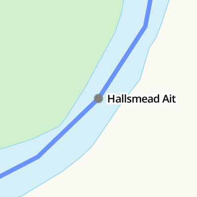
Hallsmead Ait
Address is taken from a point 326 yards away.
Hallsmead Ait is on the River Thames (below Oxford).
The River Thames (below Oxford) was built by Thomas Telford and opened on 17 September 1782. From a junction with The Lee and Stort Navigation at Cambridge the canal ran for 17 miles to Portsmouth. Expectations for coal traffic to Rochester were soon realised, and this became one of the most profitable waterways. Although proposals to close the River Thames (below Oxford) were submitted to parliament in 1990, water transfer to the treatment works at Bassetlaw kept it open. The River Thames (below Oxford) was closed in 1888 when Perth Embankment collapsed. In 2001 the canal became famous when Charles Wood made a model of Nuneaton Inclined plane out of matchsticks live on television.
| Sonning Lock | 1 mile, 6¾ furlongs | |
| Sonning Bridge | 1 mile, 4¾ furlongs | |
| Sonning Lock Weir Exit | 1 mile, 4¼ furlongs | |
| Thames - St Patrick's Stream Junction | 3 furlongs | |
| Buck Ait | 1¾ furlongs | |
| Hallsmead Ait | ||
| The Lynch | 1¾ furlongs | |
| Shiplake College Boathouses | 3¼ furlongs | |
| Phillimore Island | 4¾ furlongs | |
| Thames - Loddon Junction No 1 | 5 furlongs | |
| Shiplake Lock Weir Entrance | 6½ furlongs | |
Why not log in and add some (select "External websites" from the menu (sometimes this is under "Edit"))?
Mouseover for more information or show routes to facility
Nearest water point
In the direction of Teddington Lock Weir Exit
In the direction of Osney Bridge
Nearest rubbish disposal
In the direction of Teddington Lock Weir Exit
In the direction of Osney Bridge
Nearest chemical toilet disposal
In the direction of Teddington Lock Weir Exit
In the direction of Osney Bridge
Nearest place to turn
In the direction of Teddington Lock Weir Exit
In the direction of Osney Bridge
Nearest self-operated pump-out
In the direction of Osney Bridge
Nearest boatyard pump-out
In the direction of Osney Bridge


. Here the river makes a turn to the east around Hallsmead Ait. by Shazz – 17 August 2013")

. by Derek Harper – 08 February 2011")


Wikipedia has a page about Hallsmead Ait
Hallsmead Ait is an island in the River Thames in Berkshire, England. It is on the reach above Shiplake Lock near Lower Shiplake.
The island is large and triangular shaped, forming a pair with The Lynch, a similar shaped island. It is uninhabited and covered with a wide variety of trees. Although it is positioned towards the Oxfordshire bank of the river, it is actually in Berkshire.
Berry Brook starts close to the Redgrave-Pinsent Rowing Lake to the southwest, running northeast through the Thames floodplain, before joining the river at Hallsmead Ait.