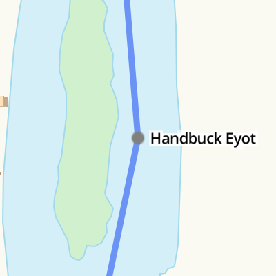
Handbuck Eyot
is a minor waterways place
on the River Thames (below Oxford) between
Wargrave (1 mile and ¾ furlongs
to the southeast) and
Racecourse Yacht Basin Entrance (Junction of the River Thames and the Clewer Mill Stream) (20 miles and 4 furlongs
and 8 locks
to the east).
The nearest place in the direction of Wargrave is Thames - Lash Brook Junction (Junction of the River Thames and Lash Brook);
2¼ furlongs
away.
The nearest place in the direction of Racecourse Yacht Basin Entrance is Poplar Eyot;
2 furlongs
away.
Mooring here is unrated.
St. George and Dragon PH | 1 mile, ½ furlongs | |
Thames - Hennerton Backwater Entrance No 1 | 1 mile | |
Thames - Hennerton Backwater Entrance No 2 | 6½ furlongs | |
Willow Marina | 6¼ furlongs | |
Thames - Lash Brook Junction | 2¼ furlongs | |
Handbuck Eyot | ||
Poplar Eyot | 2 furlongs | |
Ferry Eyot | 3½ furlongs | |
Thames - Hennerton Backwater Entrance No 3 | 4¼ furlongs | |
Marsh Lock Weir Entrance | 7¾ furlongs | |
Marsh Lock Mill Weir Entrance | 1 mile |
Amenities nearby at Thames - Lash Brook Junction
There are no links to external websites from here.
Why not log in and add some (select "External websites" from the menu (sometimes this is under "Edit"))?
Mouseover for more information or show routes to facility
Nearest water point
In the direction of Teddington Lock Weir Exit
Hurley Lock — 8 miles, 1 furlong and 2 locks away
On this waterway in the direction of Teddington Lock Weir Exit
Cookham Lock — 14 miles, 5¼ furlongs and 5 locks away
On this waterway in the direction of Teddington Lock Weir Exit
In the direction of Osney Bridge
Shiplake Lock — 1 mile, 5¼ furlongs away
On this waterway in the direction of Osney Bridge
Thames & Kennet Marina — 6 miles, 2 furlongs and 2 locks away
On this waterway in the direction of Osney Bridge
Tyle Mill Lock C&RT Services — 14 miles, 5½ furlongs and 10 locks away
Travel to Thames - Kennet Junction (Kennet Mouth), then on the River Thames (River Kennet) to High Bridge Reading, then on the River Kennet to Tyle Mill Lock C&RT Services
Cleeve Lock — 18 miles, 4¼ furlongs and 6 locks away
On this waterway in the direction of Osney Bridge
Aldermaston Lock No 95 — 17 miles and 13 locks away
Travel to Thames - Kennet Junction (Kennet Mouth), then on the River Thames (River Kennet) to High Bridge Reading, then on the River Kennet to Aldermaston Lock No 95Nearest rubbish disposal
In the direction of Teddington Lock Weir Exit
Marsh Lock — 1 mile, ¾ furlongs away
On this waterway in the direction of Teddington Lock Weir Exit
Hambleden Lock — 4 miles, 3½ furlongs and 1 lock away
On this waterway in the direction of Teddington Lock Weir Exit
Hurley Lock — 8 miles, 1 furlong and 2 locks away
On this waterway in the direction of Teddington Lock Weir Exit
Marlow Lock — 10 miles, 4 furlongs and 4 locks away
On this waterway in the direction of Teddington Lock Weir Exit
Cookham Lock — 14 miles, 5¼ furlongs and 5 locks away
On this waterway in the direction of Teddington Lock Weir Exit
Bray Lock — 18 miles, 3¾ furlongs and 7 locks away
On this waterway in the direction of Teddington Lock Weir Exit
In the direction of Osney Bridge
Shiplake Lock — 1 mile, 5¼ furlongs away
On this waterway in the direction of Osney Bridge
Mapledurham Lock — 11 miles, 4¼ furlongs and 3 locks away
On this waterway in the direction of Osney Bridge
Goring Lock — 17 miles, 7¼ furlongs and 5 locks away
On this waterway in the direction of Osney Bridge
Tyle Mill Lock C&RT Services — 14 miles, 5½ furlongs and 10 locks away
Travel to Thames - Kennet Junction (Kennet Mouth), then on the River Thames (River Kennet) to High Bridge Reading, then on the River Kennet to Tyle Mill Lock C&RT Services
Aldermaston Lock No 95 — 17 miles and 13 locks away
Travel to Thames - Kennet Junction (Kennet Mouth), then on the River Thames (River Kennet) to High Bridge Reading, then on the River Kennet to Aldermaston Lock No 95Nearest chemical toilet disposal
In the direction of Teddington Lock Weir Exit
Hurley Lock — 8 miles, 1 furlong and 2 locks away
On this waterway in the direction of Teddington Lock Weir Exit
Cookham Lock — 14 miles, 5¼ furlongs and 5 locks away
On this waterway in the direction of Teddington Lock Weir Exit
In the direction of Osney Bridge
Shiplake Lock — 1 mile, 5¼ furlongs away
On this waterway in the direction of Osney Bridge
Thames & Kennet Marina — 6 miles, 2 furlongs and 2 locks away
On this waterway in the direction of Osney Bridge
Mapledurham Lock — 11 miles, 4¼ furlongs and 3 locks away
On this waterway in the direction of Osney Bridge
Tyle Mill Lock C&RT Services — 14 miles, 5½ furlongs and 10 locks away
Travel to Thames - Kennet Junction (Kennet Mouth), then on the River Thames (River Kennet) to High Bridge Reading, then on the River Kennet to Tyle Mill Lock C&RT Services
Aldermaston Lock No 95 — 17 miles and 13 locks away
Travel to Thames - Kennet Junction (Kennet Mouth), then on the River Thames (River Kennet) to High Bridge Reading, then on the River Kennet to Aldermaston Lock No 95Nearest place to turn
In the direction of Teddington Lock Weir Exit
Thames - Hennerton Backwater Entrance No 3 — 4¼ furlongs away
On this waterway in the direction of Teddington Lock Weir Exit
Marsh Lock Mill Weir Exit — 1 mile, 2¼ furlongs and 1 lock away
On this waterway in the direction of Teddington Lock Weir Exit
Hambleden Lock Weir Entrance — 4 miles, 2¾ furlongs and 1 lock away
On this waterway in the direction of Teddington Lock Weir Exit
Hambleden Weir Exit — 4 miles, 4½ furlongs and 2 locks away
On this waterway in the direction of Teddington Lock Weir Exit
Hambleden Marina — 4 miles, 5½ furlongs and 2 locks away
On this waterway in the direction of Teddington Lock Weir Exit
Hurley Lock Weir Entrance No 2 — 7 miles, 6 furlongs and 2 locks away
On this waterway in the direction of Teddington Lock Weir Exit
Hurley Lock Weir Exit No 2 — 8 miles, 3 furlongs and 3 locks away
On this waterway in the direction of Teddington Lock Weir Exit
Temple Lock Weir Entrance — 8 miles, 5¾ furlongs and 3 locks away
On this waterway in the direction of Teddington Lock Weir Exit
In the direction of Osney Bridge
Thames - Hennerton Backwater Entrance No 2 — 6½ furlongs away
On this waterway in the direction of Osney Bridge
Thames - Hennerton Backwater Entrance No 1 — 1 mile away
On this waterway in the direction of Osney Bridge
Sonning Lock Weir Exit — 4 miles, 1¾ furlongs and 1 lock away
On this waterway in the direction of Osney Bridge
Sonning Lock Weir Entrance — 4 miles, 5 furlongs and 2 locks away
On this waterway in the direction of Osney Bridge
Thames - Kennet Junction (Kennet Mouth) — 6 miles, 3¼ furlongs and 2 locks away
On this waterway in the direction of Osney Bridge
Blakes Lock Weir Exit — 6 miles, 4½ furlongs and 2 locks away
Travel to Thames - Kennet Junction (Kennet Mouth), then on the River Thames (River Kennet) to Blakes Lock Weir Exit
Caversham Lock Weir Exit — 7 miles, ¾ furlongs and 2 locks away
On this waterway in the direction of Osney Bridge
Reading Jail Loop (eastern entrance) — 6 miles, 6 furlongs and 3 locks away
Travel to Thames - Kennet Junction (Kennet Mouth), then on the River Thames (River Kennet) to Reading Jail Loop (eastern entrance)
Reading Jail Loop (western entrance) — 6 miles, 7¾ furlongs and 3 locks away
Travel to Thames - Kennet Junction (Kennet Mouth), then on the River Thames (River Kennet) to Reading Jail Loop (western entrance)
Fry's Island Entrance — 7 miles, 5¾ furlongs and 3 locks away
On this waterway in the direction of Osney Bridge
Winding Hole above County Lock — 7 miles, 5 furlongs and 4 locks away
Travel to Thames - Kennet Junction (Kennet Mouth), then on the River Thames (River Kennet) to High Bridge Reading, then on the River Kennet to Winding Hole above County Lock
Fobney Lock Weir Exit — 9 miles, 1¼ furlongs and 4 locks away
Travel to Thames - Kennet Junction (Kennet Mouth), then on the River Thames (River Kennet) to High Bridge Reading, then on the River Kennet to Fobney Lock Weir ExitNearest self-operated pump-out
In the direction of Osney Bridge
Mapledurham Lock — 11 miles, 4¼ furlongs and 3 locks away
On this waterway in the direction of Osney Bridge
Tyle Mill Lock C&RT Services — 14 miles, 5½ furlongs and 10 locks away
Travel to Thames - Kennet Junction (Kennet Mouth), then on the River Thames (River Kennet) to High Bridge Reading, then on the River Kennet to Tyle Mill Lock C&RT ServicesNearest boatyard pump-out
In the direction of Osney Bridge
Thames & Kennet Marina — 6 miles, 2 furlongs and 2 locks away
On this waterway in the direction of Osney BridgeDirection of TV transmitter (From Wolfbane Cybernetic)
Wikipedia has a page about Handbuck Eyot
Handbuck Eyot or Handbuck Ait is a thin, wooded island in the River Thames in England towards the eastern edge of the villages of Shiplake, Oxfordshire. It is on the reach above Marsh Lock.
Other Wikipedia pages that might relate to Handbuck Eyot
[Poplar Eyot]
Poplar Eyot or Poplar Ait is an island in the River Thames in England near the villages of Shiplake, Oxfordshire and Wargrave, Berkshire. It is on the
[Eel buck]
reflect the presence of bucks at those points; for example, Buck Ait and Handbuck Eyot. A surviving eel buck may be seen on the River Test at 51°7′48″N 1°29′5″W
[Unnamed Eyot]
The Unnamed Eyot is an island in the River Thames in Berkshire, England, north of the village of Wargrave, Berkshire, its parish in civil terms and ecclesiastical
[Islands in the River Thames]
term – as ait or eyot – unusually well-preserved on the Thames. A small minority of list entries are referred to as Island, Ait or Eyot and are vestiges
[Marsh Lock]
across the river. The island here is called Ferry Eyot and it is followed by Poplar Eyot and Handbuck Eyot. This chain of islands lies off a range of large
Results of Google Search
Handbuck Eyot - WikipediaHandbuck Eyot or Handbuck Ait is a thin, wooded island in the River Thames in England towards the eastern edge of the villages of Shiplake, Oxfordshire.
Handbuck Eyot, South Oxfordshire - local area information, map, walks and more.
Handbuck Eyot est une petite île de la Tamise en Angleterre. Sommaire. 1 Description; 2 Notes et références; 3 Voir aussi. 3.1 Bibliographie; 3.2 Articles ...
Handbuck Eyot oder Handbuck Ait ist eine Insel in der Themse in England nahe dem Ort Shiplake in Oxfordshire. Die Insel liegt flussaufwärts des Marsh Lock.
Handbuck Eyot or Handbuck Ait is an island in the River Thames in England near the villages of Shiplake, Oxfordshire and Wargrave, Berkshire. It is on the ...
Handbuck Eyot or Handbuck Ait is a thin, wooded island in the River Thames in England towards the eastern edge of the villages of Shiplake, Oxfordshire.
Boating Guide to the Bolney Islands, Ferry Eyot and Poplar Eyot on the River Thames at Bolney ... Bolney Islands: Ferry Eyot, Poplar Eyot & Handbuck Eyot ...
Datei:Handbuck Ait.JPG ... English: Handbuck Ait, River Thames Shiplake. Datum, 21. Juni 2008. Quelle, Eigenes ... verwendet diese Datei: Handbuck Eyot  ...
Example sentences from Wikipedia that use the word eyot: ... Thames reflect the presence of bucks at those points - for example Buck Ait and Handbuck Eyot .
Jul 11, 2016 ... English: Handbuck Ait, River Thames Shiplake. Date, 21 June 2008 ... Handbuck Eyot. Usage on en.wikipedia.org. Handbuck Eyot. Usage on ...