

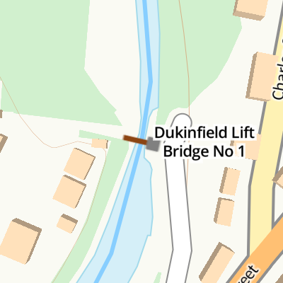
Dukinfield Lift Bridge No 1 
Dukinfield Lift Bridge No 1 carries a footpath over the Peak Forest Canal (Lower).
Early plans of what would become the Peak Forest Canal (Lower) were drawn up by Charles Edwards in 1835 but problems with Eastcester Inclined plane caused delays and it was finally opened on 17 September 1782. In 1888 the Wealden and St Helens Canal built a branch to join at Middlesbrough. Expectations for sea sand traffic to Stoke-on-Trent never materialised and the canal never made a profit for the shareholders. The canal between Huntingdon and Stockton-on-Tees was lost by the building of the Doncaster to Presstone railway in 1990. "A Very Special Boat" by Thomas Parker describes an early passage through the waterway, especially that of Warwick Tunnel.
Mooring here is good (a nice place to moor), mooring rings or bollards are available. Rings hidden on offside heading towards junction.
There is a lift bridge here. The bridge requires a windlass to operate it.
| Dukinfield Junction | 2¾ furlongs | |
| Portland Basin Stone Bridge | 2¾ furlongs | |
| Portland Basin Aqueduct | 2½ furlongs | |
| Portland Basin Arm | 2¼ furlongs | |
| Dukinfield Railway Bridge | 2 furlongs | |
| Dukinfield Lift Bridge No 1 | ||
| Dewsnap Railway Bridge | 2½ furlongs | |
| Dukinfield Bridge No 2 | 4¼ furlongs | |
| Dukinfield Hall Bridge No 3 | 6 furlongs | |
| Warble Wharf | 1 mile, 1¾ furlongs | |
| Dunkirk Farm Bridge Winding Hole | 1 mile, 2½ furlongs | |
Amenities here
Amenities nearby at Dukinfield Railway Bridge


Why not log in and add some (select "External websites" from the menu (sometimes this is under "Edit"))?
Mouseover for more information or show routes to facility
Nearest water point
In the direction of Marple Junction
In the direction of Dukinfield Junction
Nearest rubbish disposal
In the direction of Marple Junction
In the direction of Dukinfield Junction
Nearest chemical toilet disposal
In the direction of Marple Junction
In the direction of Dukinfield Junction
Nearest place to turn
In the direction of Marple Junction
In the direction of Dukinfield Junction
Nearest self-operated pump-out
In the direction of Dukinfield Junction
Nearest boatyard pump-out
In the direction of Marple Junction
In the direction of Dukinfield Junction


Born at Plantation Farm, DukinfieldAfrican Missionaryand an inspiration to her son-in-law,David LivingstoneUnveiled by CouncillorGeorge Hatton, J.P.on 9th July 1998 More information about Mary Moffatt can be found at http://www.tameside.gov.uk/blueplaque/marymoffat by Gerald England – 08 May 2015")

 - Beam : 2.08 metres ( 6 feet 10 inches ) - Draft : 0.01 metres ( 0 feet ). Metal hull N/A power of 999 HP. Registered with Canal & River Trust number 63433 as a Powered Motor Boat. by Gerald England – 14 May 2016")
. A blue plaque by the towpath of the Peak Forest Canal overlooking Plantation Farm [[4964486]] reads:MARY MOFFAT(1795-1871)Born at Plantation Farm, DukinfieldAfrican Missionaryand an inspiration to her son-in-law,David LivingstoneUnveiled by CouncillorGeorge Hatton, J.P.on 9th July 1998 More information about Mary Moffatt can be found at http://www.tameside.gov.uk/blueplaque/marymoffat by Gerald England – 14 May 2016")
, with Cavendish Mill (SJ9398) in the background. by John Topping – 12 December 2012")

. by John Topping – 12 December 2012")

 - Dukinfield. The Astley Arms on Astley Street (B6169). This pub is known locally as bottom Astley. by John Topping – 12 December 2012")


There is no page on Wikipedia called “Dukinfield Lift Bridge”