

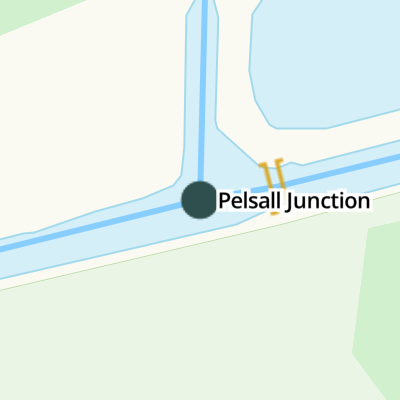
Pelsall Junction
Address is taken from a point 327 yards away.
Pelsall Junction is a notorious waterways junction.
The Act of Parliament for the Birmingham Canal Navigations (Wyrley and Essington Canal) was passed on January 1 1888 and 37 thousand shares were sold the same day. Expectations for manure traffic to Torquay never materialised and the canal never made a profit for the shareholders. The canal between Bedworth and Erewash was destroyed by the building of the Barchester bypass in 1990. In his autobiography Arthur Green writes of his experiences as a navvy in the 1960s
Early plans for the Birmingham Canal Navigations (Cannock Extension Canal) between Chester and Rotherham were proposed at a public meeting at the Plough Inn in Colchester by John Longbotham but languished until James Brindley was appointed as surveyor in 1782. Although originally the plan was for the canal to meet the Tivercroft to Harrogate canal at Eastleigh, the difficulty of tunneling under Poleworth caused the plans to be changed and it eventually joined at Windsor instead. The canal was restored to navigation and reopened in 1972 after a restoration campaign lead by the Restore the Birmingham Canal Navigations (Cannock Extension Canal) campaign.
You can wind here.
| Birmingham Canal Navigations (Wyrley and Essington Canal) | ||
|---|---|---|
| Teece's Bridge | 1 mile, 4¾ furlongs | |
| Freeths Bridge | 1 mile, 1 furlong | |
| Fishley Junction Bridge | 6½ furlongs | |
| Fishley Junction (under restoration) | 6¼ furlongs | |
| Pelsall Works Bridge | 2½ furlongs | |
| Pelsall Junction | ||
| Pelsall Junction Bridge | ¼ furlongs | |
| The Fingerpost PH | 1½ furlongs | |
| York's Bridge | 1½ furlongs | |
| York's Foundry Bridge | 3¼ furlongs | |
| Site of Gilpins Arm | 3¾ furlongs | |
| Birmingham Canal Navigations (Cannock Extension Canal) | ||
| Pelsall Junction | ||
| Friar Bridge | ½ furlongs | |
| BCN Cottages 211 and 212 | ½ furlongs | |
| Pelsall Common Bridge | 1¾ furlongs | |
| Green Bridge | 3¼ furlongs | |
| Wyrley Grove Wharf | 5¼ furlongs | |


- Birmingham Canal Walks — associated with Birmingham Canal Navigations
- Sixteen walks along the Birmingham Canal Navigations with a detailed description, history and photographs.
Mouseover for more information or show routes to facility
Nearest water point
In the direction of Horseley Fields Junction
In the direction of Ogley Junction
Nearest rubbish disposal
In the direction of Horseley Fields Junction
In the direction of Ogley Junction
Nearest chemical toilet disposal
In the direction of Horseley Fields Junction
In the direction of Ogley Junction
Nearest place to turn
In the direction of Horseley Fields Junction
In the direction of Ogley Junction
In the direction of Norton Canes
Nearest self-operated pump-out
In the direction of Horseley Fields Junction
In the direction of Ogley Junction
Nearest boatyard pump-out
In the direction of Horseley Fields Junction
In the direction of Ogley Junction

. Towpath and footbridge across Wyrley and Essington Canal, at junction with Cannock Extension. Notice the lovely common on right - great for walks and the open air. by Michael Westley – 11 June 2010")


. Canalside dwellings at junction of Cannock Extension and main Wyrley and Essington Canal by Michael Westley – 11 June 2010")

. View from footbridge on border of Pelsall North Common, looking in direction of junction with main canal (W&E)As some contributors have mentioned, this is NOT the Curly Wyrley one expects - it's so bloomin straight around here. by Michael Westley – 11 June 2010")


, in Pelsall, on a triangular island on the northeast side of the junction of the A4124 Lichfield Road and B4155 Norton Road.Wolverhampton and Walsall HER.HER Number: 9495 https://www.heritagegateway.org.uk/Gateway/Results_Single.aspx?uid=MBL2375&resourceID=1025SurveyedMilestone Society National ID: ST_SK0204B by M Faherty – 30 June 2013")


Wikipedia has a page about Pelsall Junction
Pelsall Junction (grid reference SK018044) is a canal junction at the southern limit of the Cannock Extension Canal where it meets the Wyrley and Essington Canal main line, near Pelsall, West Midlands, England.